|
|
Animals, airplanes and alps, oh my!
Pictures - Volume I (FL to AK)
Pictures - Volume II (Fairbanks, AK to Denali)
Pictures - Volume III (Denali)
Pictures - Volume IV (Kenai Peninsula)
Pictures - Volume V (Kenai Peninsula)
Pictures - Volume VI (Kenai Peninsula)
Pictures - Volume VII (SE Panhandle, AK)
Pictures - Volume VIII (Canadian Rockies)
Pictures - Volme IX (Kalispell to Yellowstone)
Pictures - Volume X (Heading back Home)
Where in the world will Wild Mama wander? * Blast
Off: Well, the Mystery Trip blasted off a day ahead of schedule ... but not for any particular good reason. While
running the last of the errands necessary to prepare for departure, I got a telephone call that my Mother had  fallen and broken her hip. So much for the last minute preparations. Vern and I threw everything in the plane, fueled
up and headed right back to Westminster, MD to see Mother. fallen and broken her hip. So much for the last minute preparations. Vern and I threw everything in the plane, fueled
up and headed right back to Westminster, MD to see Mother. * As we departed Florida,
the normal afternoon build ups yielded no rain but it was a different story by the time we reached Georgia. We dodged
storms all through Georgia an on into South Carolina where we landed at Newberry to refuel. Our goal for the day was to make
it as far as possible to we could get to Mother. Her heart has not been good but the break was severe enough that surgery
was a must. I called my sister, Michelle, for a status report. Mother is in a lot of pain but hanging in there. They will
have to do a heart work up in the morning to clear her for surgery then operate right away.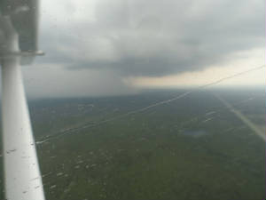 * The skies were getting dark as nightfall was approaching so we filed and climbed up
to 5,000' to catch a nice little tail wind that started at about 6 kts but gradually increased to over 30 kts. There
were still some build-ups lingering through North Carolina but they gradually dissipated as the storms moved quickly off to
the east. We were coming in on the back side of the front and the ride was pretty good now. As sunset 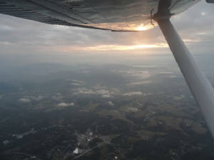 came, we were rewarded wth a little glimpse of the brilliant colors over the mountains and under the clouds. There was a
just sliver of clear enough for the sunset to wink at us as it slid behind the mountains. The last glimmer of sunlight exposed
the radiation fog that spilled over the western slopes of the mountains trying to slosh out on to the leeward side. We dipped
back into the bottoms of the cloud deck above us and lost sight of everything until we were cleared for the descent. We had
been headed to Carroll County via Martinsburg VOR when ATC asked us where we were going. Apparently no one sent the memo that
we had came, we were rewarded wth a little glimpse of the brilliant colors over the mountains and under the clouds. There was a
just sliver of clear enough for the sunset to wink at us as it slid behind the mountains. The last glimmer of sunlight exposed
the radiation fog that spilled over the western slopes of the mountains trying to slosh out on to the leeward side. We dipped
back into the bottoms of the cloud deck above us and lost sight of everything until we were cleared for the descent. We had
been headed to Carroll County via Martinsburg VOR when ATC asked us where we were going. Apparently no one sent the memo that
we had the Nottingham 6 arrival with the EMI transition. We were re-routed to EMI and headed in that direction trying
to scramble to get the arrival procedure. When asked the approach, we asked for a visual to runway 16 as we had descended
far enough below the clouds that we had a clear view of the runway from 4000'. "Oh, well direct Carroll County, then."
So much for Nottingham. We reported airport in sight and cancelled so we could continue to descend and get on the ground without
further delay. the Nottingham 6 arrival with the EMI transition. We were re-routed to EMI and headed in that direction trying
to scramble to get the arrival procedure. When asked the approach, we asked for a visual to runway 16 as we had descended
far enough below the clouds that we had a clear view of the runway from 4000'. "Oh, well direct Carroll County, then."
So much for Nottingham. We reported airport in sight and cancelled so we could continue to descend and get on the ground without
further delay. * Once we landed, we got the report from sister
that Mother is peaceful and on serious pain medication for the evening and that there was nothing to do until early tomorrow
morning. We were expected at the hospital by 8 am. I am happy we made the trip tonight so we can get a quick start in the
morning. Vern will be able to use the day to re-organize the plane while I stay with Mother. * Good news:
Although considered a moderate heart risk for surgery, Mother, at 92, came through like a trooper. She has a new hip and will
require extensive physical therapy but she is up and feisty - just like Mother!!! The Mystery Trip will resume shortly.
June 15th Marathon: No, we
are not in Marathon in the Florida Keys. We flew a marathon today - 12:34 in flight! Boy do we feel it. We got an early jump to the day - fortunately for us. Wheels up at 0700 local time from
Westminster, Carroll County heading generally westward and slightly northward. The first to greet us this morning was the fog, all nestled in the low lying areas just to the west of Westminster. We were not so concerned
about the fog as we were the strong storms that were forecast across our path. We originally wanted to head over Lake Michigan
but the line was very solid through the Great Lakes making us opt for a more southerly route to our destination for today.
We stayed fairly low to stay out of the wind but high enough to stay out of the fog. The haze was incredible and almost played
tricks with your eyes trying to see the distant images. But we pressed on. greet us this morning was the fog, all nestled in the low lying areas just to the west of Westminster. We were not so concerned
about the fog as we were the strong storms that were forecast across our path. We originally wanted to head over Lake Michigan
but the line was very solid through the Great Lakes making us opt for a more southerly route to our destination for today.
We stayed fairly low to stay out of the wind but high enough to stay out of the fog. The haze was incredible and almost played
tricks with your eyes trying to see the distant images. But we pressed on.  The first fuel stop was Rochelle, IL. We had been hard at it for over 4 hours and were ready to stretch our legs. The
wind was now picking up a bit and our tidy little 140 kts of ground speed had been slowly disappearing throughout the trip
but not too badly at this point. We made a quick stop in Rochelle and pressed on. Again we tried to stay low. We were passing
the front so the fog and the hazy gave way to green fields and blue skies ... and headwinds. Oh, the headwinds. We were not
safe from them at any point. They managed to remain fairly steady at between 35-40 kts, topping out at 42 kts at one point.
We had planned another 4 hour leg but we were not feeling too happy with the delay in the leg. By this time, the scenery was
getting way too familiar, the drone of the engine was melodic but enough to lull you to sleep in combination with the heat.
I took a brief nap while Vern flew. I was awakened by Vern's laghter as he saw the corn and wheat fields "flowing"
like rivers. The winds across the ground were strong enough to put the crops near horizontal. I wonder what the wind sock
looks like. The first fuel stop was Rochelle, IL. We had been hard at it for over 4 hours and were ready to stretch our legs. The
wind was now picking up a bit and our tidy little 140 kts of ground speed had been slowly disappearing throughout the trip
but not too badly at this point. We made a quick stop in Rochelle and pressed on. Again we tried to stay low. We were passing
the front so the fog and the hazy gave way to green fields and blue skies ... and headwinds. Oh, the headwinds. We were not
safe from them at any point. They managed to remain fairly steady at between 35-40 kts, topping out at 42 kts at one point.
We had planned another 4 hour leg but we were not feeling too happy with the delay in the leg. By this time, the scenery was
getting way too familiar, the drone of the engine was melodic but enough to lull you to sleep in combination with the heat.
I took a brief nap while Vern flew. I was awakened by Vern's laghter as he saw the corn and wheat fields "flowing"
like rivers. The winds across the ground were strong enough to put the crops near horizontal. I wonder what the wind sock
looks like.
We decided to make a precautionary stop in 1D1.
Again, we needed to stretch our legs and get a different view than the bug flled windshield and the Midwest farm lands. The
winds were quite brisk and presented a cross wind on the asphalt runway. We did not want to land on the turf not knowing its
condition as we will be making many less than great runway landings at the Mystery Destination. We came in pretty well crabbed
but had plenty of rudder left to make a smooth transition and touchdown - but it was a fight to the ground. The next leg was to be a "short leg". The winds were now picking up a bit
more and we longed for the times of only a 20 kt headwind. we decided to go full racing power ( note that I did not say "speed"
) in order to try to power our way through the winds. We settled in at 120 kts ground speed under full power - it felt
as if we were making the cross country  attempt in a 172 instead of a 182RG. We stopped as planned at Y19. The fellow at the mechanic shop mentioned to Vern
that he hoped we were not heading west as the last guys who came through told of wicked head winds. Yeah, right, tell me about
it. I wanted to stretch again and use the facilities. No one was in the building so I had to guess the mystery code to get
inside. I was brain dead and ended up laughing so hard that it attempt in a 172 instead of a 182RG. We stopped as planned at Y19. The fellow at the mechanic shop mentioned to Vern
that he hoped we were not heading west as the last guys who came through told of wicked head winds. Yeah, right, tell me about
it. I wanted to stretch again and use the facilities. No one was in the building so I had to guess the mystery code to get
inside. I was brain dead and ended up laughing so hard that it nearly caused me to use the "exterior facilities". I had to call Vern to come fix it and get the door opened -
note to self: keep the mechanic handy. nearly caused me to use the "exterior facilities". I had to call Vern to come fix it and get the door opened -
note to self: keep the mechanic handy. The last leg of the trip found
more of the same scenery althought the number of farms became fewer and farther between as we pressed on. To the north of
course, we found what looked like the ND/MT version of the SD "bad lands" so we sashed over to get some photos and
fly through the rather craggy landscape. Finally we hit our last navigation point (S71) where we ended up following the railroad,
the creek bed and a series of raods through some small towns on the way to Cut Bank, MT. Cut Bank was a welcome sight but required another one of those little practiced cross wind landings. Three
fighters in one day - almost like March in LaBelle again. We unpacked Wild Mama, got the courtesy car and headed
off to bed. After just over 12.5 actual flight hours, we were beat, wanted some real food an a comfortable bed. No Toys: Departing
cut bank this morning was a piece of cake. Eapis filed, canpasss notified and flight plan filed. Weather is typical montanna
big blue skies and uncharacteristically light winds. We departed VFR saying goodbyes to our new friend, Leon. As we started
our climb out the hsi failed. Not a deal breaker but a pain in the head. We  made the 30 minute trip to Lethbridge, called Lethbridge radio and plunked down on the runway without incident. CanPass customs
was a phone call and done. I liked that one. made the 30 minute trip to Lethbridge, called Lethbridge radio and plunked down on the runway without incident. CanPass customs
was a phone call and done. I liked that one. We called Tomlinson's to see about quick diagnostics on the hsi but it is not working as the gyro went bad. We will
press on and try to get a fix later while we are in another location. In the mean time is it beautiful and clear and we get
to pretend that we are back in a normal airplane again. Time to enjoy the scenery. ButThe scenery was not long to be enjoyed.
We started with a nice
little tail wind but shades of yesterday crept back into the flight plan. Our tail wind was short-lived as were the expansive
blue skies. A low layer of clouds soon crossed our path and we dipped low enough to go under until the cloud bank opened up
to 8'000 feet. As we pass west of Edmonton, we hear a radio broadcast of a sigmet with tornado and hail activity. Lovely.
But we are now in the clear on the way to Whitecourt. Gasing up at Whitecourt was a bit different as well. Gas was $1.63 CAD
per litre and they do not take Discover Card. We made a brief stop to file the next VFR flight plan, check weather and
be on our way. This goes back to the old plotting and planning now. No direct to, no multiplicity of landmarks to choose from
when working on the flight plan. It is pretty much follow the road or follow the river. Both take you to the same place so
it really does not matter except for the scenery below. We made our departure calls and headed NW deciding to meander between the highway and the river
as they cris crossed along the way. One cannot comprehend the vastness of the Canadian wilderness area until you fly over at 4500' and see nothing but timberland
as far as the eye can see in all directions with the distant horizon S W being the Canadian Rockies. Our original thought
was a stay in banff this evening but with 30-50 kt winds forecast through the mountains we thought better of it. We will watch
the weather for wind tomorrow as we will have a required mountain day and will not be able to go through the mountains with
ripping winds. cannot comprehend the vastness of the Canadian wilderness area until you fly over at 4500' and see nothing but timberland
as far as the eye can see in all directions with the distant horizon S W being the Canadian Rockies. Our original thought
was a stay in banff this evening but with 30-50 kt winds forecast through the mountains we thought better of it. We will watch
the weather for wind tomorrow as we will have a required mountain day and will not be able to go through the mountains with
ripping winds. Off of
the mountains, we find ourselves with only a 20-30 kt headwind. Thinking back to yesterday, we are ok with that. Our path
took us over Grand Prarie, then Dawson Creek, NW to FortSst John then the last leg to Fort Nelson which was our intended
overnight. As we rounded the bend to Fort t John FSJ radio advised that seveal planes had turned back for weather and
that we might want to call flight services for a weather report. Vern hopped on the frequency and got a report of reduced
ceilings, rain but otherwise VFR. We decided to go on. Canada has 126.7 as the enroute frequency where folks make pireps as they fly along.
We monitored the frequency and heard airplanes ahead heading to Ft Nelson and ony 59  miles out passing Mt Bigfoot. They dropped down to 4,000' but were otherwise going forward. We called FSJ radio and told
them we would go on. If they saw us again, they would know the weather got too bad to pass. When we were only 60 miles out
of Fort St John, the visibility dropped significantly and we headed for lower terrain to get below the clouds with a comfortable
margin of airspace beneath us. We continued on zigging and zagging looking for lower until we reached the Mt Bigfoot area
and found the higher ceilings and lower valley below. We were only about 40 miles from Fort Nelson and knew we made it.
Fort Nelson was very crowded with many planes coming for for Century Club annual flight across Canada. They are all here tonight
and will finish the trek in Whitehorse tomorrow night and remain there for a few days. miles out passing Mt Bigfoot. They dropped down to 4,000' but were otherwise going forward. We called FSJ radio and told
them we would go on. If they saw us again, they would know the weather got too bad to pass. When we were only 60 miles out
of Fort St John, the visibility dropped significantly and we headed for lower terrain to get below the clouds with a comfortable
margin of airspace beneath us. We continued on zigging and zagging looking for lower until we reached the Mt Bigfoot area
and found the higher ceilings and lower valley below. We were only about 40 miles from Fort Nelson and knew we made it.
Fort Nelson was very crowded with many planes coming for for Century Club annual flight across Canada. They are all here tonight
and will finish the trek in Whitehorse tomorrow night and remain there for a few days.  We came in high over
a ridge and did a dive bomb for the runway. We pulled off all power, put the carburetor heat and pitot heat on as the rain
had started again, threw out the gear and full flaps and snuck in ahead of the masses to come. We lost another hour so we
are here early enough to relax and plan for tomorrow. We were awakened by our body clocks at 0300 this morning. We are hoping
that this will not be a trend.
* Flyin' Down the Highway: The
day was beautiful as we were awakened by our body clocks at 2 am; but we managed to go back to sleep until 5 am. We had asked
about catching a ride over to the airport early. We wanted to get ahead of the mass of Century Flight airplanes but also ahead
of the weather that was forecast for the route for the late afternoon. We caught a cab early at 7 am and got off an hour earlier
than we had planned. The eapis was set for arrival at the border at 1330 local time so we might be a bit early for that. This
leg was from Fort Nelson to Whitehorse. Two of the century flight planes lifted off just before us but we knew we would outrun
them shortly enough. This was the first
of the legs to go through the mountains. We started with a more "direct to" route then switched over to the highway
about half way to Watson Lake as the granite clouds got higher and the white puffy variety got lower. In no time we passed the other 2 planes then led the pack to Watson
Lake. As we approached Watson Lake we heard another plane coming in. Apparently one of the Century Flight planes got a real
early start; but he stopped for clouds got higher and the white puffy variety got lower. In no time we passed the other 2 planes then led the pack to Watson
Lake. As we approached Watson Lake we heard another plane coming in. Apparently one of the Century Flight planes got a real
early start; but he stopped for  fuel leaving us and a Comanche, HPF all alone on the next leg. HPF was still 25 miles behind us. The trip through the valleys
was the best scenery that we had seen thus far. Even the 30 - 40 kt headwind did not bother us this time other than requiring
an update of the flight plan for the 45 minute late arrival. The mountains were dotted with the last remaining snow in the
area. The valleys below were lush and green. The highway was intertwined with the river throughout this portion of the trip
like a tangle of ribbons adorning a secret package on Christmas morning. fuel leaving us and a Comanche, HPF all alone on the next leg. HPF was still 25 miles behind us. The trip through the valleys
was the best scenery that we had seen thus far. Even the 30 - 40 kt headwind did not bother us this time other than requiring
an update of the flight plan for the 45 minute late arrival. The mountains were dotted with the last remaining snow in the
area. The valleys below were lush and green. The highway was intertwined with the river throughout this portion of the trip
like a tangle of ribbons adorning a secret package on Christmas morning. We passed a mountain at 5166'. Never saw it as Mother Nature took a cloud bowl and placed it
upside down on top of the peak. It was very deceptive to think that the cloud, so soft and fluffy looking, was hiding such
a deadly surprise. We were solidly on the highway now. The direct to route was not any longer a viable option. We crossed
over Pine Lake and Teslin then approached a very narrow saddle just 20 miles from Whitehorse and the Comanche was hot
on our tail. We chatted back and forth for a bit before we both needed to switch to tower and come in to land. He remained
behind us as a gentlemen  welcoming strangers to his country. This is our final stop before crossing the border. We visited the live people at
the Canadian Flight Service Center. They were helpful, friendly, organized and full of useful information. .... From a government
agency??????? We filed our customs, checked weather and made our way back to the airplane. This leg will be very lonely: no
Century Flyers, no friends, no other airplanes, rarely place to stop along the way. welcoming strangers to his country. This is our final stop before crossing the border. We visited the live people at
the Canadian Flight Service Center. They were helpful, friendly, organized and full of useful information. .... From a government
agency??????? We filed our customs, checked weather and made our way back to the airplane. This leg will be very lonely: no
Century Flyers, no friends, no other airplanes, rarely place to stop along the way. For this last leg into Northway, we had to follow the highway. The clouds were far too low
and the terrain far too high to try to go over. There was no benefit to trying to go direct either. As sparse as the conditions
are in this neck of the woods, the road is the best place to try to land. Occasionally there is an old abandoned airstrip nestled up against the side of the highway; and this route did present us
with a few airports to overfly in case of weather or other unforeseen problems. But we were truly on our own. We talked about
what it must have been like to be the first of the surveyors heading out to map this great territory. Wilderness and Occasionally there is an old abandoned airstrip nestled up against the side of the highway; and this route did present us
with a few airports to overfly in case of weather or other unforeseen problems. But we were truly on our own. We talked about
what it must have been like to be the first of the surveyors heading out to map this great territory. Wilderness and  ruggedness surrounds you. The vastness of the mountain ranges and the daunting task of trying to scale those giants must have,
at times, seemed quite overwhelming. But here we are today: GPS, terrain mapping, everything you could need to make a safe
trip. All you have to do is fly the plane. ruggedness surrounds you. The vastness of the mountain ranges and the daunting task of trying to scale those giants must have,
at times, seemed quite overwhelming. But here we are today: GPS, terrain mapping, everything you could need to make a safe
trip. All you have to do is fly the plane. Now
we were getting into the higher hills and following the road was no longer an option. It was the only way through. Flight
services had cautioned us about the 15 kt forecast headwind. We laughed and thought that would be a blessing. We came though
running 140-150 kits the whole way. So much for that headwind! This was a point, however, the we really did not care. We came
to see the mountains and they were laid out all around us. There were high peaks with glaciers hanging high, their silty runoff
forming a glacial river below us. There were other peaks not as high but very barren devoid of trees, of snow, of any discernible life. We meandered down the highway past Haines Junction, Silver City, across Klaune Lake, Burwash
then Beaver Creek where we crossed the border into Alaska. Our destination at last! We cleared customs in Nothway in snow, of any discernible life. We meandered down the highway past Haines Junction, Silver City, across Klaune Lake, Burwash
then Beaver Creek where we crossed the border into Alaska. Our destination at last! We cleared customs in Nothway in  less time than it has taken me to blog today. The customs agent was courteous and had us do virtually no paperwork. Pffff.
That was easy. We stopped in and spoke with another live person at the Northway Flight Services station. He gave us some good
weather information for heading into Fairbanks and sent us on our way. There are not serivces in Northway so we stopped in
Tok for fuel before making the final 1.5 hour trek up to Fairbanks. less time than it has taken me to blog today. The customs agent was courteous and had us do virtually no paperwork. Pffff.
That was easy. We stopped in and spoke with another live person at the Northway Flight Services station. He gave us some good
weather information for heading into Fairbanks and sent us on our way. There are not serivces in Northway so we stopped in
Tok for fuel before making the final 1.5 hour trek up to Fairbanks. This
was another nice part of the trip but not nearly as spectacular as the leg from Whitehorse to Northway. The landscape had
flattened out around us and the grand muntains were off in the distance, leaving only the Alaska foothills towering over our
little plane. We meandered along still at 4500' and well above the ground below.
As we approached the Fairbanks area, we decided to call in to the TRSA. We heard reports
of a storm over Murphy's Dome moving to the northeast. We needed to locate that peak as the storms were moderate
to severe. We located the point to the west souhwest of Fairbanks and figured that we would get little more than the light rain that we saw coming in. would get little more than the light rain that we saw coming in.
We were clered for a left downwind to 20L but as we approached they gave us right base to 2 right.
Strange. We looked off to the approach end of 20 and saw a monster of a rain shower. We saw a flash here and there and figured
we had better get to the rnway ASAP. As we land and taxi to the ramp we hear the ping, ping, ping of hail hitting Wild Mama
and the rains pounding in large drops on the airplane and the pavement. We just sat and waited, hoping the hail would get
no larger. Soon enough it cleared enough for
Vern to make the break for the car so we could unload the plane and head to the hotel for the night.  One of our new found Century Flight friends suggested Circle Hot Springs as a possible overnight spot. We checked wth the
flight service fellow in Northway and he suggested not but offered the alternative of Chena Hot Springs Resort. We called
and they had a room available for the weekend. We will relax here after the 30 hour trip to Fairbanks and get an early start
Monday to get the gyro repaired or replaced so we wll have it for the REAL mountains. One of our new found Century Flight friends suggested Circle Hot Springs as a possible overnight spot. We checked wth the
flight service fellow in Northway and he suggested not but offered the alternative of Chena Hot Springs Resort. We called
and they had a room available for the weekend. We will relax here after the 30 hour trip to Fairbanks and get an early start
Monday to get the gyro repaired or replaced so we wll have it for the REAL mountains.
We stoppede at Pike's Landing Restaurant for some salmon and halibut. Mario would have been pleased
as he always ate the halibut once he dscovered how suculent that fish was compared to the salmon. He never ate anything else
when we came to Alaska back in 1995. We started our drive off to Chenna Hot Springs alsong the Chena Hot Springs Road. The
Guidepost Book was a huge help pointing out the sights as we crossed each mile post. As we passed post 28, I read aloud: "Watch
for moose in the Slough Lake". "Yep," Vern commented as we sped past "... there i one drinking fro the
lake." STOP!!!! How can you drive by a moose and say nothing. Go back, go back. It was pouring rain by now but who 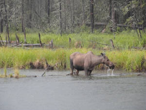 cares. This is a moose. Our first moose and I wanted a picture. cares. This is a moose. Our first moose and I wanted a picture. We spotted several others along the way. What a nice drive. We finally came to the end of the road and the lodge.
It is a rustic family place with an adult only hot spring rock lake. This is my kind of place. Without further ado, we were
there. Basking in the 100 pus degree water while the outside temperature remained a cool 55 degrees. We found heaven. Lights
are on: It was really strange not having it get dark at all. We tried to see if there was any period of dark
and the front desk said this was about it. To us, it looked like 5 o’clock in the afternoon all evening with a sunrise,
if you could call it that, once the clouds cleared . . . so much for the Northern Lights. 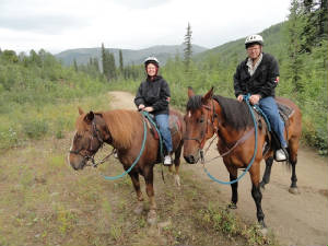 This was a day of exploration around the Chena Resort area. We started with a 30 minute horseback ride, figuring that would
about be the limit for butt fatigue. We were right. The trail was very serene and scenic. Laura was an outstanding guide giving
us a good narration of the wildlife, vegetation and the area. We meandered around a small pond with a beaver dam, listened
to the sounds of nature and saw some wild, exotic and HUGE mushrooms sprouting about the fields intertwined with the wildflowers.
The horses, Buckshot, Rio and Yukon, were very well behaved and This was a day of exploration around the Chena Resort area. We started with a 30 minute horseback ride, figuring that would
about be the limit for butt fatigue. We were right. The trail was very serene and scenic. Laura was an outstanding guide giving
us a good narration of the wildlife, vegetation and the area. We meandered around a small pond with a beaver dam, listened
to the sounds of nature and saw some wild, exotic and HUGE mushrooms sprouting about the fields intertwined with the wildflowers.
The horses, Buckshot, Rio and Yukon, were very well behaved and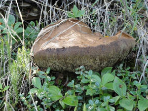 needed little prodding and correction. needed little prodding and correction.
Our butts
signaled that the 30 minute ride was about to end as we crossed the runway and headed back to the lodge where we stopped for
lunch. This lodge is completely self sufficient using geothermal technology and hydroponics for electricity, power and basic
food needs. All of the greens, tomatoes and herbs are grown in the greenhouse … and does it ever make a difference
in the salad. I had a spinach salad with the crispest green leaves of spinach ever seen. Vern ate a tomato and mozzarella
salad and a pear and apple salad – both extremely good. I have always said that 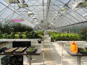 you cannot ruin a salad. Well, I was wrong. It seems that all other salads that I have ever eaten have been ruined and today
I finally got a good one. I am not sure what I will do from now on. you cannot ruin a salad. Well, I was wrong. It seems that all other salads that I have ever eaten have been ruined and today
I finally got a good one. I am not sure what I will do from now on. The afternoon found us touring around the ice museum – a one of a kind experience. There is a couple
who are multi-time world champion ice carvers. They put on a small display then granted us a tour of the facility where we
saw the ice overnight rooms, ice bar where you can get an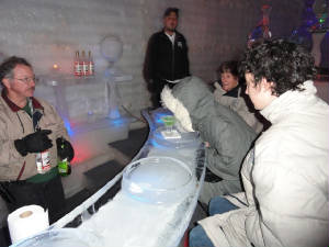 “appletini” in an ice glass (just don’t spill your drink or it will literally melt the bar!) and the various
sculptures including the gladiators, naked woman, Coca-cola bear and spiral stair case. The tour was 30 minutes and, at 20º
inside the tour, that was plenty long enough. My fingers and I were frozen even with gloves, 2 shirts, a sweat shirt, jacket
and parka. “appletini” in an ice glass (just don’t spill your drink or it will literally melt the bar!) and the various
sculptures including the gladiators, naked woman, Coca-cola bear and spiral stair case. The tour was 30 minutes and, at 20º
inside the tour, that was plenty long enough. My fingers and I were frozen even with gloves, 2 shirts, a sweat shirt, jacket
and parka. One of the highlights for Vern
came this afternoon with the geothermal tour. We saw the industrial chiller units working backwards to turn a 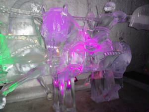 generator that supplied all of the power to the complex of hotel rooms and 65 residential units for the employees. Quite impressive.
They turned their energy costs from $0.30/ kilowatt hour to $0.06/ kilowatt hour. Again, quite impressive; but it also allowed
the facility to turn a profit for the first time in many, many years. generator that supplied all of the power to the complex of hotel rooms and 65 residential units for the employees. Quite impressive.
They turned their energy costs from $0.30/ kilowatt hour to $0.06/ kilowatt hour. Again, quite impressive; but it also allowed
the facility to turn a profit for the first time in many, many years. Historically, the hot spring is over 100 years old and was discovered by 2 aching miners. They formed a community
around the spring; that community eventually becoming a resort that was never really profitable as long as fuel had to be
trucked in for energy. Once the were able to tap into the geothermal power that sits on the site for free, the free enterprise
system took over and a profitable business was born.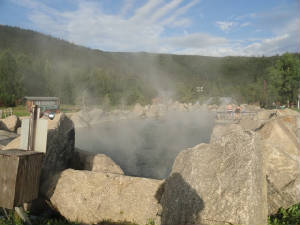 The remainder of the day was spent in the hot springs again and
relaxing for tomorrow. We also had another good salad. We will check out early to make our way back to Fairbanks to attend
to Wild Mama and her broken gyro. We have discussed the “plans” for flight seeing and have determined that a properly
working gyro is most desirable in high terrain  and questionable weather. Most unfortunately, the gyro repairs might be the determining factor for the journey for the remainder
of the trip. Fingers crossed for tomorrow. and questionable weather. Most unfortunately, the gyro repairs might be the determining factor for the journey for the remainder
of the trip. Fingers crossed for tomorrow. There’s
gold in them thar hills: Bright and early we departed from Chena Hot Springs to make the trek
back to Fairbanks with the hope of getting Wild Mama repaired in short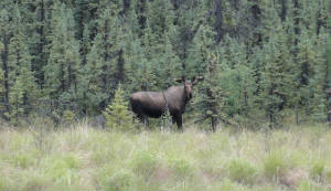 order. The morning was cool and relatively clear. Here “clear” is a strange concept and it really depends what
you are doing as to how you might define “clear”. The drive was clear; the roads were clear (except for the occasional
moose that wandered onto our pathway); but looking toward the sky to determine possibilities of flight, well, we were not
so clear. order. The morning was cool and relatively clear. Here “clear” is a strange concept and it really depends what
you are doing as to how you might define “clear”. The drive was clear; the roads were clear (except for the occasional
moose that wandered onto our pathway); but looking toward the sky to determine possibilities of flight, well, we were not
so clear. Back in Fairbanks, it started to rain again – not so clear. But Vern had some repair work to
do. We pulled everything out of the airplane and he fetched the malfunctioning gyro. We were fortunate to get it to the local
avionics shop before anyone else go hold of the technician, got the unit tested and determined that it was broken. They have
no spare. They have no way to fix the gyro. We call Tomlinson’s. They have taken care of Wild
Mama; they have kept her running and they know her panel. They also have a spare that they can overnight to Fairbanks
so we can get it replaced and get on our way. We are pleased.
 Fairbanks has a campground adjacent to the airport where you can camp with your plane. We drove to the campground to check
out the site – very nice; but it was pouring rain again. I do not feel that adventurous and I need good internet service
to check email and update the web. We opt for the Comfort Inn instead. With the hotel arrangement made, we are off to be tourists
for the day and head to North Pole for a visit with the worlds largest Santa; a stop at the Notty Pine Shop and a little tour
of the town of North Pole. Fairbanks has a campground adjacent to the airport where you can camp with your plane. We drove to the campground to check
out the site – very nice; but it was pouring rain again. I do not feel that adventurous and I need good internet service
to check email and update the web. We opt for the Comfort Inn instead. With the hotel arrangement made, we are off to be tourists
for the day and head to North Pole for a visit with the worlds largest Santa; a stop at the Notty Pine Shop and a little tour
of the town of North Pole.
For the
afternoon activity, we decide on the train to the El Dorado Gold Mine. The Alaskan pipeline viewing station was enroute to
the gold mine. It gave us a good opportunity to take a peak and read a little about pipeline history. We boarded the train
to the sounds of the conductor singing Johnny Cash songs and telling old miners tales. He was a hoot. He entertained us on
through the permafrost tunnel where a “miner” joined us to describe the old days of mining; the mining techniques
and equipment and the men who forged ahead with the gold rush in Alaska. The final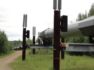 demonstration was extracting the gold from the soil and the panning techniques. This was done so we would all be able to
pan for our own gold from the pouch provided. demonstration was extracting the gold from the soil and the panning techniques. This was done so we would all be able to
pan for our own gold from the pouch provided.
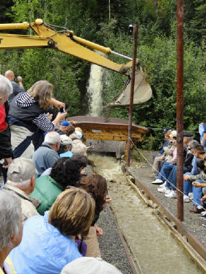 Vern and I obliged and did our dead level best to coax gold from the bag of dirt handed to us. . . and much to our amazement,
we came up with about $27 in gold flakes!!! Probably, in all reality, not even enough to fill a baby tooth but it was fun
and the flakes make a truly authentic souvenir from Alaska. Vern and I obliged and did our dead level best to coax gold from the bag of dirt handed to us. . . and much to our amazement,
we came up with about $27 in gold flakes!!! Probably, in all reality, not even enough to fill a baby tooth but it was fun
and the flakes make a truly authentic souvenir from Alaska.
The last
gasp of our day was spent at Pioneer Park adjacent to the hotel where we participated in the Salmon Bake – all the salmon,
halibut, prime rib and fixings that you can eat. Thank goodness for the park – we walked off our dinner afterward exploring
the Alaska Pioneer Air Museum before retiring to the hotel room – complete with (gas) fireplace. My kind of place! Tomorrow we wait for UPS to arrive and see what the repairs and
the weather bring. No plans, no worries.
How low do you go?: IFR,
MVFR and fog are terms that we are hearing a lot of. There is a low trough parked over our area. While there are periods of
VFR, you will catch the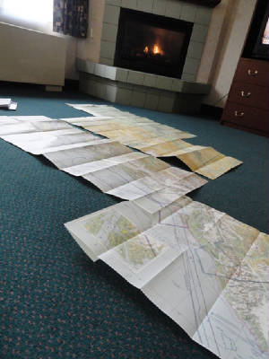 occasional low cloud deck coming by. In Florida, this is a cake walk: drop down a bit skirt under the clouds and pop
back up in a minute. Here it is not the same. We have spent the morning mapping out our course for the trip out of Fairbanks,
anticipating the arrival of our gyro momentarily. Checking the weather, there is MVFR over Talkeetna. This means that you
can land at the airport ... if you can get through the pass. The passes are reporting MVFR as well with 1500' ceilings and
periods of 500' or lower ceilings. Hmmmm. I don't think so. occasional low cloud deck coming by. In Florida, this is a cake walk: drop down a bit skirt under the clouds and pop
back up in a minute. Here it is not the same. We have spent the morning mapping out our course for the trip out of Fairbanks,
anticipating the arrival of our gyro momentarily. Checking the weather, there is MVFR over Talkeetna. This means that you
can land at the airport ... if you can get through the pass. The passes are reporting MVFR as well with 1500' ceilings and
periods of 500' or lower ceilings. Hmmmm. I don't think so. Plan
B: The first order of business was still to make sure that we had an airplane. The gyro finally arrived just
before noon and within an hour Vern had that gyro our ring like a kitten. Next was the weather. With the long range forecast
not set to change we decided to keep the rental car and drive down to Denali for spend some time wildlife viewing.
We set off under overcast skies down Parks Highway 3. There was ample look out spots here we could pull over for a photo
opportunity. On one such stop we met Harry and his wife who had driven their motor home from North Fort Myers, FL. Small world.
The drive was a good thing. Since we are completely unfamiliar with the lay of the land, it is giving us
a good opportunity to get a sense of the clouds and weather in relation to the mountains and the passes as the route is the
same that we will take in a flight to Anchorage. As we pass Nenana, the skies turned to a brilliant blue with scattered clouds.
I was ready to scream. Perfect VFR. I should know better than to out any faith in a forecast. We can only hope this is a trend
that will continue by the time we get back to Fairbanks to pick up Wild Mama.
The drive is lovely, majestic
mountain vistas, wide open valleys and a smothering of wildlife. Nearing Julius Creek we spy 2 red tailed fox sunning on the
side of the road. We think it is road kill until they were awakened from the dead and ran off. Needless to say, we missed
that photo op!
The mid afternoon temperature remains a cool 70 degrees - just right to avoid both the heat
and A/C. It is apparently just right for the wild flowers that line the highways. I remember from the last trip to Alaska
in 1995 that there were so many wildflowers and that surprised me, thinking that would not be the case in such a cold climate.
Nenana was full of wild 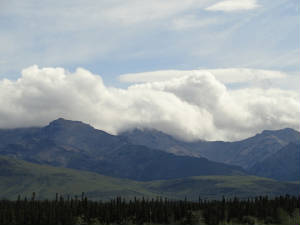 flowers and planted flowers that we enjoyed as we stopped at the Alaska Railroad Museum. This museum is special as it marks
the location of where the golden spike was hammered in as the final spike to open the Alaska Railroad. Nenana is
als the site of the annual Ice Pack contest. Each year people pay $2 per guess to guess the minute when the winter ice pack
will break apart. This is al local tradition since 1917 and the purse now runs about $300,000! flowers and planted flowers that we enjoyed as we stopped at the Alaska Railroad Museum. This museum is special as it marks
the location of where the golden spike was hammered in as the final spike to open the Alaska Railroad. Nenana is
als the site of the annual Ice Pack contest. Each year people pay $2 per guess to guess the minute when the winter ice pack
will break apart. This is al local tradition since 1917 and the purse now runs about $300,000!
At the Tatlanika
Trading Post a lady who moved to Alaska from Texas two years ago began to chat us up for a bit. She was telling about the
changing Esther and how this area was so pretty but to the south it could get quite violent and wicked raining and dark. .
. something for us to think about.
As we neared Denali Park we could see the sky change. The bright blues
gave way to more clouds: more lower clouds or, possibly, must higher terrain. We dropped down into the Nenana Canyon and the
wind started whipping around. There were signs along the road and even on the sectional charts warning of the winds. The perfect
VFR was not looking so perfect again.
Finally, the park entrance was in sight. We decided to make our first
Denali experience a real wilderness adventure and got a camp site at the Denali Grizzly Camp grounds. We got a nice root filled
site on the Nenana River. The camp sites are immediately on the river; then up the hill are the tent sites and the RV sites
and cabins. We heard some of our up the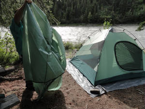 hill neighbors talking but by the time we were at rivers edge, all sounds ceased but the rushing rapids. Good thing we do
not sleep walk lest it be a rude awakening. hill neighbors talking but by the time we were at rivers edge, all sounds ceased but the rushing rapids. Good thing we do
not sleep walk lest it be a rude awakening.
Dinner was across the street at McKinley Village Lodge. We opted
not to bring all of the cooking gear for camping to try to save on weight. We figured that getting food was not going to be
an issue; after all, we are in salmon country and we have fishing tackle!!!
The evening will be cool so we
have all of our blankets and long johns ready to go. Good night, hope we sleep tight! Head in the Clouds: We retired early last night amongst our other campers. We were
pleased tat they were a quiet bunch although the bottles of beer on the table were a bit of a worry at first. It is still
very strange that it never gets dark. In a hotel, you can pull closed the blackout shades and pretend that there is an obnoxious
street light right outside of your bedroom window. Such is not the case camping as you are keenly aware that the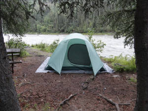 darkness never quite arrives. darkness never quite arrives.
It was cool last night so we brought out all the blankets including the down
comforter that we had. Normally unusable because of how warm it is the comforter was perfect last night. The temperature was
dropping steadily all night. Vern woke up at 3 o'clock to locate the outhouse. I passed as it was just too cold to move out
of the cocoon. There was a small amount of dew on the tent and the ground but tat was nothing compared to the rains that soon
followed. Around 4 a.m. we heard the pitter patter of rain drops; then the pitter patter soon turned to a thunderous roar
of water hitting the top of the tent but we were snug and dry inside (kudos to Eureka Tent Company). The sounds of the rushing
river 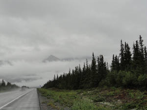 and the rain were comforting . . . So long as no flash flood warnings sounded! and the rain were comforting . . . So long as no flash flood warnings sounded!
We stayed in the tent until
nearly 6:30 a.m. to give the rain a chance to subside so we could pack up camp with relative dryness. Packing was done in
short order thence headed south to get some apple, cinnamon and pecan pancakes with reindeer sausage at the McKinley Creekside
Cafe. Hot cake and warm coffee cured the coldness from this 48 degree morning.
We are heading farther south
toward Talkeetna. We will have a chance to get a good look at the pass and the terrain that we will cover when we fly. One
thing is for certain: morning flight brought these mountains is not the thing to do. The passes and mountain tops are shrouded
in fog. Low clouds are passing periodically letting the peaks play peek-a-boo with here visitors. The atmosphere is very enchanting
but gives us a real appreciation for the trek ahead. It is still out hope to be able to fly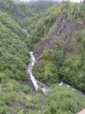 around Alaska through the mountains but Mother Nature will be the final authority on the part of the journey. For now, we
will be content to be land bound and enjoy the sights and sounds of nature reserved for those glued to this earth. around Alaska through the mountains but Mother Nature will be the final authority on the part of the journey. For now, we
will be content to be land bound and enjoy the sights and sounds of nature reserved for those glued to this earth.
We meandered our way down the Park Highway toward Talkeetma watching the fog tickle the tree tops barely 100' AGL. All along
the route there are signs touting the break taking mountain views but we have yet to see more than the tree line. The Guidepost
book notes the Alaska Veterans Memorial at mile post 147. There is a nice memorial and visitors center where we meet a couple
from Idaho hosting the kiosk. They tell us they have not seen Denali in over 2 weeks. All of the Talkeetna flight seeing operations
have been shut down because of the low ceilings. They also tell of the weather starting to break and they are hoping for a
trend toward higher ceilings and great ere visibility. We join in their hopes! They also direct us to Byers Lake behind the
memorial for a scenic stop on a serene lake. This instance we can see the small hillside that cradles the lake in her belly.
Quite beautiful.
We go back to the low visibility near Trapper Creek so we are left to watch for wildlife
and road signs and rain. We see signs that wwe have missed ten Talkeetna Moose Droppings Festival and we might miss the Fireweed
Festival unless wew stick around for the July 24th weekend. Darn, I hate when that happens!
The afternoon
in Talkeetna was spent wandering around this unique and very historic town. We ate caribou burgers, fresh halibut and a carrot
cake from the Talkeetna Roadhouse that would knock your socks off. We visited the Alaska Adventure Museum and peeked into
the little artisin shops along the main street of town.
The evening was time to rest, shower and study the
flight plans. We had the chance to speak sit many pilots as Talkeetna is the primary hopping off  point for flight seeing around Denali. All have universally told is how unusual this weather pattern is and they have not
flown in days. They are joking for a change soon. Yes, well, we, too, are hoping for the change. Even the Alaska Airmens Association
Logbook talks about the unlimited visibility and wide open skies where you can see storms coming for miles ahead of you. We
are still waiting for that. point for flight seeing around Denali. All have universally told is how unusual this weather pattern is and they have not
flown in days. They are joking for a change soon. Yes, well, we, too, are hoping for the change. Even the Alaska Airmens Association
Logbook talks about the unlimited visibility and wide open skies where you can see storms coming for miles ahead of you. We
are still waiting for that.
Tomorrow we I'll make a stop at the Ranger Station and talk about flying with
them before we head back. To Denali Park for our foray into the park where we I'll do some critter spotting and hopefully
see some mountains while we are here.
A departure from Civilization: We departed Denali
Rail Station on the Kantishna Roadhouse bus with Gary, our driver of 37 years. He assured us that we would not get lost ...
 especially since there is only one road in and out. The trip is 91 miles in to the Roadhouse on mostly a dirt road. There
are 5 mountain passes to cross on the way and, hopefully, lots of critters. especially since there is only one road in and out. The trip is 91 miles in to the Roadhouse on mostly a dirt road. There
are 5 mountain passes to cross on the way and, hopefully, lots of critters.
The first 34 miles of the journey
is to be relatively animal-free as the terrain is lower and the people more plentiful. But just a few miles off the paved road (14 miles into the park) we spot a caribou buck with a beautiful rack. He stands and poses for us on the ridge
- a spectacular sight! paved road (14 miles into the park) we spot a caribou buck with a beautiful rack. He stands and poses for us on the ridge
- a spectacular sight!
The trees we see are white spruce trees with growth rings so close they literally
tough each other. The root system is horizontal so there is no tap route and it is not uncommon for the spruce to get blown
over in heavy wind. There are also even smaller black spruce that grow well in wet rocky areas. Cottonwood, birth and Aspen
are the 3 deciduous trees in the area.
Shrubbery consists of dwarf birch and willow. There are 27 different
varieties of willow in the park that are already turning yellow. For some 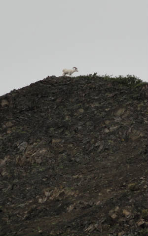 reason, the fall has come about 2 weeks early this year. The grasses are starting to yellow, the berries are ripe and ready
for the bear to eat, and the trees are starting to turn. The wild flowers are disappearing rapidly. The fireweed is already
changing and will explode with color soon. reason, the fall has come about 2 weeks early this year. The grasses are starting to yellow, the berries are ripe and ready
for the bear to eat, and the trees are starting to turn. The wild flowers are disappearing rapidly. The fireweed is already
changing and will explode with color soon.
The valley in the park sits between the Alaskan Range and the
Outer Range. The weather is quite uncertain and ever changing as the convergence of the two mountain ranges plays havoc with
the frontal systems that pass by.
We pas over a series of braided rivers on the north side of the Alaska
Range. Only about 3 feet of a very dry snow falls here annually. Even a large rain or the spring snowfall will not fill up
the river beds. There is a low volume of water with a high concentration of silt so there are not any fish in these braided
rivers.
We stop on a bridge over a little creek to spy 3 dall sheep - 2 ewes and a ram. We need the binoculars
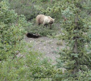
to see the horns on the ram but they are clearly visible from the bus. Around another corner, we see 2 buses stopped. They give the bear sign. The bus pulls up to
expose a mother and older baby grizzle bear foraging through the willow bushes. clearly visible from the bus. Around another corner, we see 2 buses stopped. They give the bear sign. The bus pulls up to
expose a mother and older baby grizzle bear foraging through the willow bushes.
At mile 45 we stop for a
foot path to the top of the pass. As we approach the top of the path we spy the ghostly images of a heard of dall sheep shrouded
in the fog bank that passes by. On the next ridge is another large ram playing king of the hill as he grazes.
The narrow roadway clings to the hillside so precariously that the buses must tenderly pass each other along the ditches
that are used for the shoulder. Dwarf fireweed poke out through the jagged rocky cliffs adding a splash of purple to the otherwise
dark background. We climb to only 3,700' but the tree life is nil. The frost layer under the ground is getting ever so closer
to the top where the vegetation can no longer thrive as it does in the lower elevations. We ate getting closer to the caribou
habitat as they need wide open spaces to use their speed for protection. We stop at the ranger station at mile post 53 for
a short break. We have been on the road for a little ore 3 hours and still have 38 miles to go!
 As we pop up over the next ridge a passing bus signals that a wolf has been sighted and we soon see the lone wolf asleep in
the tundra. We keep climbing into solid IMC as the clouds hang stubbornly in the crevices of the mountains. We stop at Eielson
Visitors Center where a lone ranger remains to answer questions of the visitors. We are 68 miles in on the park road. What
a peaceful existence for this ranger. Quiet evenings and days punctuated by a small bus load of curious onlookers. As w leave
the visitors center we climb eve so higher into the clouds but our driver says "no worries" we can trust his instrument
navigation! As we pop up over the next ridge a passing bus signals that a wolf has been sighted and we soon see the lone wolf asleep in
the tundra. We keep climbing into solid IMC as the clouds hang stubbornly in the crevices of the mountains. We stop at Eielson
Visitors Center where a lone ranger remains to answer questions of the visitors. We are 68 miles in on the park road. What
a peaceful existence for this ranger. Quiet evenings and days punctuated by a small bus load of curious onlookers. As w leave
the visitors center we climb eve so higher into the clouds but our driver says "no worries" we can trust his instrument
navigation!
As we exit grassy pass we depart from the alpine tundra area to the moist tundra area where there
are very dense shrubs - willows and alders - horrible for hiking but very good moose habitat. There she is: a momma and her
baby mouse resting in the grass next to the small lake. We have seen all of the big 5 of Alaska: moose, grizzly bear, caribou,
dall sheep and wolf. This make the ground bound portion of the program much more "bear-able"!
The
Kantishna Lodge is a recluse dream- no phones, no TV, no Internet and wilderness galore. The Lodge is situated next to a river
just 3 miles from Wonder Lake. We passed the lake on the way in and learned that it was a glacier formed lake or "kettle"
over 200' deep and over 2 miles long. There is a hiking and naturalist program for those with an extended stay or just the
peace and solitude for those of us riding back to civilization tomorrow.
Our escape: The rooster crowing at 4:30 this morning
was the first sound we has heard all night. No, this was not a lone Alaska roost ere, but Vern's alarm clock to be sure we
were 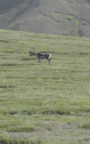 up and ready for the 6:15 am morning departure. We had breakfast and set off. Not 10minutes into our journey we were surprised
by a lone moose in a small willow patch next to the road, followed by a family of ptarmigan crossing our path. Then we quietly
disappeared into the soup of IMC as w ascended to the first pass. up and ready for the 6:15 am morning departure. We had breakfast and set off. Not 10minutes into our journey we were surprised
by a lone moose in a small willow patch next to the road, followed by a family of ptarmigan crossing our path. Then we quietly
disappeared into the soup of IMC as w ascended to the first pass.
The fog is really persistent this morning,
not wanting to give up her treasures. As we stop at the Eielson Visitor Center we see a glimpse of a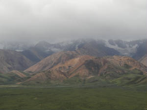 distant snow covered peak and a faint glow of the sun giving us hope that the fog will give up the ghost soon. distant snow covered peak and a faint glow of the sun giving us hope that the fog will give up the ghost soon.
In time, the fog starts to reveals the secrets hidden within Denali: a small herd of about a dozen caribou grazes on the
far side if the braided stream; another small herd of 3 adults and a baby next to the road; field birds are taking flight
and the valley below comes into focus. You can tell a little about the history of the area by the shape of the valleys: U
shaped valleys are formed by glaciers cutting their way across the landscape while V shaped valleys are forged by water making
here mark of erosion over time.
There is a battle this morning between the fog and the sun, each claiming
temporary victory. The sun momentarily prevails to expose the Polychrome Mountains and a golden eagle. In the sunlight you
CSM see the mountains dotted with delphinium, fireweed and potentella.
As we top the polychrome pass the
wind begins whipping around removing tourists hats and making the willows and flowers perform a ritualistic sun dance. The
good news is that the wind will blow out the clouds. The bad news is that. The wind might be high enough that flight through
the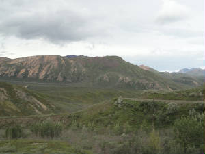 passes will be impossible. passes will be impossible.
Another large herd of caribou appears on the distant ridge line and bear scat
in the road rich with blueberry is but no grizzly this morning.
 The fog gives way for a bit and we see Double Mountain at 5900'. Most of the tops of the mountains are barren as the tree
lines ceases between 2700-3100'. We turn the corner to see another bus perched on the side of the road, tourists looking downward.
It is a mother grizzly bear with here spring cub munching on soapberries in the river bed. We linger for a bit until she comes
too close to the bottom cliff age where she is obscured by the tall trees. The fog gives way for a bit and we see Double Mountain at 5900'. Most of the tops of the mountains are barren as the tree
lines ceases between 2700-3100'. We turn the corner to see another bus perched on the side of the road, tourists looking downward.
It is a mother grizzly bear with here spring cub munching on soapberries in the river bed. We linger for a bit until she comes
too close to the bottom cliff age where she is obscured by the tall trees.
We make the final rest stop before
the remaining hour back to the train depot and the winds are now howling; the port-o-johns are quivering in the winds and
it makes us wonder what the wind is like in ten Nenana Canyon Pass.
We finish our trek into the Park on
a high note with the grizzly sighting and we high-tail it north to go fetch Wild Mama. The conditions on the drive north look good. We call various automatic weather reporting stations along the route and they look good. Let's hope this
hold until we can get back through the passes and into Anchorage. north look good. We call various automatic weather reporting stations along the route and they look good. Let's hope this
hold until we can get back through the passes and into Anchorage.
We get delayed in Fairbanks with the rental car return
and getting fuel. There was actually a line for fuel. I keep checking the AWOS reports and make the final call to flight services
for a weather briefing. All continues to look good except through the Chulitna area where the ceilings are  fluxuating down to 1500’ with occasional scatted layers between 600 and 900 feet: still doable as the layers have been
very thin. We decide to make the run for it. fluxuating down to 1500’ with occasional scatted layers between 600 and 900 feet: still doable as the layers have been
very thin. We decide to make the run for it. Almost immediately
upon lift-off we hit the light rain falling in the Fairbanks are. No worries. We have plenty of space between us and the mountains
and this is not the worrisome part. As we near the pass we feel the wind pick up and see that is is approaching 33 kts. We
cinch the belts down, drop the speed to closer to maneuvering speed and enter the pass. It is a bit bumpy but not nearly as
bad as we figure. At the Nenana Canyon, the ceilings are still very high – over 5,000’ – and the visibility
is good. We head for Windy Pass and Broad Pass and skate through with no problem. We talk to a couple of other plane who have
come up from Anchorage and they tell us that Chulitna is low – they came through at 200’ but say they are a Cub
so low and slow is the name of their game. As we near Chulitna
we see the issue. The scattered layers are not going to be easy to go through and we are not dropping down to 200’.
We elect to go over the scud and settle in at 2500’. We have lost sight of the road but the braided river is prominent
below us and runs in a low section of the valley just west of the road. We are OK with this. We continue in toward Talkeetna.
The weather is reporting 1700’ broken then 1400’ broken. We decide that it will be best to land there and file
IFR for the last part of the trip in to Anchorage. We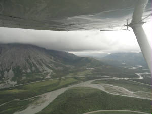 would have gotten flight following in to this busy area anyway and the MEA’s are low enough that we do not have to
climb to the freezing level at 6,000’. would have gotten flight following in to this busy area anyway and the MEA’s are low enough that we do not have to
climb to the freezing level at 6,000’. We talk
to flight services and get our clearance, departing to the south and heading to 3,000’ where we are solidly IMC all
the way to Anchorage. They give us a visual approach and, once we drop to about 1800’, we are able to see the airport
and make our way in. We did not make any plans for an arrival today so we are a bit lost for a room and a car. Ace Hangars
has a courtesy car and the nicest “hotel room” over the hangars. We stop here for the nice happy to have Wild
Mama with us and out of Fairbanks!
Heading South: Once again the rental car companies
are the ones getting our business rather than the aviation fuel companies. Although the weather in Anchorage is flyable, it
is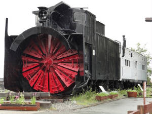 another rainy day with occasional low ceilings and it gets worse to the southwest along the Kenai Peninsula where we are
headed. another rainy day with occasional low ceilings and it gets worse to the southwest along the Kenai Peninsula where we are
headed.
 We stop at the Potter Creek Marsh and the Chugach Ranger Station. There is an old train display with THE BIGGEST snow plow
I have ever seen. The tide is out at Turnagain Arm exposing the quicksand-like mud flats bottom. Many warning signs are posted
to avoid the tempting walk out onto the mud flats. There is a bore tide at Turnagain Arm and we try to check to see if we
can see the tide as the water is choked down coming into the inlet. There is a 32' tide for Friday, July 30th on our way back
but nothing mentioned for today . . . except the winds at 40 kts gusting to 50 kts along the inlet. We can feel the wind rocking
the car as we head south on Seward Highway. We stop at the Potter Creek Marsh and the Chugach Ranger Station. There is an old train display with THE BIGGEST snow plow
I have ever seen. The tide is out at Turnagain Arm exposing the quicksand-like mud flats bottom. Many warning signs are posted
to avoid the tempting walk out onto the mud flats. There is a bore tide at Turnagain Arm and we try to check to see if we
can see the tide as the water is choked down coming into the inlet. There is a 32' tide for Friday, July 30th on our way back
but nothing mentioned for today . . . except the winds at 40 kts gusting to 50 kts along the inlet. We can feel the wind rocking
the car as we head south on Seward Highway.
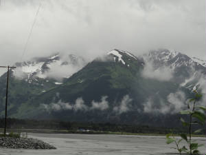
About 40 miles south of Anchorage is a little town called Girdwood
where we found the Aleyeska Resort. We rode the tram to the top of Aleyeska Mountain where we could see 7 hanging glaciers
in the neighboring mountains. It was a brisk 43 degrees at the top of the mountain and the annual snow was still melting.
It is the coldest summer on record with only 2 days of sun in July. Normally they get about 2 rainy then 2 sunny days during
the month. They expect no change for the month of August! The view from the top, even through the fog and low clouds was spectacular
with a sweeping view of Turnagain Arm.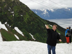
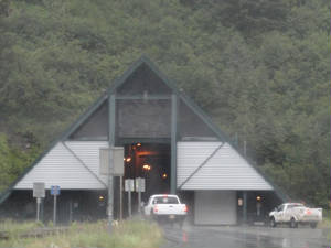
We turn off of Seward Highway toward Whittier, a small town that, until 2000, was only accessible by train
or boat. In 2000 they made the train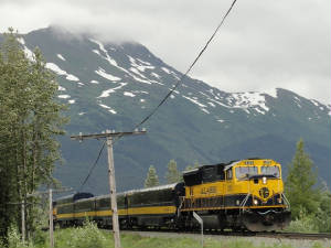 tunnel available to cars. It is one lane and you can only get across every hour ... that is, unless the train is coming then
you have to wait. tunnel available to cars. It is one lane and you can only get across every hour ... that is, unless the train is coming then
you have to wait.
But before heading to Whittier, we wanted to see Portage Glacier and took the hour long
cruise to the glacier. This is a fresh water glacier that terminates into Portage Lake, the lake that was formed by the glacier
about 100 years ago. This is a dead lake meaning that because of its depth (600' or so) and the short summers, insufficient
light can reach the bottom to make photosynthesis to make fish food so nothing lives there by glacial silt.
We step to the window to purchase our ticket in time to hear the captain on the incoming cruise talk about the 50 kt winds
he has for docking. It is also a hard steady rain by now but we go anyway as the conditions are perfect for glacier viewing.
Sunlight clears the glacial ice and you cannot see the deep blues as much as you 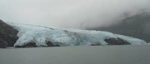 do when it is foggy and rainy. I am glad the weather has served us well for something! do when it is foggy and rainy. I am glad the weather has served us well for something!
The MV Ptarmigan approaches
the glacier within 300 yards, close enough for us to hear the "white thunder" - the sound of the cracking and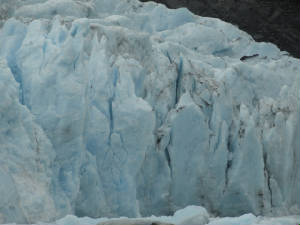 calving glacier. We see 2 large chunks break off and come crashing into the water. After being battered by the wind and driving
rain for 30 minutes are come inside happy and drenched and make our turn for the 6:30 pm train tunnel and Whittier. calving glacier. We see 2 large chunks break off and come crashing into the water. After being battered by the wind and driving
rain for 30 minutes are come inside happy and drenched and make our turn for the 6:30 pm train tunnel and Whittier.
The tunnel crossing was interesting as we drove on the train tracks for the 6.5 minute crossing. We exited into the quaint
little village of Whittier on Prince William Sound. Obviously a fishing oriented town with many fishing charters, glacier
cruises and sea kayaking as the principal activities. Most of the town lives in the Begish Towers, a 15 story condominium
building originally built by the military for BOQ housing years ago. It now also houses many of the government offices and
a few other businesses. This was also our lodging for the evening as we rented one of the condos, complete with dry sauna
- something we both really appreciate after being cold most of the afternoon – a complete kitchen and an 8-track tape
 player and tapes. Now that is an antique! We have a great glacier and water falls view from the condo. The mountain, which
rises about 2,500', is lush and green with numerous smaller waterfalls and one large falls cascading down it's side. player and tapes. Now that is an antique! We have a great glacier and water falls view from the condo. The mountain, which
rises about 2,500', is lush and green with numerous smaller waterfalls and one large falls cascading down it's side.
After dinner of halibut and shrimp at Swiftwater Seafood Cafe we walked back out along the harbor. The wind was blowing
so hard that i was not sure if we were being pelted by rain or salt watt coming on off the Sound. Either way, we felt like
the walking versions of "The Deadliest Catch".
All of the fishing and outer water charters are
canceled because of the weather. No one has run for a week. They are hopeful that the weather will break on Tuesday for a
change. Again, we were told this has been the most rainy and cold summer seen in a long time. We will all look for improvement
tomorrow.
Another day of rain: Our awakening this morning
showed no promise of a prettier day. The Whittier Glacier that we saw from our room last night was completely obscured and
the  rain was pounding hard on the car as we left the condo. We would not be able to do a glacier cruise today so we decided to
move on farther down the peninsula. We did, however, stop at the local Whittier town museum to see the local displays about
Whittier events and heroes. rain was pounding hard on the car as we left the condo. We would not be able to do a glacier cruise today so we decided to
move on farther down the peninsula. We did, however, stop at the local Whittier town museum to see the local displays about
Whittier events and heroes.
Heading south on highway 1 toward Seward, we were followed by low hanging clouds
all along the mid-ranges of ten mountains. We would get an occasional glimpse of the snow covered top but the views were few
and far between. A planned stop was Moose Pass at the seaplane base to get some more float plane time in. The best they could
do is to tell us to call when we passed back to the north to see if the ceiling was high enough to fly. They were grounded
today and had been for the last several days.
The turnoff for Exit Glacier was on the way to Seward. This
provided and excellent opportunity to stretch our legs, get in a nice mile log hike and get up close and personal with a hanging
glacier. The rain eased off enough and the hike was really nice and the glacier spectacular. Exit, like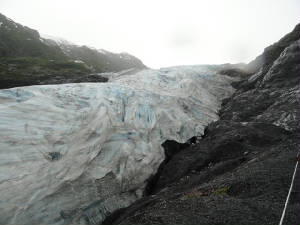 other glaciers, has been retreating lately - this one since ten early 1900's. There were marks along the path to see where
the far marl of the glacier once stood. It was quite alarming to see how far it retreated in just the few years since 1998
- well over 50 feet. other glaciers, has been retreating lately - this one since ten early 1900's. There were marks along the path to see where
the far marl of the glacier once stood. It was quite alarming to see how far it retreated in just the few years since 1998
- well over 50 feet.
Looking for food, we decided to head on to Seward and find some salads. Both of us were
about "fish and chipped" out and wanted those nice, fresh salads like we had back at Chena Hot Springs. I had a
Nellie's Grandview salad, named after a famous Alaskan woman, and Vern got a rather different version of a Caesar salad with
blackened halibut.
With the remainder of the cruises still shut down from the heavy rains and high winds'
we wandered the town and finally decided to find a place for the night. Everything was booked solid. I guess folks are waiting
around for the better weather. We opted to tour the Seward town museum and then head to Cooper Landing where there was a lodge
with evening availability.
Heading back out of the Seward Highway over to Cooper Landing, we spy a pull
out on Upper Trail Lake. There is a beautiful view of the mountains shrouded by fog and a picnic  table: the perfect spot for a roadside camping retreat to pitch your snack sack for the bear that frequent the area. Finally,
nearly 5:30 this after noon we see the first sunlight we have seen in a couple of days...maybe a new trend. table: the perfect spot for a roadside camping retreat to pitch your snack sack for the bear that frequent the area. Finally,
nearly 5:30 this after noon we see the first sunlight we have seen in a couple of days...maybe a new trend.
We turn the corner on Bean Creek Road to the Kenai Princess Lodge on the Kenai River. Boy, when life turns good it really
turns. We have a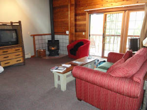 beautiful bungalow suite overlooking the mountains with some blue sky in the background, a wood burning stove, serene surroundings
and the sun came out. Does it get any better? beautiful bungalow suite overlooking the mountains with some blue sky in the background, a wood burning stove, serene surroundings
and the sun came out. Does it get any better?
Dreamed and done: Our excitement
from last night fades when we awakened only to have our heads back in the fog … another rainy day. We had heard the
rain pounding on the   roof last night but hoped it was only a dream. Instead of fighting it today we wandered off to Soldotna and toward the town
of Kenai. Enroute, we stopped at many of the local artisan shops along to the way to see carvings of horns and tusks, rocks
and minerals and all sorts of other local crafts. roof last night but hoped it was only a dream. Instead of fighting it today we wandered off to Soldotna and toward the town
of Kenai. Enroute, we stopped at many of the local artisan shops along to the way to see carvings of horns and tusks, rocks
and minerals and all sorts of other local crafts.
Soldotna found us hungry so we grabbed a quick bite and
headed to the Carhart store to get a hood for Vern's jacket and get some serious rain gear. We spent quite some time in the
store only to come out to the bright sunshine. Had I know this, I would have bought a raincoat days ago.
With
the sun out, we called back to Moose Pass to see if the ceiling was high enough there to try to do some float plane flying.
The sun was in and out but it looked promising for the afternoon. We turned around and headed back the other way. Kenai will
be there tomorrow but the sun might be gone.
 We got to Scenic Mountain Air in Moose Pass. There were 2 super cubs and 2 instructors available and the ceiling was high
enough. I flew with the owner, Vern, a humorous gentleman who has been flying these parts for the past 39 years. We took off
from Upper Trail Lake and headed back to the south straight for the mountain. Vern was good enough to give me some mountain
flying tills along with the float time. We hugged the side of the mountain to get enough lift to make the ridge where we dropped
down to see the black bear on the side of the mountain and 3 grizzlies in the stream catching dinner. We circled for a few
minutes the headed for the ice fields. We got to Scenic Mountain Air in Moose Pass. There were 2 super cubs and 2 instructors available and the ceiling was high
enough. I flew with the owner, Vern, a humorous gentleman who has been flying these parts for the past 39 years. We took off
from Upper Trail Lake and headed back to the south straight for the mountain. Vern was good enough to give me some mountain
flying tills along with the float time. We hugged the side of the mountain to get enough lift to make the ridge where we dropped
down to see the black bear on the side of the mountain and 3 grizzlies in the stream catching dinner. We circled for a few
minutes the headed for the ice fields.
Harding Ice Field is one of the largest in Alaska. To say that the
sight was spectacular does not even begin to describe the beauty of the snow capped mountain. The benefit of having the colder summer is that the blinding white snow pack was still on the top of the
ice pack and it has not yet turned to the glaze ice. This is what helps make the advance in the long run. No global warming
here this summer. This is capped mountain. The benefit of having the colder summer is that the blinding white snow pack was still on the top of the
ice pack and it has not yet turned to the glaze ice. This is what helps make the advance in the long run. No global warming
here this summer. This is 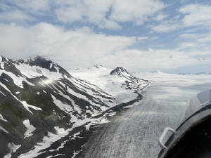 one of the most awesome sights I have ever seen. I had wanted to make this flight in Wild Mama but with the weather, we simply
have been unable to make the flight. But today, in a Super Cub plugging along at 70-75 mph we had a leisurely journey, with
an experienced guide and mountain pilot. I was very much at ease and we switched back and forth on the controls so he could
maneuver me in for some really nice Kodak moments. But there were so many. one of the most awesome sights I have ever seen. I had wanted to make this flight in Wild Mama but with the weather, we simply
have been unable to make the flight. But today, in a Super Cub plugging along at 70-75 mph we had a leisurely journey, with
an experienced guide and mountain pilot. I was very much at ease and we switched back and forth on the controls so he could
maneuver me in for some really nice Kodak moments. But there were so many. Each turn of my head made my heart leap; the pure white snow, the deep blue ice packs; the dark brown
jagged peaks untouched by the lingering snows. Each captured my attention as we flew past. We turned out left to come over the back side of Bear Glacier and flew down this tide water glacier
to Prince William Sound. Dropping down to near the water level we turned back and flew beside the glacier below it's height
at the water. We were at 300'. We made a couple of passes in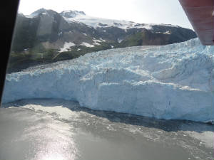 front of the glacier and I took in every detail the best I could. Wild Mama could not have made this trip. She is much too
fast and to slow her to near stall speed at this altitude to sight see would be, well, let’s just say my mind would
not be on sight-seeing. front of the glacier and I took in every detail the best I could. Wild Mama could not have made this trip. She is much too
fast and to slow her to near stall speed at this altitude to sight see would be, well, let’s just say my mind would
not be on sight-seeing.
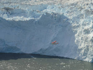 Vern and his instructor, Joe, were in trail behind us. We called to them to circle back to snag a picture of the plane in
front of the glacier. They dropped as we climbed to get a great shot. We could see up the crevices of the glacier, could see
the medial line and the small (200 pound or so) ice chunks that had recently calved off. Vern and his instructor, Joe, were in trail behind us. We called to them to circle back to snag a picture of the plane in
front of the glacier. They dropped as we climbed to get a great shot. We could see up the crevices of the glacier, could see
the medial line and the small (200 pound or so) ice chunks that had recently calved off.
We circled and
climbed back over another small ridge. At the next left turn, the whole Iliac Glacier opened up before us with a full ice
field. The water was so clear that you could see much of the ice beneath the surface to make you truly believe that only 10%
of the ice is visible on the top. We climbed staying just about Iliac Glacier all the way to the top seeing her long lines
that flowed from the mountain top to the Sound. From crossing Iliac we swooped down across the Exit Glacier where we had walked
yesterday - such a different and much more spectacular view from the air.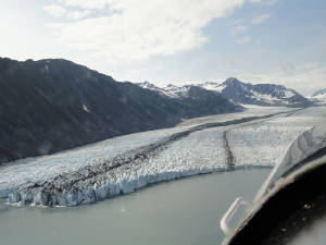
On the way back to the seaplane base, we passed a lone mountain goat, then a herd of about 40 more on the
ridge line. All too soon, we dropped 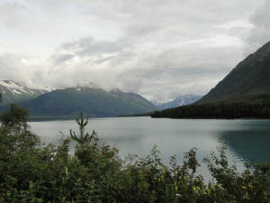 in for a glassy water landing and it was all over. I was not yet ready to land. in for a glassy water landing and it was all over. I was not yet ready to land.
Two years ago, Nicole Cagnolatti
awarded me the WAI scholarship "If you can dream it you can do it". My dream was to get my float plane rating and
fly a float plane in Alaska. Thank you, Nicole. You made it happen. Dreamed and done!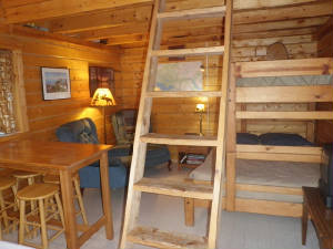 This evening we are back at a beautiful, small,
rustic cabin at Cooper Landing Fish Camp. Let's see what tomorrow will bring ...
Something's fishy: Having spent the night
in Cooper Landing Fish Camp, you have probably already guessed the planned activity for the day. We are on the Upper Kenai
River, 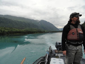 famous for salmon fishing and today is our day. We started out early this morning with guide Eric and another client, Mike.
The trip was about 4 or 5 miles down river from the drop in point. The Kenai runs fairly swiftly but it is easy to fly fish
along the banks. The deepest part of the river where we were was only around 3 feet. famous for salmon fishing and today is our day. We started out early this morning with guide Eric and another client, Mike.
The trip was about 4 or 5 miles down river from the drop in point. The Kenai runs fairly swiftly but it is easy to fly fish
along the banks. The deepest part of the river where we were was only around 3 feet. The trip down the river was filled with lots of eagles perched high in the trees. We saw many full grown adults,
several nests and a yearling that still had its’ brown head. The eagle does not get its’ white head until the
age of 5. The gurgling waters, the serene setting and the majestic eagles on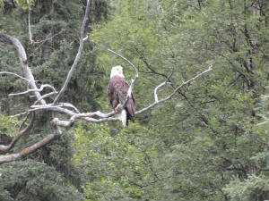 the shores made the float to the fishing spot quite enjoyable. the shores made the float to the fishing spot quite enjoyable. All
3 of us were novices so Eric had his work cut out for him. We donned waders and warm clothing - I felt like the Michelin Tire
Man, and probably looked like him too with heavy wool socks, a complete set of long johns, heavy jeans, a turtle neck shirt,
long sleeved denim shirt, heavy sweat shirt and fleece lines jacket – then waddled out into about 1 foot deep water.
Eric gave us a group orientation and handed us the fly rods then briefly gave us individual instruction, starting with Mike. I was next on the list. Eric explained that the object is to have the hook
float into the fish’s mount as the fish swims up river and the hook drifts down river. There is no bait as the spawning
salmon are not eating any longer. So the idea is to have the hook drift past the mount then you have to snare the fish as
he swims by. OK. I am all set and start the fly fish casting technique that Eric taught me. Once Eric was satisfied that I
was not going to snare anyone he moved on to Vern for his orientation …. then it happened … “Eric, I have
a fish!” “Let him run, let him run!” Eric called back as he got the net. The fish took out just a
little line then stopped and Eric instructed me on how to work him back in, explaining that he will start fighting when he
gets close to shore. I coaxed the fist in very slowly until Eric scooped him up in the net. A keeper! The salmon we fished for are sockeye salmon – the red ones. But you do not want the fish to be too red. The
story is that as they fish get closer to spawning – and closer to then end of their lives – they use their meat
and muscle mass. At this point in the river they are various colors ranging from a silvery with light pink tones to a tomato
red. The silvery/pink ones are the ones to keep. Once they become tomato red, the meat is mushy like a fish pâté
and is not fit to eat and very difficult to clean. According to Eric, you can cut it with a stick. 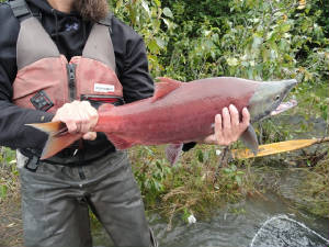 The fish came in schools. There would be a gap then another school would swim by. I must have been in the perfect spot near
a hole where the fish stopped to rest because ZAP, I caught another one …. and another, and another and another. Six
in all although only 3 were the really good silvery/pink ones. The other 3 were tomato red; and one of those put up a fight!
Once he was snared, he took off, the line was buzzing. He ran down between Mike’s and Vern’s legs with Eric giving
chase. He was going to be a tangle in everything. “Reel The fish came in schools. There would be a gap then another school would swim by. I must have been in the perfect spot near
a hole where the fish stopped to rest because ZAP, I caught another one …. and another, and another and another. Six
in all although only 3 were the really good silvery/pink ones. The other 3 were tomato red; and one of those put up a fight!
Once he was snared, he took off, the line was buzzing. He ran down between Mike’s and Vern’s legs with Eric giving
chase. He was going to be a tangle in everything. “Reel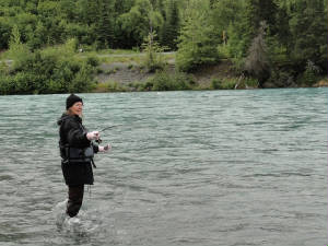 the line!” Eric hollered, and I inched the fish in to a reasonable location where Eric could scoop him up. That one
was work. the line!” Eric hollered, and I inched the fish in to a reasonable location where Eric could scoop him up. That one
was work.
There was a lull where we did not even see the fish
in the water as we had for the past hour or so. Eric had time to set a line and do some fishing on his own. He had one almost
immediately and called me to take the rod to bring her in. But it was a left handed rod – he tried to throw me a curve.
I started to reel and the reel handle unscrewed itself. We caught the pieces but that left us with a fighting fish on the
end of the line and no way to reel it in. Eric coached me on how to bring the line in with the fish and the two of us worked
her back to shore where she was scooped up. Another keeper! In
all for the day, Eric caught 2 keepers and a couple more red ones; Vern caught 2 red ones and I managed to get 3 keepers and
3 red ones (plus the assist to Eric on one of his keepers). Eric cleaned the fish right there in the river and showed
us all of the eggs. He explains how all the parts and pieces of the cleaned fish would go back to nature: the eggs for the
trout; the fish heads for the bears and the other carcasses for the eagles and the sea gulls that swarmed over head. Nothing
went to waste. 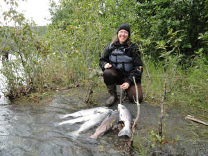 As for the 20 pounds of salmon filets, they are on their way back to Fort Myers for us for dinner!!!! As for the 20 pounds of salmon filets, they are on their way back to Fort Myers for us for dinner!!!! Exhausted from 4 hours of steady fly fishing on the river, we headed back to where we started yesterday: to Kenai.
Kenai is the largest town on the Cook Inlet in the Peninsula. It is situated where the Kenai River ends and “where adventure
begins” according to the promotional material. Our adventure is ending early today. We are both tired. I needed to shed
the extra 20 pounds of clothing that I carried around all day and get some rest. We will head out tomorrow to explore before
making our way back off the peninsula. After an afternoon nap, we got a second breeze
(I can hardly call it a second wind as we were not that enthusiastic) early this evening and drove the remaining
miles out to Captain Cook State Recreational Park north of Kenai and we stopped along the Cook Inlet to watch the natives
go dip net fishing. Off in the distance you could see the volcano, Mount Redoubt, through the haze. We decided to do this
tonight as the weather is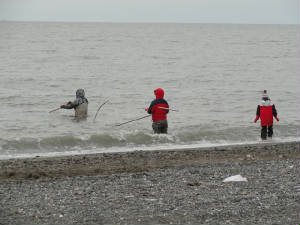 looking good for a while and might be promising for some flight time out of Anchorage in the next day or so before the MVFR
and IFR moves back in. Our time in the peninsula is drawing to a close but I have to say that it has been a highlight thus
far. looking good for a while and might be promising for some flight time out of Anchorage in the next day or so before the MVFR
and IFR moves back in. Our time in the peninsula is drawing to a close but I have to say that it has been a highlight thus
far. I can see clearly now, the
rain is gone: We
slept like the dead last night. I think we are getting vacationed out at this
point and needed some rest. But we got up early this morning 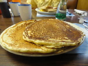 to head back to Anchorage. The weather was looking the best we had seen it but there is a big storm coming in tomorrow so
we need to get out of the area. to head back to Anchorage. The weather was looking the best we had seen it but there is a big storm coming in tomorrow so
we need to get out of the area. The first stop was breakfast.
I had “Alaska style pancakes”. When I asked what that meant, the waitress just laughed. When I saw the 2 pancakes
brimming over the sides of the platter, I understood. I ate ½; Vern ate ½ and the other pancake we could not
touch. I have never seen a pancake so large and I will be sure to check the Guinness Book of World Records to see if their
pancakes are listed. They certainly should be.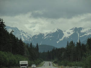 The ride up to Anchorage was beautiful:
the mountains were out and the visibility was pretty good. We got to see all of the stuff we missed on the way south. The
mud flats at Turnagain Arm were completely covered this time. We made it back to Anchorage and went to see the Aviation Heritage Museum at Lake Hood. The museum has really
nice exhibits about the old bush pilots and the aviation roots in Alaska. We followed that with a visit to the seaplane base
and then went off to see Wild Mama who had been, unfortunately, left behind on our adventure. She was happy to see
us but got rained on pretty good and was wet inside. We had heard there were  blowing winds and a flood watch while we were in the Peninsula but we had no idea. We pulled up the carpet and got her dried
out and headed to the hotel to do laundry and prepare for a morning departure through Glenallen and back out the highway route.
The storms are covering Valdes which is a critical point in our attempt to make the water route to the southeast pan handle.
With Valdes clouded in and a storm coming, the feet wet route is out. We will look at the feet dry route to Skagway and see blowing winds and a flood watch while we were in the Peninsula but we had no idea. We pulled up the carpet and got her dried
out and headed to the hotel to do laundry and prepare for a morning departure through Glenallen and back out the highway route.
The storms are covering Valdes which is a critical point in our attempt to make the water route to the southeast pan handle.
With Valdes clouded in and a storm coming, the feet wet route is out. We will look at the feet dry route to Skagway and see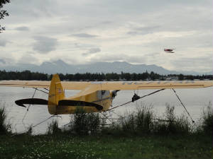 if it is doable in the morning when we can see the weather cams through the passes. if it is doable in the morning when we can see the weather cams through the passes. For tonight: laundry, packing and flight planning.
Back in the air again: This is the
day that we did the sun dance for: blue sky (not 100% but certainly you saw more blue than white); light wind; perfect flying
conditions. And we were 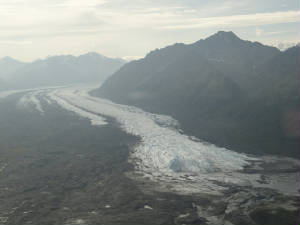 off! off! We made quick work of the rental car return and canceling
the hotel reservations we had for the weekend to see the Arctic Thunder Airshow over Anchorage. The TFR would start at 1100
so we had to be gone meaning eAPIS filed, CANPASS called, flight plans filed. We hustled and were off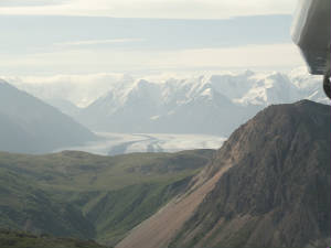 the ground at 1015 local heading back to the north-ish. the ground at 1015 local heading back to the north-ish. All
of the mountains to the east were visible: Wrangle Mountain with all of her glaciers and lots of smaller peaks; but nothing
to the west was to be seen. The monster storm was lurking on the horizon and it signaled our need to depart. We followed the highway to Wasilla then Palmer. Off to our right was a flight of
3 sightseeing planes making the run over Matanuska Glacier. We 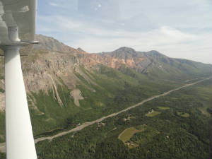 did not follow them in as four would have been a crowd. We opted, instead of the Tazlina Glacier; then followed the Tazlina
River on to Gulkana where we stopped for fuel and refilled the international portion of the fight plan. did not follow them in as four would have been a crowd. We opted, instead of the Tazlina Glacier; then followed the Tazlina
River on to Gulkana where we stopped for fuel and refilled the international portion of the fight plan. We did not do the low and slow as we had in the float planes; but we did slow Wild
Mama down quite a bit to be sure we could make the turn around in the pass over the glacier. The glaciers could way out-climb
us and we were not interested in starting the trip in the nose-bleed altitudes. We got at a comfortable 3500’ for the
first leg and had plenty of wonderful sights to see. We were
to follow the highway out of Gulkana to Northway then on to Whitehorse; but there was another glacier that called to us –
Neminda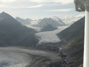 Glacier – and we wandered a bit off course to the valley of that giant. This looked like a dying glacier compared to
the others over which we had flown. Its bottom was ragged and muddy and it did not have the clear, clean definition of the
more healthy looking ice masses. We turned in short time and made our way back to the join the highway north of Beaver Creek. Glacier – and we wandered a bit off course to the valley of that giant. This looked like a dying glacier compared to
the others over which we had flown. Its bottom was ragged and muddy and it did not have the clear, clean definition of the
more healthy looking ice masses. We turned in short time and made our way back to the join the highway north of Beaver Creek. 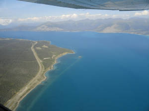 We were still surrounded by the giants and we had to climb up to 5500’ in the valley to make this leg without issue.
We squeezed through a couple of tight passes but with CAVU at points and other points sporting a 20,000’ broken layer,
we knew we had lots of room to play. We were still surrounded by the giants and we had to climb up to 5500’ in the valley to make this leg without issue.
We squeezed through a couple of tight passes but with CAVU at points and other points sporting a 20,000’ broken layer,
we knew we had lots of room to play.
We came in to Whitehorse
and decided to stay for a day or so. Neither of us had ever played around the Yukon Territory and the weather was outstanding.
We felt silly being in long sleeved shirts and long pants when the mercury was pushing 30 (that Celsius, not the Fahrenheit
that we had been used to lately). We finally got to see the famous working wind indicator at Whitehorse – talk about
a sense of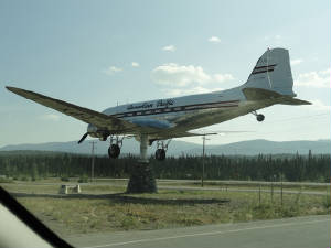 humor! humor! Vern found us a car again – that seems to be the
theme here – and we got a camping spot at the Takhina Hot Springs – oh, yes, another one. We are blazing hot as
we come in to camp at nearly 2000 hrs; but this is a good thing. The last thing that I wanted to do, however, was jump in
to that warm of water. We set up camp in short order and are determined to relax in the wilderness … just us and the
bears …
A
day off: It was so nice to wake up to blue skies and nice cool temperatures this morning. The heat of last night
quickly dissipated overnight to leave us with an absolutely stellar 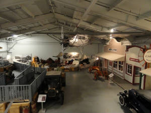 morning. We awakened this morning to the sound to the hundreds of seemingly harmless yellow jacket looking bees buzzing around
all over the outside of the tent; but none were able to get inside. The only issue this morning was where to go and get coffee.
We did not pack the full camping package - the things we left off being more than bare emergency cooking equipment. Personally,
I thought a coffee pot and coffee was part of the morning. We awakened this morning to the sound to the hundreds of seemingly harmless yellow jacket looking bees buzzing around
all over the outside of the tent; but none were able to get inside. The only issue this morning was where to go and get coffee.
We did not pack the full camping package - the things we left off being more than bare emergency cooking equipment. Personally,
I thought a coffee pot and coffee was part of the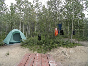 emergency supplies. emergency supplies.
We headed into the town of Whitehorse as it was the closest coffee we could get. Once
there, after breakfast, we went to the town to explore and started with the rail depot and the transportation museum.
While at the transportation museum, we met a gentleman who was flying a super cub headed north. Seems he had no charts as
they order from his chart supplier was miss-delivered. We gave him our Alaska charts are we were done with the interior and
wished him well.
The remainder of the afternoon was spent lounging in the hot springs. This was way different
from Chena Hot Springs in that it had a hot and hotter section. We slipped back and forth between the two sections for the
better part of 2 hours before we were pruned enough to get out. Our 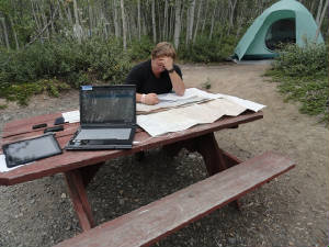 stomachs got the better of us by this point and it was time for dinner at the local restaurant. We are, once again, out
in the wilderness area and services are hard to come by and the dinner menu was slim; but I managed to find a nice salad and
fruit cup and Vern a tuna platter. The restaurant is not open until 1100 on weekends and 1600 on weekdays - hence
the necessity of the Whitehorse coffee run this morning. stomachs got the better of us by this point and it was time for dinner at the local restaurant. We are, once again, out
in the wilderness area and services are hard to come by and the dinner menu was slim; but I managed to find a nice salad and
fruit cup and Vern a tuna platter. The restaurant is not open until 1100 on weekends and 1600 on weekdays - hence
the necessity of the Whitehorse coffee run this morning.
The day remained really nice, too: not cool but
not blazing hot with a fine afternoon breeze and slightly overcast skies, perfect for hiking and relaxing and flight planning.
South, to Alaska: The evening suddenly turned
dark and windy and we packed the charts and became tent-bound in a hurry. It was not so much the rain as it was the winds
at first. 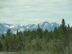 Mother Nature started playing a symphony of nature: the winds would howl from different directions, rustling the leaves in
various parts of the forest around us. Then the birds would chirp alternately as if on queue from their conductor. Finally
came the pitter-patter of a light rain that lasted until 0200 this morning. Mother Nature started playing a symphony of nature: the winds would howl from different directions, rustling the leaves in
various parts of the forest around us. Then the birds would chirp alternately as if on queue from their conductor. Finally
came the pitter-patter of a light rain that lasted until 0200 this morning.
I got up shortly after the rains
ended to use the outhouse and the moon was bright and shining through lightly scattered clouds. All was good. When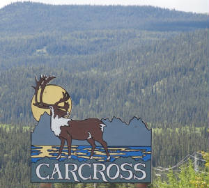 we finally crawled out of bed to break camp at 0630 there was he return of the blue sky with the clouds off in the distance.
It is looking like another beautiful day. we finally crawled out of bed to break camp at 0630 there was he return of the blue sky with the clouds off in the distance.
It is looking like another beautiful day.
When Vern rented the car back in Whitehorse, the agent gave it
to him until Wednesday afternoon, telling him is was easier to give it back early and get a refund. We decided to take advantage
of that and make the drive into Skagway, AK to complete the final part of the Alaska journey. It would have been a great flight
to make through the pan handle but those clouds that came from the northwest are all headed to Skagway where we are. We were
warned about the final pass into Skagway being a visual 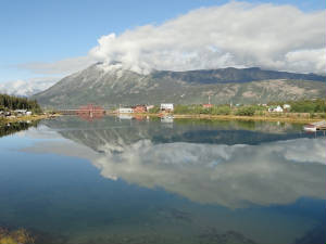 approach that can be all but visual. We have grown accustomed to travel by car now, punctuated with a spectacular flights
so we will stay the course. But first ... coffee! approach that can be all but visual. We have grown accustomed to travel by car now, punctuated with a spectacular flights
so we will stay the course. But first ... coffee!
With the important stuff out of the way we hopped on the
Klondike Highway south to Skagway. Once again we were rewarded with some beautiful scenery. Half-way to Carcross a lynx ran
across the road and posed on the side taunting us as if to say "catch me if you can". By the time the camera was
ready there was nothing but tail as he disappeared into the woods.
Carvross was a nice little stop for a
coffee. A historic town from the gold rush days, the remains a general store, visitors center and rail depot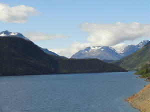 where folks can jump on the train and make the ride into Skagway via rail with a return trip by motor coach along the highway.
We will cross the tracks several times but at some point the train will make a large departure from our course and we will
travel on opposite sides of the river. where folks can jump on the train and make the ride into Skagway via rail with a return trip by motor coach along the highway.
We will cross the tracks several times but at some point the train will make a large departure from our course and we will
travel on opposite sides of the river. 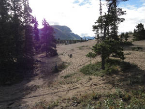 A strange site to see in the middle of the Yukon Territory was a desert – the Carcross Dunes. This desert formed eons
ago as the remnants of the lake bottom from glacial ice and has remained over time as the world’s smallest desert due
to the strong winds off of Lake Bennett prohibiting growth on the earth bed. A strange site to see in the middle of the Yukon Territory was a desert – the Carcross Dunes. This desert formed eons
ago as the remnants of the lake bottom from glacial ice and has remained over time as the world’s smallest desert due
to the strong winds off of Lake Bennett prohibiting growth on the earth bed.
Somewhere between the Canadian
customs and the US customs and north of the border with Alaska, we ran across Tormented Valley, an odd mix of water holes,
craggy rocks and something resembling a moonscape. From the bright sunshine we entered into a mist over the valley. A lone
gull sang out and disappeared into the white sky. We pressed on only to hit a dense fog at White Pass Summit, the Alaska border
at 2,865'. Visibility dropped to about 1/4 mile ay best. We slowed to a crawl to make our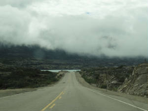 way through this white tunnel. We finally stop just short of Moose Creek Bridge, a suspension bridge over the creek next
to the waterfalls. We could hear the falls in the background but it was not visible until we were right on top of it. We descended
down the pass to lower and clearer territory. As we look back we see how thick and how high the fog bank was. Had way through this white tunnel. We finally stop just short of Moose Creek Bridge, a suspension bridge over the creek next
to the waterfalls. We could hear the falls in the background but it was not visible until we were right on top of it. We descended
down the pass to lower and clearer territory. As we look back we see how thick and how high the fog bank was. Had 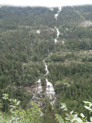 we been flying, it would have been completely impassable. we been flying, it would have been completely impassable.
Pitchfork falls caught our attention just before
US customs. There is a huge hydroelectric project from Goat Lake that provides power to Skagway and now Haines. The view of
the falls is quite spectacular and, according to the train literature, is quite a site as the train track passes directly
over the falls.
Skagway is another old gold mining town and many of the buildings are on the Klondike National
Park historic register. Just outside of toewn is a lovely garden and glass blowing business where we admisred the array of
colorful flowers and model train garden. We wandered about town for quite a bit perusing the old buildings and the shops,
most of which seem to cater to the cruise industry. Today was a slow cruise day - only 2 small ships and none of the behemoths
that will dump 3,500 passengers on a small town. We watch the local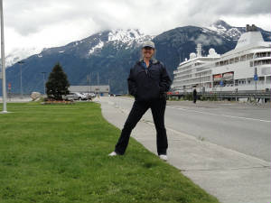 sightseeing and commuter planes come in and out of the airport via Lynn Canal - none come from the pass that remains blocked. sightseeing and commuter planes come in and out of the airport via Lynn Canal - none come from the pass that remains blocked.
Dinner at the Stowaway Cafe at the small boat docks was one of the best we have had on vacation. The halibut,
grilled vegetables and dessert - OK, we splurged with peach bread pudding and Xango (banana cheesecake, cinnamon and cream).
We will relax at the Mile Zero Bed & Breakfast this evening then head off for more adventures tomorrow.
A whale tale: Our day in Skagway started and ended
all at the same time when we boarded the Fjordland Express to Juneau for a full day excursion. Skagway is at the end of Lynn
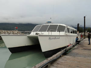 Canal, which is not really a canal at all. It is a fjord at the end of the Inside Passage. At this point, Lynn Canal is some
1300’ deep and runs to about 2400’ at her deepest point. This is a glacial valley carved out many moons ago. The
first stop is in Haines to pick up more passengers. Although Haines is 15 miles by boat, it is 360 miles via the highway from
Haines Junction in Yukon Territory, Canada; just as Skagway can only be accessed through the Alaskan Highway at and near Whitehorse,
YT. Canal, which is not really a canal at all. It is a fjord at the end of the Inside Passage. At this point, Lynn Canal is some
1300’ deep and runs to about 2400’ at her deepest point. This is a glacial valley carved out many moons ago. The
first stop is in Haines to pick up more passengers. Although Haines is 15 miles by boat, it is 360 miles via the highway from
Haines Junction in Yukon Territory, Canada; just as Skagway can only be accessed through the Alaskan Highway at and near Whitehorse,
YT.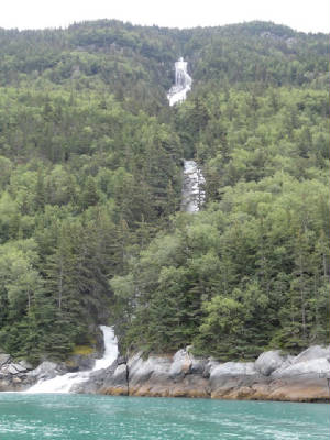 In the short distance to Haines, we passed by Long Falls, spectacularly
long water falls coming from Goat Lake which is part of the hydroelectric project that supplies the area. We thought the Haines
people missed some of the best scenery. Guess again. The journey took us through the Chilcat and Chilcoot River Valleys:
all glacial valleys. There were sheer rock walls, scarred by boulders being forged into the rock faces by the massive ice
of the glaciers working their was to the valley floor. The tops of the mountains are still littered with the glacial remnants
of the ice age – the large ice fields and glaciers, plus the all but extinct retreating hanging glaciers. To our east
is the Coast Mountain 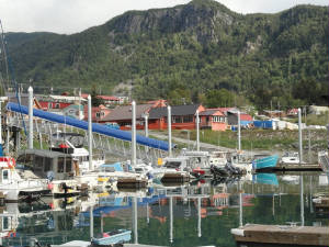 Range, the boundary between the US and Canada. Range, the boundary between the US and Canada. The first glacier
of any size that we see is the Davidson Glacier – a hanging glacier. It sits perched high up in the mountain –
about 4500’. None of these mountains are high but their characteristics tell a tale of history and geology. The timberline
runs up to about 2700’-3000’; the rounded mountain tops have been worn away by glacial ice while the pointy peaks
have not been so worn. Those peaks are at about 4000’ and above. Our next sighting was the stellar seal lion rookery. The sea lions perched on the rocks are the juveniles who have
just been cast off by their mothers to fend for themselves. They are staying on the rocks, safe from their main predators,
the Orca Whales. These youngens barely pay us any attention as they go about their business of sunning themselves and
playing king of the hill. 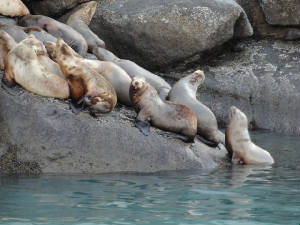 Greg, our Captain, and Ann, his daughter and mate, guaranteed us a whale sighting. It was not 30 minutes into the cruise that
the sighting happened. “Blow spout at 11 o’clock!” Once, twice, and then nothing by tail (fluke as it is
called) and that whale is gone. We continue on seeing more spouts of more whales. The whales come up to breathe –
they spout – and dive again for 4-7 minutes before they return. So once you see the fluke, that whale is gone for a
while. Greg, our Captain, and Ann, his daughter and mate, guaranteed us a whale sighting. It was not 30 minutes into the cruise that
the sighting happened. “Blow spout at 11 o’clock!” Once, twice, and then nothing by tail (fluke as it is
called) and that whale is gone. We continue on seeing more spouts of more whales. The whales come up to breathe –
they spout – and dive again for 4-7 minutes before they return. So once you see the fluke, that whale is gone for a
while.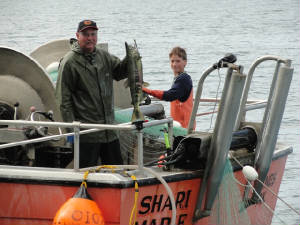
There is a short season of string-line net fishing for salmon.
There are 40 permits issued for a period of 3 days where commercial fisherman can haul what they can haul with the nets; then
it is line only. The lines extend out hundreds of feet beyond the boat and when the buoy balls start to bob furiously, the
fisherman knows he has a haul. But he must be quick lest the sea lion and seals steal his catch. Today is day one of the short
season and the canal is full of boats and nets. Our captain spots and navigates very carefully to avoid becoming entangled
in these nets reaching 40’ into the deep. As we approach
Herbert Glacier along the shore line we spy eagles going after the salmon in the stream. There are hundreds of salmon and
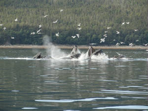 almost as many eagles – in the trees, in the air, perched on the shore and in the stream. It is a buffet lunch for them
today! almost as many eagles – in the trees, in the air, perched on the shore and in the stream. It is a buffet lunch for them
today! We are only about 30 minutes out of Juneau and we are
told to expect to see more whales. This is not a surprise to me as it was 15 years ago that Mario and I came to Juneau and
saw whales in Auke Bay. This time it was better. Captain Greg told us of a pod of 11 humpback whales that have been working
together lately to do some bubble netting to catch herring. It seems that when the herring become scared, they try to hide
behind their neighbor and end up making a big fish ball – a buffet for the whales. We spy numerous blows and the Captain
inches forward to a good vantage point. He stops the engines, puts the microphone into the water and he tells us how the system
works. There is a lead whale who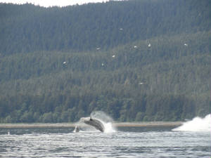 directs the bubble netting. That whale leads the others to the bottom swimming in a circle and blowing bubbles below. That
rounds up the herring. When the lead whale gives the long shrill call, all the whales surface simultaneously, mouths open
to feast. There were gulls in the area. He said to watch the gulls as they will be the first clue to the whales surfacing.
And almost as if Captain Gary was orchestrating the spectacle, the whale sounded, the gulls circled and a symphony of whales
surfaced and blew in unison, feasting on the panicked herring. Then to keep the herring in a panicked state the multitude
of whales started doing full body breaches right in front of our ship. Even Ann got giddy with excitement at the sight of
the breaching whales. directs the bubble netting. That whale leads the others to the bottom swimming in a circle and blowing bubbles below. That
rounds up the herring. When the lead whale gives the long shrill call, all the whales surface simultaneously, mouths open
to feast. There were gulls in the area. He said to watch the gulls as they will be the first clue to the whales surfacing.
And almost as if Captain Gary was orchestrating the spectacle, the whale sounded, the gulls circled and a symphony of whales
surfaced and blew in unison, feasting on the panicked herring. Then to keep the herring in a panicked state the multitude
of whales started doing full body breaches right in front of our ship. Even Ann got giddy with excitement at the sight of
the breaching whales. 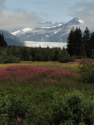 The highlight of the trip was supposed to be Juneau and the Mendendall Glacier – sorry, but it was the breaching whales
bubble-netting. The glacier, however, was quite a stunning sight. Coming 25 miles out of the Juneau ice fields, the Mendenhall
Glacier is another tide water glacier that as been in retreat lately, losing almost 60’ per year. We stayed on a rock
for a while watching the glacier and we were rewarded with a calving of a nice sized chunk. The highlight of the trip was supposed to be Juneau and the Mendendall Glacier – sorry, but it was the breaching whales
bubble-netting. The glacier, however, was quite a stunning sight. Coming 25 miles out of the Juneau ice fields, the Mendenhall
Glacier is another tide water glacier that as been in retreat lately, losing almost 60’ per year. We stayed on a rock
for a while watching the glacier and we were rewarded with a calving of a nice sized chunk.
The return trip home was full of beautiful scenery of the high rock faces littered with small waterfalls, hanging
glaciers and punctuated with wildlife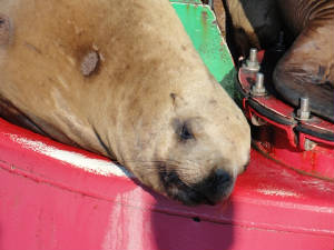 sightings – more eagles, seals, porpoises, whales and sea lions. There was even a channel marker so packed with sea
lions that not another could come to rest. We also were privileged to have Ann make us some secret family recipe salmon chowder
for dinner. This was the perfect end to an extraordinary day – great weather, sun, calm seas, and abundant wildlife.
What else could we expect? sightings – more eagles, seals, porpoises, whales and sea lions. There was even a channel marker so packed with sea
lions that not another could come to rest. We also were privileged to have Ann make us some secret family recipe salmon chowder
for dinner. This was the perfect end to an extraordinary day – great weather, sun, calm seas, and abundant wildlife.
What else could we expect? We arrived back at the docks in Skagway,
grabbed the car and made the beeline for Whitehorse. We want to be poised for an early departure tomorrow morning to try to
make the trench route to go home. We look to have a good weather opportunity for the next 2 days and want to make the best
of it. As we leave town and head up to a perfectly clear White Pass Summit, we see a porcupine along the road – the
last of the Alaska animals that we had not seen. We stop the car to get a picture but the light is getting low – this
is the first sunset that we have really seen since our arrival over 2 weeks ago. We head out to the Canadian customs and they
detain us for a bit to check out passports. As we wait, out wanders a black bear from the woods near the lake. He is heading
right for the car. We try to get the attention of the customs people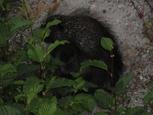 to remain inside but they come out and scare the bear away. He was just a small bear; cute and curious. Now it is alomst
dark and our tale ends with a long drive up the South Klondike Highway watching the silouhette of the mountains in the dim
glow of the moon. to remain inside but they come out and scare the bear away. He was just a small bear; cute and curious. Now it is alomst
dark and our tale ends with a long drive up the South Klondike Highway watching the silouhette of the mountains in the dim
glow of the moon.
In the valley: I suppose that I should have more
aggressively planned to come home the way we went to Alaska so we could do what we really wanted to do instead. Somehow I
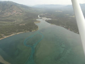 have not learned the finer art of not using the words “plan” and “airplane” in the same sentence;
unless, of course, it is something like:” I plan to go visit my airplane in the hangar today.” The trench route
did not happen but the news is not so grim. have not learned the finer art of not using the words “plan” and “airplane” in the same sentence;
unless, of course, it is something like:” I plan to go visit my airplane in the hangar today.” The trench route
did not happen but the news is not so grim. The weather was
great; the ceiling was over 20,000’; the winds were light. So what went wrong? Wild fires! There is a huge wild fire
just south of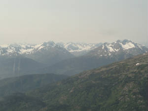 Watson Lake, our jumping off point for the trench. Kelly, our Canada FSS guy, said the highway was even closed to traffic
so nothing going there. He also said that convective activity was on the highway route farther to the east, so that was not
possible; but he suggested an alternate “trench” route to the west of the real trench. The terrain was higher
but not by much – one pass topped out at 4,000’ as opposed to 3,500’. Not bad. The route was just a smidge
longer. Not bad. We are still flying through the heart of the Rockies with spectacular scenery (OK, it is time for a thesaurus
to get another word for “spectacular”). Not bad. The down side is that the wind is a tailwind and it will be blowing
smoke through the passes. We might have some areas where visibility is reduced to 20 miles. Oh, darn. Watson Lake, our jumping off point for the trench. Kelly, our Canada FSS guy, said the highway was even closed to traffic
so nothing going there. He also said that convective activity was on the highway route farther to the east, so that was not
possible; but he suggested an alternate “trench” route to the west of the real trench. The terrain was higher
but not by much – one pass topped out at 4,000’ as opposed to 3,500’. Not bad. The route was just a smidge
longer. Not bad. We are still flying through the heart of the Rockies with spectacular scenery (OK, it is time for a thesaurus
to get another word for “spectacular”). Not bad. The down side is that the wind is a tailwind and it will be blowing
smoke through the passes. We might have some areas where visibility is reduced to 20 miles. Oh, darn. 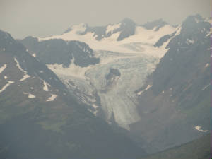 We’ll take it. We’ll take it. This route, called Cassair Route by the
Alaskan Airmen’s Association, starts right out from Whitehorse and heads to Teslin then Dease Lake where we stop for
fuel; then continues, basically down highway 16, with some minor deviations until you get to Prince George, BC. We fuel Wild
Mama, file our flight plan and take off. The forecast –
both the good and bad – held true: the winds were very light to a slight tailwind; the route was amazing and the smoke
eventually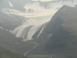 choked us out. Following the highway was easy – there are trees, lakes, rivers, mountains or a paved, long, stringy-looking
thing. The highway ran through the narrow passes at some points and others it laid in the floor of the valley. The mountains
were full of hidden treasures that were not visible immediately unless you took the time to turn your head and look up the
fissures in the rock faces. Many of these mountains had ice fields and glaciers. The tree line was a bit higher, up to 4,500’
at this point. choked us out. Following the highway was easy – there are trees, lakes, rivers, mountains or a paved, long, stringy-looking
thing. The highway ran through the narrow passes at some points and others it laid in the floor of the valley. The mountains
were full of hidden treasures that were not visible immediately unless you took the time to turn your head and look up the
fissures in the rock faces. Many of these mountains had ice fields and glaciers. The tree line was a bit higher, up to 4,500’
at this point. 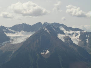 We started out at 3,500’ through most of the first leg of the journey, having to climb to 5,500’ as we rounded
the bend and made our own route from 80 miles south of Teslin Lake at Prairie Lake (more like Prairie Pond). At that point
we took up a rough 120 heading and did not hit the rocks for the remainder of the way to Dease Lake. Not 15 miles out of Dease
Lake, the visibility off to our north dropped to less than 10 miles and it got really difficult to suck in a good strong breath.
Once we turned back south along the lake, the visibility and the breathability improved and we dropped into visit the nice
folks at Dease Lake. We started out at 3,500’ through most of the first leg of the journey, having to climb to 5,500’ as we rounded
the bend and made our own route from 80 miles south of Teslin Lake at Prairie Lake (more like Prairie Pond). At that point
we took up a rough 120 heading and did not hit the rocks for the remainder of the way to Dease Lake. Not 15 miles out of Dease
Lake, the visibility off to our north dropped to less than 10 miles and it got really difficult to suck in a good strong breath.
Once we turned back south along the lake, the visibility and the breathability improved and we dropped into visit the nice
folks at Dease Lake.
From Dease, we picked up highway 37 south-east-ish
to a point about 25 miles southeast of the fork in the road near Swan Lake(s) where the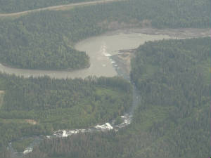 route was to stay in the big, fat valley and follow the logging trail to highway 16 all the way to Prince George. The radio
was silent. There was nothing for over 3 hours but the drone of the engine – a very comforting sound, I might add, especially
when the FSS asks: “One hour on the search and rescue?” Ummmm, yes, that will work. route was to stay in the big, fat valley and follow the logging trail to highway 16 all the way to Prince George. The radio
was silent. There was nothing for over 3 hours but the drone of the engine – a very comforting sound, I might add, especially
when the FSS asks: “One hour on the search and rescue?” Ummmm, yes, that will work. We could soon see by the charts that the ice fields and glaciers were dwindling rapidly, as was the terrain but we
remained at 5,500’ as we had 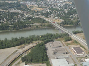 one last little ridge to clear. Speaking of clear …. the smoke did finally start to thin out a bit. It was so dense
and wide spread that it was most difficult to get good, clear photos even tough you could see the strong ridgelines and contrasting
ice fields. About 40 miles outside of Prince George, the radio finally came to life and we soon started receiving sporadic
position reports from other GA aircraft. We raised Prince George and landed after nearly 5 hours to flying today. We were
beat as we were hammered by turbulent air during the last portion of the flight – after we left the mountainous area.
There were some small building clouds – nothing like what we see in Florida; but these sure packed a punch. one last little ridge to clear. Speaking of clear …. the smoke did finally start to thin out a bit. It was so dense
and wide spread that it was most difficult to get good, clear photos even tough you could see the strong ridgelines and contrasting
ice fields. About 40 miles outside of Prince George, the radio finally came to life and we soon started receiving sporadic
position reports from other GA aircraft. We raised Prince George and landed after nearly 5 hours to flying today. We were
beat as we were hammered by turbulent air during the last portion of the flight – after we left the mountainous area.
There were some small building clouds – nothing like what we see in Florida; but these sure packed a punch. We were glad to be on the ground and were done for the day. Vern got fuel and I
secured the nights lodging. When I came back out to see Wild Mama she looked as if she had the measles. I have never seen her so covered with bug: the windshield, winds, struts,
cowl, everything. She was a mess. We will have to clean her before we depart tomorrow – at least enough so we can see
to take off. Mama she looked as if she had the measles. I have never seen her so covered with bug: the windshield, winds, struts,
cowl, everything. She was a mess. We will have to clean her before we depart tomorrow – at least enough so we can see
to take off. We will try to make it to the US tomorrow so,
once again, we must perform the mundane task this evening of flight planning our return to the “lower 48”.
Return to civilization: After a sound nights sleep
we got up and going by 0600 for weather checking, flight planning, and customs and eAPIS filing. We seem to conflict with
Prince 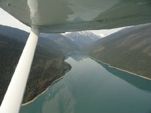 George time as everything was closed for breakfast - even Starbucks for coffee. With all of the packing done and car loaded,
we managed to grab coffee and a danish and were on our way. While I filed the flight plans, did the weather and customs filing,
Vern took his time to de-bug Wild George time as everything was closed for breakfast - even Starbucks for coffee. With all of the packing done and car loaded,
we managed to grab coffee and a danish and were on our way. While I filed the flight plans, did the weather and customs filing,
Vern took his time to de-bug Wild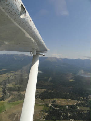 Mama so we could see through the windshield. We will have to wait until we land at Kalispell to get a basic wash and full
de-bug. Mama so we could see through the windshield. We will have to wait until we land at Kalispell to get a basic wash and full
de-bug.
Our departure into perfect VFR weather was a much appreciated event. The pass through the south part
of the trench is VERY narrow and any wind at all will be exacerbated by that narrow valley; fortunately, winds were very light.
We were not 15 minutes out of Prince George through the valley and the bugs were hitting the windshield like
a pelting rain. There were so many that it looked as if Vern did not clean it off at all, in spite of his 20 minute cleaning
job. I can imagine that we 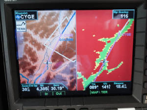 would not be able to see had he done nothing. would not be able to see had he done nothing.
Being back in the trench, we were surrounded by the tall mountains
now - peaks at the 8,000' range. There were more snow covered peaks, deep trenches. As the valley narrows, we pick up the
McNaughton Lake to follow. There will be neither roads nor airports for the next 130 miles over the lake. Hopefully, there
will be no bugs either!
We continued to snake our way along the valley floor gawking at the giants on either
side of us. There is no traffic, no one on the radio, no one painting our transponder. We are truly alone out here in the
Rockies. It is very peaceful, serene, and beautiful. Finally as we approach Golden, we hear some traffic heading northbound
along our route at 10,500'. No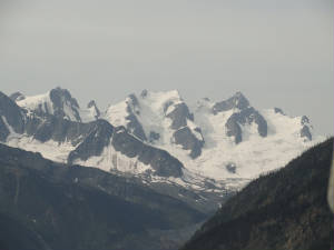 conflict but it was nice to hear someone’s voice. We fly with the ditch bag and emergency supplies handy - 406 ELT,
first aide kit, raft and life conflict but it was nice to hear someone’s voice. We fly with the ditch bag and emergency supplies handy - 406 ELT,
first aide kit, raft and life 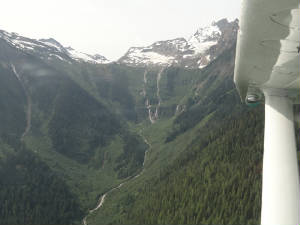 jackets. While that seems strange in the mountains, we never anticipated flying over so much water inland, but there is no
place to ditch but in the water. Once past Golden, we are back over some land for a while. We hear traffic between us and
Inveremere. jackets. While that seems strange in the mountains, we never anticipated flying over so much water inland, but there is no
place to ditch but in the water. Once past Golden, we are back over some land for a while. We hear traffic between us and
Inveremere. All too soon, we are back to civilization: there
are more small towns dotting the valley and we hear more than the occasional position report on the radio. We are about 50
miles from Kalispell and Pacific FSS gets our discrete transponder code so we can cross back in to the lower 48. We
contact tower at Kalispell and land behind an Eclipse jet – oh, so many people are around all of the sudden. We pull
up to Customs and are greeted by a friendly, happy customs inspector – are we really in the US??? He goes through all
of our stuff – especially the bag of Tim Horton coffee that we bought for friends (hint: Peter, we are heading to Tennessee
on the way home) – then he sends us on our way. Vern gets Wild Mama in for an oil change and tries to find
a detailer to do another bug removal – they are really thick now.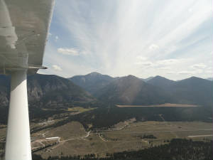 The remainder of the day we spend doing absolutely nothing
but wandering around Kalispell and … flight planning for the ride tomorrow.
Birds' eye view: We arrived at the airport a bit
late. Apparently, we were both quite tired from the days mountain flying and the workload that goes with it. We were also
about 30 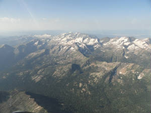 minutes from the airport. Once there we saw a debugged Wild Mama: all but the windshield, but that debugging was
a fairly quick job by minutes from the airport. Once there we saw a debugged Wild Mama: all but the windshield, but that debugging was
a fairly quick job by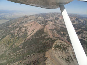 comparison. comparison.
We made it off by 0830 and started a climb to 11,500' (no, Jim, the nose bleed did not happen).
we were able to pick up a very little tailwind and scoot over most of the terrain, which explains the lack of photos. There
were more fires in the area and the smoke created that haze that makes photography a bit useless. Additionally, the dramatic
backdrops are just not there when you are skimming over the tops of the shorter peaks. Once we neared Enis, we needed to drop
down a bit and follow the highway again so we could enter Yellowstone National Park and actually see more than dots on the
ground.
We have driven Yellowstone a couple of times and were familiar enough with the lay of the land that
we knew right where to go. Since we had a 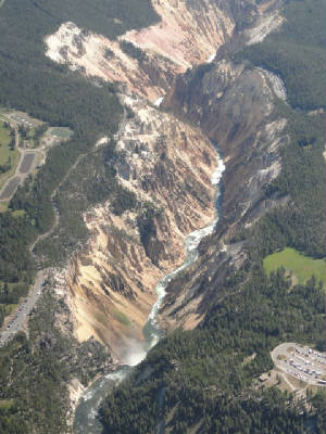 late start, we did not want to waste time and we got right to the good stuff. We saw another plane on the TCAD 3,000' below
us over the park but we remained up to 10,800 to give the critters and guests an undisturbed mutual viewing experience. We
headed straight for the canyon. late start, we did not want to waste time and we got right to the good stuff. We saw another plane on the TCAD 3,000' below
us over the park but we remained up to 10,800 to give the critters and guests an undisturbed mutual viewing experience. We
headed straight for the canyon.
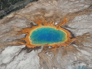
Yellowstone has the "Grand Canyon of Yellowstone"; a depression not nearly as vast as THE Grand Canyon
but very picturesque nonetheless. We circled the canyon to get a good view of both the upper and lower falls and the entire
length of the canyon itself before heading to Yellowstone Lake. The lake is quite vast and is now what once was the caldera
of the volcano that formed the Park. To the north now is a large area that was burned by the 2009 fires that got close enough
to threaten buildings in the area and had to be extinguished. Today there were no fires in Yellowstone but there was a fire
TFR to the SE of Jackson Hole.
From the lake we went to my favorite spot in the Park: the Grand Prismatic
Pool. From the ground level, it is a normal hot spring and nothing particularly spectacular to look at; but from the
air it is unbelievably colorful and resembles an eye into the heart of Yellowstone. We circled a bit as it is a sight that
I cannot get enough of. We continued to the middle geyser basin to the fountain geyser then circled to try to catch a glimpse
of Old Faithful but she did not blow.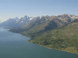
It was approaching noon, the bewitching hour to bring mountain flying excursions to a screeching halt.
It was only in the low 80's today but the airport elevation is nearly 6,500' and the density altitude registers a good 2,000'
plus above actual. This is nothing to fool with, especially with Wild 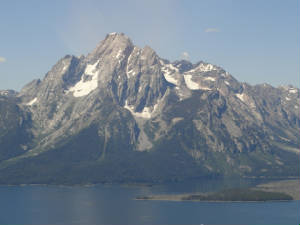 Mama who does not care for the high flight levels on a good day. Mama who does not care for the high flight levels on a good day.
We plopped into Jackson Hole and were met
by my niece, Brenda. We continued the remainder of the day visiting family and wandering around Jackson Hole for my annual
shopping expedition at the fur rug shop and the antler stores. I made my obligatory purchases before we headed down the canyon
to Star Valley to Brenda's house for the evening. Vern relocated Wild Mama to the Alpine airport where she is much
closer and the fuel is LOTS cheaper. We can rest here for a couple of days before heading east.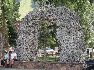 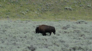 Oh, yes: Did I happen to mention that there was a herd of buffaol wandering past the airport entrance? Oh, yes: Did I happen to mention that there was a herd of buffaol wandering past the airport entrance?
Oh, give me a home ...:I keep saying that we are
going to have a lazy day and i suppose by comparison, it was. We got a bit of a late start then headed to town for more family
visits 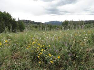 then on up to Teton National Park to go to the Two Oceans Lake on the continental divide. This is a part of the park that
we had seen before and that is not frequented by tourists as the main part of the park. then on up to Teton National Park to go to the Two Oceans Lake on the continental divide. This is a part of the park that
we had seen before and that is not frequented by tourists as the main part of the park.
The drive was full
of lush vegetation and oodles of wildflowers. There was a storm that had been brewing all day and the cloud deck over the
mountain framed the peaks very well until the rains came down upon us. Most unfortunately, our timing was to arrive at the
lake just as the rain started so the hike around the lake will have to wait until the next visit.
For the
evening entertainment, we went to the Bar T 5 Ranch for a covered wagon ride to a chuck wagon dinner and audience participation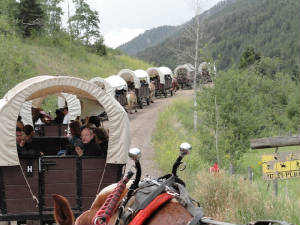 entertainment. The cowboys and selected "volunteers" put on quite a shoe of singing and comedy. The dutch oven
dinner was outstanding and our wagon drive, David, lead the team of Ginger and Dixie, 2 draft horses that can pull together
between 10,000 -12,000 pounds! We were the last of 11 wagons in the train so we had to watch for the indian attack coming
in from the rear. The whole evening was hoot. entertainment. The cowboys and selected "volunteers" put on quite a shoe of singing and comedy. The dutch oven
dinner was outstanding and our wagon drive, David, lead the team of Ginger and Dixie, 2 draft horses that can pull together
between 10,000 -12,000 pounds! We were the last of 11 wagons in the train so we had to watch for the indian attack coming
in from the rear. The whole evening was hoot.
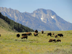 .. And did I mention that critters roam all around the streets? We captured another herd of buffalo and a moose that ran out
in front of the car on the way home. .. And did I mention that critters roam all around the streets? We captured another herd of buffalo and a moose that ran out
in front of the car on the way home.
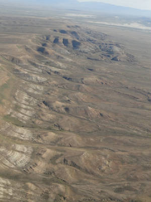 Reverse course: We managed to get off this morning at 0715 after a sound nights sleep. The temperature was a
brisk 41 degrees and the skies were unbelievably clear. Nice. We followed the highway from Alpine to Afton then loosely followed
it until we lost it in a deep valley. We continued down the valley until we had clear terrain then made a beeline for Kemmerer,
skimming across the tops of the lower peaks. From Kemmerer, the terrain remains relatively high (6,800' or so) but relatively
flat and featureless except for the smattering of oil wells that dot the landscape. Very Reverse course: We managed to get off this morning at 0715 after a sound nights sleep. The temperature was a
brisk 41 degrees and the skies were unbelievably clear. Nice. We followed the highway from Alpine to Afton then loosely followed
it until we lost it in a deep valley. We continued down the valley until we had clear terrain then made a beeline for Kemmerer,
skimming across the tops of the lower peaks. From Kemmerer, the terrain remains relatively high (6,800' or so) but relatively
flat and featureless except for the smattering of oil wells that dot the landscape. Very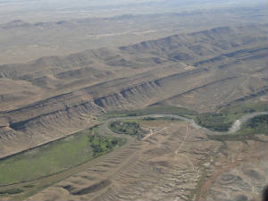 soon, we face the scarred but barren land as far as we can see. Visibility is only 50 miles or so. soon, we face the scarred but barren land as far as we can see. Visibility is only 50 miles or so.
Finally
outside of Cheyenne we saw the first trees that we had seen in 2 hours. The visibility remained clear and we finally caught
a nice 26 kt tailwind. With the long day ahead, any tailwinds are greatly appreciated.
As we pass Cheyenne
with the passing of a magical wand, all of the mountains have vanished and we fi d ourselves in the high plains: patchwork
quilted fields of greens and earth tones, winding creeks and not the first hint of a hill as far as the eye can see. It never
ceases to amaze me how quickly the landscape changes over our country.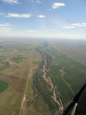
It was time to come down for our planned fuel stop in McCook. We had such a nice speed and the plane was
still cool. We hated to come down and we paid the price: after refueling Wild Mama was hot from sitting on the tarmac and
we could not get quite the performance back out of her that we had before coming down...but the is that small matter of AvGas
...
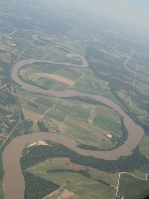 We climbed back to 7500' where there was a hint of cool air - 72 degrees. The density altitude gave us about a plus 2,200'
so we were sucking wind pretty fast but was still managed a quartering tailwind or a respectable speed. We were pleased. Back
to the grind of miles and miles of high plains. After an hour, the geometric landscape turns to a more random pattern and
we near some of the river basins - Kansas River being the first. It has turned the patches of browns and tans into a stitch
work of trees around the small streams and tributaries. We climbed back to 7500' where there was a hint of cool air - 72 degrees. The density altitude gave us about a plus 2,200'
so we were sucking wind pretty fast but was still managed a quartering tailwind or a respectable speed. We were pleased. Back
to the grind of miles and miles of high plains. After an hour, the geometric landscape turns to a more random pattern and
we near some of the river basins - Kansas River being the first. It has turned the patches of browns and tans into a stitch
work of trees around the small streams and tributaries.
We are keeping up a good speed so we decide to bypass
our cheap fuel stop in favor of staying aloft. We have enough fuel and reserve to make it to Sparta, assuming no change (slow
down) in our speed nor increase in out fuel burn. Worst case, closer to Tennessee there are a multitude of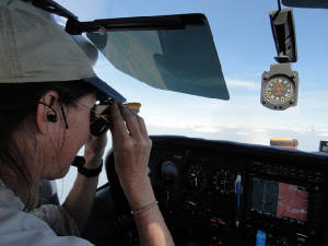 places to stop, unlike out west, so an unplanned airport is not as much of an issue. If we do not like the fuel price, we
take enough to get to Sparta and have a small temporary pain in the wallet. places to stop, unlike out west, so an unplanned airport is not as much of an issue. If we do not like the fuel price, we
take enough to get to Sparta and have a small temporary pain in the wallet.
At 7:14 in to the flight we finally
crossed the Mississippi River. We also ran in to a small cloud bank. I had to sight the clouds to see if w had to change altitudes,
but with a small amount of deviation, we were able to scoot through without a problem. We have managed to keep up our ground
speed so the second planned fuel stop might get to be history. We are hopeful for an 1800 arrival in Sparta to give us enough
time to get the car and get to the cabin before dark. It seems so strange now to have it get dark. Once we got accustomed
to it, we kind of like the light although it really reeked havoc with the body clock. We never seemed to get that drowsy feels
that will overtake you as dark approaches.
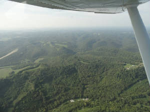 We made our final approach into Sprata. What a wonderful sight. This is home – of sorts – at least it is very
familiar surroundings and OUR place to stay. We will remain here for a few days then make the last push back to Alva. This
stopping in the various time zones is certainly helping with the Wild Mama lag (I can hardly call it jet-lag). We made our final approach into Sprata. What a wonderful sight. This is home – of sorts – at least it is very
familiar surroundings and OUR place to stay. We will remain here for a few days then make the last push back to Alva. This
stopping in the various time zones is certainly helping with the Wild Mama lag (I can hardly call it jet-lag).
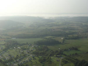 Homeward Bound: After our month long odyssey we are finally on the last leg for home. It is beautiful VFR as
we leave Sparta but we know the ceiling over Georgia is very low so we file out of caution. As we approach Chattanooga, the
layer of clouds - about 50' thick is right at our 7,000' altitude. OK, we get to claims some actual IFR for 30 minutes. We
break out to see solid fog below us, just as forecast. We are sporting a nice little tailwind forecast for most of the journey
so we are pleased. Homeward Bound: After our month long odyssey we are finally on the last leg for home. It is beautiful VFR as
we leave Sparta but we know the ceiling over Georgia is very low so we file out of caution. As we approach Chattanooga, the
layer of clouds - about 50' thick is right at our 7,000' altitude. OK, we get to claims some actual IFR for 30 minutes. We
break out to see solid fog below us, just as forecast. We are sporting a nice little tailwind forecast for most of the journey
so we are pleased.
Finally the call came: the one we had been waiting for. We had filed direct to RMG then
direct LGC, bypassing HEFIN. "N614WM proceed direct HEFIN, rest of route unchanged." oh well, we tried. By now there
is a solid sea of white beneath us as far as tje eyes can see. Occasionally, we see a towering cumulus building off in the
distance. We need to make it to X14 before the afternoon thunderstorms begin.
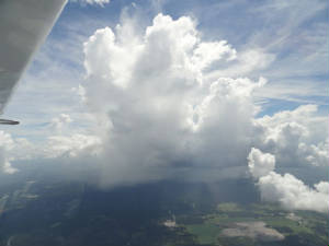 By the time we hit Moultrie, there were some holes in the clouds and we saw our first hint of ground – green and flat.
We know we are nearing home. The storms are already starting to build and pop around us but our path is clear. Almost on cue,
it is 1053 hrs and someone turned on the bump machine for a while but it soon smoothes out and we go back to the stable tormented
looking sky around us. By the time we hit Moultrie, there were some holes in the clouds and we saw our first hint of ground – green and flat.
We know we are nearing home. The storms are already starting to build and pop around us but our path is clear. Almost on cue,
it is 1053 hrs and someone turned on the bump machine for a while but it soon smoothes out and we go back to the stable tormented
looking sky around us.
We spend the next hour dodging the storms in front of us. The tops are not high -
only to about 10,000' but they are strong enough that we want to avoid them. Getting back into familiar territory near Tampa
we fly over Zephyrhills where these is a large skydiving outfit. I look down to see a gently reminder for the skydivers to
open their chutes – like someone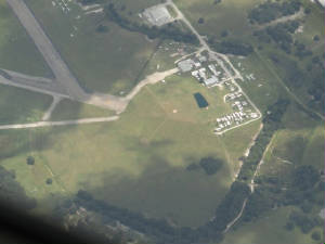 would be likely to forget! would be likely to forget!
In short order we pass Lakeland
and we know we are just 30 minutes from home. Miami hands us off to Fort Myers approach as we begin our descent. We touch
down shortly before 1300 hours. Home at last.
Logbook: The results are
in and the final verdict for trip statistics is: Time
logged: 63.4 hours Days on trip: 34 Miles Logged: 8,663 nm States crossed: 24 Canadian Providences crossed: 3 Number
of Landings: 25 (amazingly enough, this is equal to the number of airports at which we landed) Cost: priceless
|
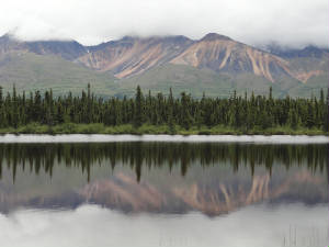 tomorrow morning so we will make our way back from Talkeetna today.
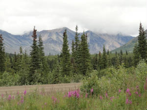 The whole trip through the passes this morning has been outstanding and I view the scenery with mixed emotions. I wanted so
desperately to be flying today but here we are land bound with a tour scheduled for the next 2 days. *sigh* I keep talking
about the trend improving. The rangers said that this is more typical of the August scud that has come early instead of the
big, clear blue skies of July. Let's keep praying to the weather Gods that this continues.
The whole trip through the passes this morning has been outstanding and I view the scenery with mixed emotions. I wanted so
desperately to be flying today but here we are land bound with a tour scheduled for the next 2 days. *sigh* I keep talking
about the trend improving. The rangers said that this is more typical of the August scud that has come early instead of the
big, clear blue skies of July. Let's keep praying to the weather Gods that this continues.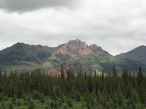 otherwise unimproved. The Mile Post book said the scenery is well worth the effort. Although we are.not making the whole
trip, we venture forth about 15 miles along the road and are rewarded with the promised beautiful vistas. Our wildlife count
has been low for the last couple of days. Other than mosquitoes we have only seen one lone rabbit dart across highway 8.
otherwise unimproved. The Mile Post book said the scenery is well worth the effort. Although we are.not making the whole
trip, we venture forth about 15 miles along the road and are rewarded with the promised beautiful vistas. Our wildlife count
has been low for the last couple of days. Other than mosquitoes we have only seen one lone rabbit dart across highway 8. 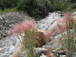 will wander around the local shops for a bit before heading toward the park for some local sights. We have to check in a 3
pm for the beginning of the tour package that we got for Denali. As the park is tightly controlled, there is only a short
section of road that guests can travel on their own; otherwise, one must take the bus system through the Park. We opted for
the 12 hour round trip ride back to Kantishna Roadhouse and Wonder Lake 95 miles into the park. It is the best opportunity
to see Denali and to get a good glimpse of wildlife, maybe even the elusive bears.
will wander around the local shops for a bit before heading toward the park for some local sights. We have to check in a 3
pm for the beginning of the tour package that we got for Denali. As the park is tightly controlled, there is only a short
section of road that guests can travel on their own; otherwise, one must take the bus system through the Park. We opted for
the 12 hour round trip ride back to Kantishna Roadhouse and Wonder Lake 95 miles into the park. It is the best opportunity
to see Denali and to get a good glimpse of wildlife, maybe even the elusive bears.