|
|
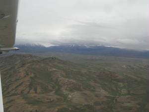
Photos - FL, AL, TX to Carlsbad, NM Photos - Carlsbad Caverns & Carlsbad, NM Photos - Taos Enchanted Circle Photos - Page to Mammoth and Mono Lake Photos - Yosemite, Devils Postpile, Lake Tahoe Photos - Pre-Race Activities Concord, CA April 26th - Annual: With some of the most beautiful weather ever seen in the Florida Keys, Wild Mama is in annual. It is her turn to get race ready. Ellen and Terry have  already poured over the charts and the other stuff that we need. We have made a tentative "pre-race vacation" plan
and hope not to be de-railed by tornadoes as we were last year. already poured over the charts and the other stuff that we need. We have made a tentative "pre-race vacation" plan
and hope not to be de-railed by tornadoes as we were last year.  Today, however, in spite of not having Wild Mama, I had the privilege to fly with Classic Racer 24 for their handicap
flight. We made our rendezvous at Homestead General Airport at 0 dark:30, topping off the fuel and making the final plane
inspection. We departed into perfectly smooth air, flying just over 1 hour and over 146 miles. We certainly burn up a lot
of space flying around in a box. It was a shame that we had to fly so high (over 5,000' to match our 6,000' density altitude)
as the water was clear and calm and the fish action must have been Today, however, in spite of not having Wild Mama, I had the privilege to fly with Classic Racer 24 for their handicap
flight. We made our rendezvous at Homestead General Airport at 0 dark:30, topping off the fuel and making the final plane
inspection. We departed into perfectly smooth air, flying just over 1 hour and over 146 miles. We certainly burn up a lot
of space flying around in a box. It was a shame that we had to fly so high (over 5,000' to match our 6,000' density altitude)
as the water was clear and calm and the fish action must have been really great. really great.We landed, finished the paperwork and logged one for the books. Wild Mama's flight is coming soon; but first, mechanic, Vern, must work his magic! May 12th - J-Who? JU!: The flying
weather in Florida is still as beautiful as ever and I am thankful that there are others with handicap flights to fly so I
have an opportunity to sit in an airplane and dream of the day Wild Mama comes out of annual this year. Vern is always
so very good to make my annuals as painless as possible. And he has done a good job at the painless part but
lady luck is not cooperating. All was well until he discovered a specially manufactured part that was broken. Since the engine
is still under warranty, it was not problem to have them  warrant the part .... they just did not have a spare; so a new one had to be made or the old repaired.. there is 10 days.
But tat is OK, because there is still much to do and Vern can keep on working. warrant the part .... they just did not have a spare; so a new one had to be made or the old repaired.. there is 10 days.
But tat is OK, because there is still much to do and Vern can keep on working.The 10 days come and pass and the part arrives and gets installed. I am a happy camper. Vern goes for the test flight from X14 to KFMY. The IFR certification check was due and this smartly killed two birds with one stone. I meet him in Fort Myers and was greeted with a quizzical look followed by the statement: "Something is not right." I am  thankful that my mechanic can figure that something is not right after a 15 minute flight; and even more thankful that he
took her back to X14 to figure out what it was. I was NOT happy with the answer. It seems that BOTH mags have a defect in
the impulse coupling. This is a "catastrophic engine failure waiting to happen" type of defect. Warranty? Absolutely.
That was one week ago. So with my handicap flight still tentatively scheduled for tomorrow and an airplane still without mags,
I am getting a little anxious. Vern is feverishly working on her today as the mags just arrived, factory fresh. We are hoping
for a test run-up soon and a test flight when the storms pass this afternoon. Fingers crossed. thankful that my mechanic can figure that something is not right after a 15 minute flight; and even more thankful that he
took her back to X14 to figure out what it was. I was NOT happy with the answer. It seems that BOTH mags have a defect in
the impulse coupling. This is a "catastrophic engine failure waiting to happen" type of defect. Warranty? Absolutely.
That was one week ago. So with my handicap flight still tentatively scheduled for tomorrow and an airplane still without mags,
I am getting a little anxious. Vern is feverishly working on her today as the mags just arrived, factory fresh. We are hoping
for a test run-up soon and a test flight when the storms pass this afternoon. Fingers crossed.In the mean time .... Jacksonville University (J-who) need a flight and I had the honor to fly that Katja Jourdan in the Cirrus SR20. The seat belts with the air bags are not my   favorite as I am quite bony in the shoulders, but for an hour long flight, I toughed it out. We had a great morning planned
.... until the fog descended on Craig Airport - and none other in the area. It was so thick that we could not see even part
way to the runway. Boy, was I ever surprised as the fog lifted and the Met Life Blimp was sitting a few hundred fee away!
We made our way to the box and finally go a two thumbs up from ARC HQ that the flight was good. Another down. My turn is coming
.... hopefully soon. favorite as I am quite bony in the shoulders, but for an hour long flight, I toughed it out. We had a great morning planned
.... until the fog descended on Craig Airport - and none other in the area. It was so thick that we could not see even part
way to the runway. Boy, was I ever surprised as the fog lifted and the Met Life Blimp was sitting a few hundred fee away!
We made our way to the box and finally go a two thumbs up from ARC HQ that the flight was good. Another down. My turn is coming
.... hopefully soon. May 16th - Windy day in Paradise: Reminiscent to 2012, the first of our scheduled handicap flight days was a bust. The early morning winds were 15 gusting to 23 kts - not good. Besides that, Vern worked late into the night last night re-assembling Wild Mama and has not yet made the flight test. I anxiously await news of the conclusion of my annual this year. ... and it finally came late in the afternoon. The handicap flight is a GO! May 17th - Handicapping: We got an early start to the morning to make it to Clearwater by 0800. Vern accompanied me to assist with fuel, bug cleaning and checking the aircraft status. The wind was blowing a steady 8 kts on the ground when we landed and met Marvin, our check pilot. We cleaned, fuels and did the preliminary stuff that the 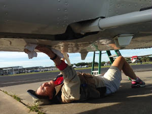 check pilots have to do - walk around inspection, pictures and paperwork. I had an oil dribble on the belly left over from
a leak that Vern had check pilots have to do - walk around inspection, pictures and paperwork. I had an oil dribble on the belly left over from
a leak that Vern had fixed. It always takes a bit to drain the last bits out. So with a clean belly, we blasted off to the north so we could avoid
crossing the ADIZ. fixed. It always takes a bit to drain the last bits out. So with a clean belly, we blasted off to the north so we could avoid
crossing the ADIZ.We ha a stead 25 kt wind out of the north but the flight was very smooth. We set the autopilot, set the altitude, set the power and leaned. It was hands and feet off for the next half hour while we flew the run. All went well and we landed without an problems. Wild Mama performed flawlessly. Now we wait for the word if the flight data was good. Word came through the next day as did the word that our AD list was accepted. So with all papers in, handicap flight complete and safety training complete, we are ready to depart. As of now, we are scheduled to head out on May 23rd for the first journey across the United States to California. We have lots of fun things planned and hopefully some beautiful scenery to go with it. May 23rd - FL to Fairhope, AL: By the time all of
our work was done, it was 1300 hrs before we were able to leave LaBelle; but Ellen and Terry lifted off into the hazy FL skies
without incident. This is our first leg on a long journey to the race start this year. We have to fly all the way to Concord,
CA 2539 nm in all just to Shortly after 1500 local time, we arrived
at Sony Callahan Airport - the site of the 2015 ARC terminus. Wild Mama is on
May 28th - So long Texas: And another foggy morning
where we get off to a very slow start. All surrounding stations are reporting IFR or LIFR so the order of the day is take
our time, look for a park for a short hike and launch when able .... The hike was forgotten as we wandered about the hotel
and airport, meeting and  chatting with other pilots from the Meyers Convention until the fog had lifted and it was time to leave the fix. It was such
a pleasure to launch into relatively clear blue skies. As we made our turn westward, we could look back to see the mounds
of clouds thick behind us but thinning with every mile the we passed. chatting with other pilots from the Meyers Convention until the fog had lifted and it was time to leave the fix. It was such
a pleasure to launch into relatively clear blue skies. As we made our turn westward, we could look back to see the mounds
of clouds thick behind us but thinning with every mile the we passed.The winds were forecast to shift to a light tailwind and, as promised, we crossed with New Mexico border with clear skies and tailwind aloft. Carlsbad Airport was coming into view. It was a conglomeration of runways and with light surface winds, we had our pick of the litter for landing spots. We selected runway 21 and had a long taxi back to the ramp. Grabbing our car, we dashed off to  Carlsbad Caverns so we could get a little cave hiking in before days end. Carlsbad Caverns so we could get a little cave hiking in before days end. The cave was a cool 56 degrees but we elected to have lunch 750' below ground in the 90 year old café. We headed into the main public part of the caves called the Big Room. The room had an interesting assortment of the typical stalactites and stalagmites along with draperies, soda straws and some unique cascading formations. We saw Java the Hut, cave pearls and lily pads all formed from a different combination of water and surface conditions. There were sharp formations, rounded formations and some with rings or other arrays of color. After the better part of two hours we headed out of the cave to find our hotel and prepare for the evening. For the evening we made another
attempt at the bat emergence but this time at the Carlsbad Caverns. We arrived in time to listen to the ranger give an 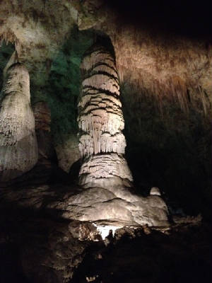 interpretative discussion on the bats habitat, breeding, feeding, predators, etc. At the appointed time the emergence began.
First there was a bat or two then three then more. A hush fell over the crowd as ribbons of bats began swirling above our
heads. They came in small waves, doing the little bat flight dance, swooping so close at times that we could hear the flutter
of their wings. For more than 30 minutes the bat flight continued. It was quite enchanting to focus on the flight of one bat;
watching it swoop past, circle back than disappear into the clear darkening New Mexico sky. Then as the crowd thinned, so
did the bat emergence until the last of the bats had departed on its nightly mission of finding food. interpretative discussion on the bats habitat, breeding, feeding, predators, etc. At the appointed time the emergence began.
First there was a bat or two then three then more. A hush fell over the crowd as ribbons of bats began swirling above our
heads. They came in small waves, doing the little bat flight dance, swooping so close at times that we could hear the flutter
of their wings. For more than 30 minutes the bat flight continued. It was quite enchanting to focus on the flight of one bat;
watching it swoop past, circle back than disappear into the clear darkening New Mexico sky. Then as the crowd thinned, so
did the bat emergence until the last of the bats had departed on its nightly mission of finding food.We made or way out of the Visitors
Center and down the park road, the night was enveloping the area and the stars began to play peek-a-boo as they revealed
themselves us with the disappearance of the center and city lights. We were nearly the last to leave the park and the
cars behind us were few. We pulled off onto an Exhibit parking area and watched as the stars appeared in all of their
brilliance. We identified the Big Dipper, Scorpion and saw an unidentified planet or two. The evening was silent and still
and we listened to the symphony of crickets as the stars twinkled above us until the chill of the night tugged at our shirt
tails and called us back to the car to go in for the evening. We returned to get ready for our lower cave tour tomorrow. May 29th - Going deeper, deeper: Early this morning we departed
for Carlsbad Caverns again for another cave tour. This was the highly sought after Lower Cave Tour. We booked this several
months ago and for good reason: we understand that this tour is now sold out through mid-July! Mustering in one of the classrooms,
we doned our hardhats and head lamps and special gloves for the caave. There is a bacteria that has been 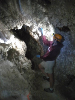 infecting caves and killing bats so they are quite careful to make sure that this arch enemy of the bats does not find its
way to Carlsbad. infecting caves and killing bats so they are quite careful to make sure that this arch enemy of the bats does not find its
way to Carlsbad.With the group equipped we started our descent to the 1000' below ground mark. The elevator took us to -750' and we had 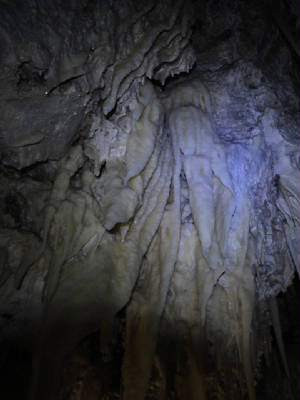 to descend the remainder on our own through a series of rope holds and ladders. While it sounded a bit treacherous we figured
this is America and the US government is not going to promote something that would harm the average vacationer. This was wild
caving 101. We started through the small entry to the lower cave called the "Florida Key" aptly names because of
the entryway being int he shape of Florida and because it was the key to the lower cave. to descend the remainder on our own through a series of rope holds and ladders. While it sounded a bit treacherous we figured
this is America and the US government is not going to promote something that would harm the average vacationer. This was wild
caving 101. We started through the small entry to the lower cave called the "Florida Key" aptly names because of
the entryway being int he shape of Florida and because it was the key to the lower cave.From the entry, we saw an even more amazing array of formations than we did in the Big Room. This portion of the cave is only seen by 36 visitors per week so it is dark, relatively unspoiled and contains some cave decorations unique to the cave. There are cave pearls that we watch still in the formation stages, cave pop corn, stalactites and stalagmites still growing, unlike the majority of the public portion of the cave. A geologist accompanied us on the tour and explained the formation of the cave and talked about the cave discover, Jim White. There was evidence of his being in parts 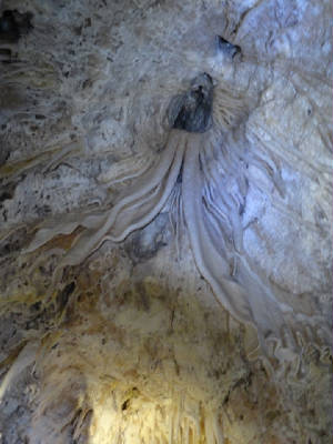 of the cave where he signed his name in 1906. He showed us evidence of earth quake activity and told how safe it was to be
in a cave during an earthquake. The earthwuake needs solid rock to do the most damage. Since a cave cotains much air space,
the shock waves of the earthquake quicky dissipate and do little to no harm to the cave. of the cave where he signed his name in 1906. He showed us evidence of earth quake activity and told how safe it was to be
in a cave during an earthquake. The earthwuake needs solid rock to do the most damage. Since a cave cotains much air space,
the shock waves of the earthquake quicky dissipate and do little to no harm to the cave.There were parts of this cave still forming, evidenced by the water droplets and rings on the formations. Parts of the cave resembled swiss cheese because of the sulfuric acid and how it ate its way through the limestone, leaving other portions untouched. As we meandered through the cheese section, we paused for a moment to experience the stillness of cave dwelling. We all shout off our lights and sat in absolute darkness and silence. The last portion of the cave was an option crawl out or walk out. I opted for the crawl just for the fun of it. We re-surfaced with a greater appreciation of this 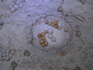 magnificent structure and for the national park that surrounds it. magnificent structure and for the national park that surrounds it.The afternoon was spent wandering the town of Carlsbad to the north. We were staying in the City of White - that we learned was named after the cavern discoverer - and needed to go out and beyond. Carlsbad was a small city predominantly with business centered on one main drag. The Pacos river runs through the City in a lushly landscaped neighborhood. We chuckled at the prospects of moving to the desert only to live by the river. We went to the Living Zoo nd Gardens State Park. The park contains a fascinating display of native animals, insects, reptiles and plant life. There are several eco-systems that make up the region, each with its own diverse array of plants and critters. As our day winds down, we prepare foe departure to Taos, NM tomorrow. Taos is just north-ish of Santa Fe, a place we had stopped 2 years ago. Heaven forbid we make a repeat, so Taos it is! May 30th - From high to low, away we go!: There is something magical about flying through the mountains in the early morning hours. Usually this is necessitated by high winds that kick up during the afternoon, or high temperatures that accompany the mid-day over the mountainous regions; but today was a gotta get there kind of day. Our 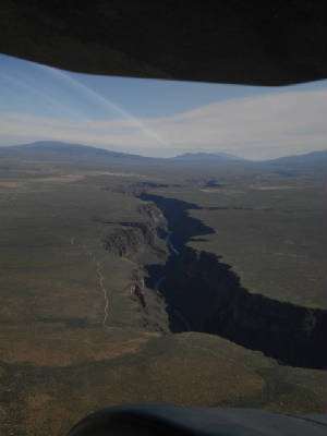 destination is Taos, NM. We have never been to Taos and by
all accounts, it was a place we wanted to go: beautiful mountains, lots of shops, hiking, and scenery. Who could pass this
up? Our pre-dawn arrival at the airport was a good thing. The sun crept up in the distance, illuminating the uncharacteristic
haze that hung over the area, but painting the sky with an array of reds, yellows and oranges that was delight to our eyes.
After fueling, packing and returning the car, we blasted off to some uncertain skies. There were scattered showers in the
area, virga and “low” ceilings …. “low” still allowing plenty of VFR space to fly. destination is Taos, NM. We have never been to Taos and by
all accounts, it was a place we wanted to go: beautiful mountains, lots of shops, hiking, and scenery. Who could pass this
up? Our pre-dawn arrival at the airport was a good thing. The sun crept up in the distance, illuminating the uncharacteristic
haze that hung over the area, but painting the sky with an array of reds, yellows and oranges that was delight to our eyes.
After fueling, packing and returning the car, we blasted off to some uncertain skies. There were scattered showers in the
area, virga and “low” ceilings …. “low” still allowing plenty of VFR space to fly.Our path took us through a large valley, over Santa Fe and in to Taos. Looking at the TAWS, we were going nowhere after Taos as the green colors we were flying quickly disintegrated into a large red mass with Wheeler Peak extending up over 13,000’ off the end  of the runway. There was plenty of maneuvering room but the local typically say be on the ground by 10:00 am as the winds
from the mountains can be quite squirrelly. of the runway. There was plenty of maneuvering room but the local typically say be on the ground by 10:00 am as the winds
from the mountains can be quite squirrelly.We opted for a straight in final for runway 4. There was no other reported traffic in the area and we only needed to descend 700’ to pattern altitude from our cruising altitude. The Rio Grande Gorge surprised us with a spectacular view of the bridge, the gorge and the river below. There was no real hint of it on the chart although the bridge is marked. We certainly think there would have been a warning like: “Spectacular scenery ahead: prepare to circle before landing.” A car trip to the Gorge was the first stop. The view from above was much more spectacular but standing on the bridge was  interesting, especially as heavy trucks crossed and we could feel the bridge vibrations. Hiking was the real order of the
day so we dashed off to the Taos Ski Village and for the trails on the top of the mountain. Unfortunately, we were told that
many of the upper mountain trails were still closed from the snow with reports of 1’ still on the ground. We opted for
a couple trails at the 9200’ level. Starting up Italiana, it was not long before we realized these were not
even Utah “flat”: this trail was filled with rocks and was quite muddy. It appeared as if the racing creek that
meandered alongside the trail had spilled its banks recently. We encountered a couple of hikers who were shimmying across
a log over the creek. They were wet and advised us that the trail had a multitude of creek crossings, none of which were any
easier than the shimmy that they just completed. … so much for interesting, especially as heavy trucks crossed and we could feel the bridge vibrations. Hiking was the real order of the
day so we dashed off to the Taos Ski Village and for the trails on the top of the mountain. Unfortunately, we were told that
many of the upper mountain trails were still closed from the snow with reports of 1’ still on the ground. We opted for
a couple trails at the 9200’ level. Starting up Italiana, it was not long before we realized these were not
even Utah “flat”: this trail was filled with rocks and was quite muddy. It appeared as if the racing creek that
meandered alongside the trail had spilled its banks recently. We encountered a couple of hikers who were shimmying across
a log over the creek. They were wet and advised us that the trail had a multitude of creek crossings, none of which were any
easier than the shimmy that they just completed. … so much for  Italiana. We hiked back to the trail head and headed to Manzanita. Italiana. We hiked back to the trail head and headed to Manzanita.Manzanita Trail was labeled as a “moderate” trail. We were willing to give it a go. The trails was more flat and easy to walk. The creek (a different creek, probably more aptly called a mountain stream) paralled this trail as well for the most part but the crossing was an easy log bridge. The trail, however, was a 3600’ incline over 5 miles and there was no break from the up-hill climb. After 20 minutes of a steady trudge upward we abandoned Manzanita and headed for lower ground. We found a riverside trail that ended abruptly in the river on either end and we came to the conclusion that the spring snow melt was upon us making all of the creeks and streams overflowing or at the very least running quite swiftly. Our last stop of the day was a meander through the City of Taos in and out of the quaint shops and eateries. There is an eclectic mix of people, shops and activities in town and we manage to entertain ourselves for the remainder of the evening without difficulty as we gathered information about other local trails for hiking opportunities tomorrow. May 31st - Enchanted Circle: We were flying low today: ground bound but heading up the mountains on the Enchanted Circle  route. There were many "flatlander" hikes available on the top of the hills so we headed there and let the
car do the climbing. Our first stop was for a short hike to an overlook for the Rio Grande and another section of the Gorge
and the Big Arsenic trail. This area was primarily characterized by sage brush and scrub pines with a smattering of wild flowers.
Throughout the length of the trail, the scenery remained mostly unchanged and we opted for something more scenic. route. There were many "flatlander" hikes available on the top of the hills so we headed there and let the
car do the climbing. Our first stop was for a short hike to an overlook for the Rio Grande and another section of the Gorge
and the Big Arsenic trail. This area was primarily characterized by sage brush and scrub pines with a smattering of wild flowers.
Throughout the length of the trail, the scenery remained mostly unchanged and we opted for something more scenic. Before leaving the Questa area we stopped at the visitors center to get a better lay of the land, hoping that we could find
some other trails that offered a bit more scenic variety. The ranger directed us to the overlook where the Red River and the
Rio Grande meet. It was quite a spectacular view although not much of a hike. Before leaving the Questa area we stopped at the visitors center to get a better lay of the land, hoping that we could find
some other trails that offered a bit more scenic variety. The ranger directed us to the overlook where the Red River and the
Rio Grande meet. It was quite a spectacular view although not much of a hike.The Enchanted Circle road passed around Wheeler Peak. As we gazed off in the distance, the sight of the nearly lime/neon green new growth leaves contrasted sharply with the dark green of the pines. The chunks and ribbons of green that meandered through the mountains seemed brilliant against the bright blue skies. This scene was played out time and again on through the entire circle. Probably our favorite spot was in Red River. The town was a cross between western and rustic with many shop and curios along the main drag. We stopped for lunch and some shopping before continuing on to the next hiking spot along Goose Creek. The walk was  easy and the creek was running heavy with the spring runoff. We could not get to far before we had to cross a log "bridge",
the looks of which promised a good foot wetting if not more. We returned to depart the area. We were saddened in this area
as many of the trees were downed, either by disease or fire. We could not tell which. The forest had thinned, except for the
myriad stumps and felled logs that we had to walk over and under. easy and the creek was running heavy with the spring runoff. We could not get to far before we had to cross a log "bridge",
the looks of which promised a good foot wetting if not more. We returned to depart the area. We were saddened in this area
as many of the trees were downed, either by disease or fire. We could not tell which. The forest had thinned, except for the
myriad stumps and felled logs that we had to walk over and under. The remainder of the Circle provided beautiful vistas of the north face of Wheeler Peak still steeped in snow; lush meadows abutting the many creeks; wild flowers and expansive valleys. Coming back in to Taos, we realized that out 2 hour drive lasted all day, much to our delight. We are leaving the area again with a promise to return for more exploration. We never did see the Pueblo but that is the hazard of a "hit and run" trip as we make when we are heading to the race. We must keep our timeline and ultimate destination in mind. June 1st - a Monumental Flight: A beautiful Sunday morning came to greet us in Taos. The surface winds were light even though the winds aloft we – can you  imagine – 20kts headwinds. We departed out over the Gorge for the last lingering views. Our destination today is Page,
AZ. imagine – 20kts headwinds. We departed out over the Gorge for the last lingering views. Our destination today is Page,
AZ.We have flown this area before in 2012 for the pre-race vacation. It was funny for us to recognize scenery: lakes, mountainous features and odd land features had that comfort of familiarity. Even having seen the sights, we were still in awe of the cornucopia of colors, deep rifts, pointed hills and the myriad geological features that accompany this area on the border between Arizona and Utah. Our path took us north of Ship Rock. We did not make a special trip to go see it again as we had made that jaunt the first time 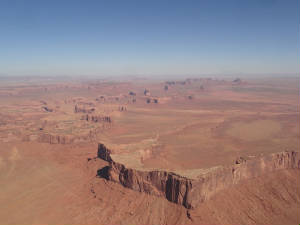 around. We did, however, make the excursion through Monument Valley en route to Lake Powell. We had passed by Monument Valley
before to witness the towering monoliths but the views were not so good. It was worth the return trip. around. We did, however, make the excursion through Monument Valley en route to Lake Powell. We had passed by Monument Valley
before to witness the towering monoliths but the views were not so good. It was worth the return trip.We headed on over Lake Powell into Page. The Lake has been quite low, according with the locals. We could see the water line but we were still quite impressed with the blue colors of the lake as they contrasted with the limestone rusts towering above. Lake Powell Jet Center was out FBO of choice on this trip. They have been most accommodating, trying to get a car for us as we were a day behind and missed our car reservation – Avis was closed on Sunday. They gave us the crew car and we trotted off to the Hanging Gardens before the heat of the day made hiking unbearable. With temperatures already soaring to 95 degrees, we made our way through the 1 mile desert trail to the Hanging Gardens. It was at least 20 degrees cooler in the 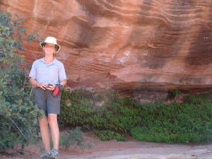 shade and the ferns and other foliage made a nice backdrop for the half-way point of our hike. The area was quiet save for
the sounds of the light breeze and an occasional bird. It was quite still, peaceful and another beautiful contrast of the
harsh desert as a backdrop to some unexpected treasure. shade and the ferns and other foliage made a nice backdrop for the half-way point of our hike. The area was quiet save for
the sounds of the light breeze and an occasional bird. It was quite still, peaceful and another beautiful contrast of the
harsh desert as a backdrop to some unexpected treasure.By the time the evening came we were ready to head back out to the Horseshoe Bend in Lake Powell. It is a popular spot for photographers and was quite spectacular. Most of the folks there were awaiting sun set. We opted for some less than perfect views so we did not have to make another miles hike in the dark. We have an early night tonight as our morning hike is a 0630 meeting with our tour guide. June 2nd - A “Slot” of Hiking: First light happens in these parts at 0430 or there about. I was still asleep for a change at daybreak. No worries as we had to check 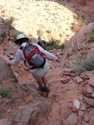 out of the hotel and make it to the tour meeting spot by 0630. The trek for the day is Canyon X and Antelope Canyon. Both
of these are slot canyons known for their unique sandstone formations and photographic opportunities for those who sit for
endless hours waiting for the light shaft to filter through the formations “just right”. Since we are opportunistic
photographers we were more interested in the hike, the scenery and, of course, snapping the more than occasional photo. out of the hotel and make it to the tour meeting spot by 0630. The trek for the day is Canyon X and Antelope Canyon. Both
of these are slot canyons known for their unique sandstone formations and photographic opportunities for those who sit for
endless hours waiting for the light shaft to filter through the formations “just right”. Since we are opportunistic
photographers we were more interested in the hike, the scenery and, of course, snapping the more than occasional photo.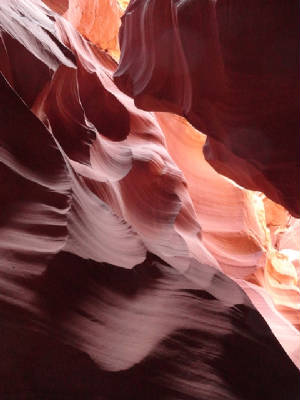 We have found that this part of the country offers no bad scenery. There are parts that might appeal to the eye of one more than another but there is nothing bad to look at. The rock formations are incredible, full of vivid colors, interesting shapes and stark contrasts. The flora and fauna are different that we tropical dwellers are accustomed. While the flora is not “lush” in the ordinary sense, it is abundant, varied and quite interesting. It is fascinating how an area so devoid of water can sustain wild flowers in such abundance. Canyon X is a hike down to get in and up to get back out. While the terrain looked fairly daunting, it was really quite easy, much to our surprise and delight. We had an excellent guide, Bill, who assisted in navigating the slippery rocks and soft sandy slope. The morning temperature was already up to 85 degrees but the slot canyon was much cooler. The bulk of the canyon floor is shaded, with the spires of sandstone twisting and towering above us. Bill maneuvered us into position for several good photographic opportunities. He showed us the remnants of the August 2013 flash flood that left its high water mark on the canyon wall some 25-30’ up and displaced trees, concrete and steel 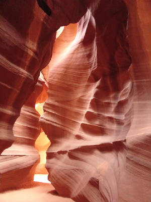 structures, leaving them scattered about the canyon and desert floor. structures, leaving them scattered about the canyon and desert floor. After hiking about for an hour or more, we hiked our way back out of X to head over to Antelope Canyon. Both of these canyons are owned by and regulated by the Navajo Nation. There are limits to the numbers of people who can enter and the length of time that each group can remain so all can have an opportunity to view. Antelope Canyon boasts over 1 million visitors per year and when you think of a ¼ mile long slot canyon that equates to a lot of people in a very small space all at the same time. We were fortunate that our time was not an elbowing event as it was a Monday and the crowd had not yet materialized. Still, there were 20 or more groups in the canyon with us. The interesting and popular feature of Antelope is the light shaft show. The best time is 100-1200 hours and we made the ideal time. 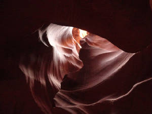 There are streaks of light that cast eerie illuminations on the canyon walls; there are formations that the eye will not
see that the camera picks up quite readily. One such formation is the “heart of the canyon”. Bill snapped a photo
with my camera otherwise I would have never seen it. There are streaks of light that cast eerie illuminations on the canyon walls; there are formations that the eye will not
see that the camera picks up quite readily. One such formation is the “heart of the canyon”. Bill snapped a photo
with my camera otherwise I would have never seen it.The ambience at Antelope is not nearly as nice as X. X is quiet and we were the only group there. It was peaceful and solemn while Antelope was abuzz. Guide spoke one over the next, tourists’ oooed and aaaahed and all jockeyed to be in “the perfect spot” for “the perfect” photo. Our time slot lasted an hour and we made our way back to civilization. While there is so much to see and do in Page, AZ out time is running short, as usual. There is still much exploration of Lake Powell and the surrounding area, we are preparing for departure again. We are still westward bound for CA but we have one little piece of unfinished business in AZ: the over-flight of the Grand Canyon. Stay tuned tomorrow. June 3rd - Plan E: Sunrise was at 0506 this morning and we were already at the airport, loaded and ready to go.
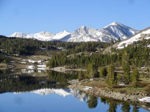
The winds were up so we knew our trip to 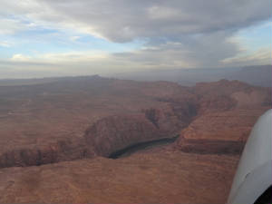 Mammoth, CA would take a little longer. We might even need to make a fuel stop in order to make it with a large margin of
safety. The surface winds at Page were relatively low which was nice. That was the last of the calm winds for the morning. Mammoth, CA would take a little longer. We might even need to make a fuel stop in order to make it with a large margin of
safety. The surface winds at Page were relatively low which was nice. That was the last of the calm winds for the morning.
Heading over Marble Canyon, we had to climb to 10,500’ in order to comply with the Grand Canyon overflight regulations. We were able to maintain a steady climb but the high clouds were blocking out the best ray that made the colors of Marble Canyon really pop.  They were dull and washed out. It was probably a good thing in hind sight. They were dull and washed out. It was probably a good thing in hind sight.We were keeping watch of our ground speed hovering around 125 kts. If we kept up that pace over this part of the trip, we would pick up a tail wind as we exited the canyon and be OK on our fuel. We checked back moments later to see a ground speed of 106 kts. The nose was raising and the air speed was bleeding off to about 120 kts. Forgetting about photos, we became concerned that we had hit a down draft and we needed to fly out of it. We waited and watched the ground speed … 90 kts … 80 kts… 70 kts ….65 kts. Our airspeed had likewise degraded to 80 kts. We could no longer hold altitude and we had to remain above 10,500’. It was now headed toward being a dangerous situation and we had to turn around. We made a gentle turn and immediately exited the flyway corridor and regained our airspeed. Now we were 205 kts in level flight trying to stay high enough above the ridges to remain in one piece. We circled to lose the required altitude and land back at Page. That was way too exciting. That took care of plans A, B and C – dealing with issues getting in to the Mammoth area. Plan D was the  return to Page. Now what? return to Page. Now what?Time for plan E. We remained on the ground for the better part of 2 hours. We needed to study the weather and the possible routes. There are many restricted areas and high terrain – both to be avoided. We finally made our plan and worked out a route to Minden/Tahoe. We opted for a route to get us out of the AZ wind band as quickly as possible. This area was desolate. There were no airports over which we passed and the geography was quite inhospitable. We bumped our way along here and there but for the most part the ride was relatively smooth and we had a cross wind that kept us in the 140-150 kt range for the bulk of our journey. Our last ridge to cross was coming into Minden. We circled to the south for our approach and landed in the midst of many glider launches and static air show.  We were able to get a car, so with a little juggling we figured we could drive into Mammoth about 2.5 hours to the south.
We stopped for lunch at Red’s 395. It was a nostalgic type of place with fun décor, good food and a surprise
waiting for us in the ladies room. We were able to get a car, so with a little juggling we figured we could drive into Mammoth about 2.5 hours to the south.
We stopped for lunch at Red’s 395. It was a nostalgic type of place with fun décor, good food and a surprise
waiting for us in the ladies room.The drive to Mammoth was pretty with lush green meadows in contrast to the snow covered mountains. We crested a hill to see the full Mono Lake come into view almost all at once. Stopping by the visitors’ center, we got information for our planned hikes over the next few days. It has been a long day: we made our planned 3 hour trip in just over 12.5 hours! Oh, the surprise in the ladies room? The restaurant owners had a sense of humor. As tired as I was, they got me too. As I was washing my hands, I looked in the mirror to see the word “MENS” on the door behind me. Are you kidding??? I went in the Men’s Room???? I scurried out the door to look at the Ladies Room sign … and a false/artificial door face on the inside. They got me good but I got a good laugh at myself! June 4th - Mono Lake Region: Our first hiking stop today was around Mono lake. We took the trail around the south side of the lake to get a good view of the Tufas. These are calcium carbonate structures which sprung up from a natural spring in the lake. The lake is very salty, similar to the great Salt Lake, in fact they 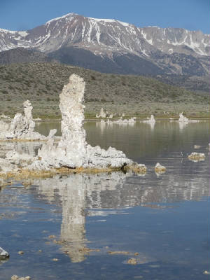 are said to be sisters. are said to be sisters.The lake sits at the bottom of the great basin. The majestic snow-covered mountains standing century over the lake. The area is lush and green with the scent of sagebrush permeating the air. As we departed the parking area and hike down towards the lake, our pathway changed from the sagebrush to the land of tufas. They are oddly shaped calcium carbonate formations jutting out of of ground. As the lake recedes, they stop growing; otherwise the fresh water springs bubbling up from the lake carry the minerals that spur their growth.  We arrived early enough that the area was still peaceful. The sage thrasher was creating his own symphony of courtship nearly
drowning out the remainder of the chorus of birds. The area was teaming with wildlife and it was still early and cool enough
for the critters to be out and about for their morning meals. We arrived early enough that the area was still peaceful. The sage thrasher was creating his own symphony of courtship nearly
drowning out the remainder of the chorus of birds. The area was teaming with wildlife and it was still early and cool enough
for the critters to be out and about for their morning meals. We meandered in and out of the tufas, admiring the beauty of the still waters, the mountains and tufas reflecting in the blue lake. Nearing the beach, the aromas changed from the sagebrush to salty air. If was hard ti believe that there was no ocean in front of us. The sound of crashing waves was replaced by the aviary chorus. Our next hike was it Panum Crater. The creature resulted from a dormant volcano. There is an interesting mix of obsidian and rock and pumice that is scattered all about the crater. It appears that the volcano once blue it's top, then filled it self back in with the stuff that it throughout. We hiked up the rim and around then down inside the crater where there was an island of obsidian rock, pumice and a variety of other rocks scattered about. The shiny obsidian rock shined brightly in the sun, and the pathway, littered with crushed pieces of obsidian sparkled as we walked. We stood atop the island looking down. We were for certain on top of our little corner of the world except for the sierra Nevada mountains towering over our backs. Our last hike of the day was to Parker Lake. It was recommended to us flatlanders as the "easiest" hike on the area. This reminded of of "flat" being a relative term  depending on whether you hail from FL or Utah. depending on whether you hail from FL or Utah. The drive back to the trail head was via a gravel road up a hilly meadow. There was no evidence of the location of the lake from the trail head; just that it was 1.8 mikes one way. That sounded "easy" enough. We stopped at Parker Stream first just on time to see 3 prong horn scurry across the meadow. This is another sage brush and pine forested area but the wild flowers were starting to bloom and the sounds of song birds filled the air. We returned to the lake trailhead and started our ascent of cardiac hill. We began to question the wisdom of our decision to make this hike but decided to press on a little further. The first 15 minutes straight up seemed an eternity. We paused when we say a team of hikers half our age approaching. They said we finished the worst part but still had a long way to go. We say a photo of the lake and decided it would be worth the trip. Breathing heavily from the altitude and the strenuousness of the hike our lungs filled with the heavy sage and pine forest mix with fresh mountain air. For some reason the smells were particularly pungent in this section of the forest but the sage was such a sweet smell that we did not complain. Our next encounter was another lady hiker, former military ATC. We chatted a bit and she encouraged us on saying that we made the half-way point and the remainder was very easy. Refreshed, compressed on. After a little more than an hour of hiking we came to the clearing with the lake. It was beautiful: crystal clear and serene, sitting at the base of a 12,000' snow-capped mountain. We sat for a bit to take in the scene before heading back as it was already getting late. Cardiac Hill was worth the effort. We made the trip back in record time and headed back to the hotel. It was a long day but a great day. Tomorrow is the trip into Yosemite. June 5th - Yosemite: Early
this morning we headed across the mountain pass to Yosemite. The passes were all open because it was a light snow year, as
the rangers
 have told us, but there was still snow in the higher elevations. There was such a chill in the air this morning that
we both donned long pants, sweats and a jacket. have told us, but there was still snow in the higher elevations. There was such a chill in the air this morning that
we both donned long pants, sweats and a jacket. The
10,000' elevations were beautiful but short lived. We quickly descended down the mountains and on into the main section of
the park where all of the activity is located. Unlike the hiking we had been doing, this was "combat hiking" with
throngs of people, paved passes and lots of folks competing for the same photo spot. We wanted to do the tourist part of Yosemite
so we could head off to the parts less traveled tomorrow. Our first stop was a hike to the Lower Yosemite Falls. The Falls was flowing but not as
swiftly as it had been in past years. Again, 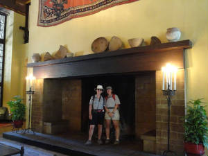 this was the result of the lack of snow over the past winter. From the Falls, we hiked out to Mirror Lake. Although the lake
was low, there was still sufficient water for the reflection of Half Dome. this was the result of the lack of snow over the past winter. From the Falls, we hiked out to Mirror Lake. Although the lake
was low, there was still sufficient water for the reflection of Half Dome. We stopped by Ahwahnee Resort. Everything about it was bigger than life: its scale, its placement in front of the gargantuan rock faces; even the fireplace was huge! We met up with Harry at the neighboring Yosemite Village Sports Center. Harry is just getting back into flying after along absence so we all got to have a nice chat about aviation. 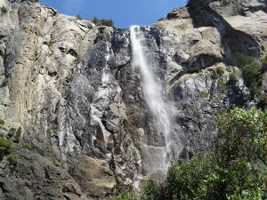 We did the drive by of Half Dome, and El Capitan before continuing to Bridal Falls. The last time I saw the falls it was barely
a trickle. Today it was much better and we gazed upon the falls long enough to see how it got its name. As the wind shifts
over the top of the falls, it blows the cascade in all different directions creating a veil instead of a single cascade. It
was quite special. We did the drive by of Half Dome, and El Capitan before continuing to Bridal Falls. The last time I saw the falls it was barely
a trickle. Today it was much better and we gazed upon the falls long enough to see how it got its name. As the wind shifts
over the top of the falls, it blows the cascade in all different directions creating a veil instead of a single cascade. It
was quite special.June 6th - Land of Giants: A long hour drive to Yosemite was made even longer by the remote location of our morning hike at McGirks Meadow. It was. Ot the typical meadow that I expected to see. There were many trees and little open space for most of the 4 mile hike. We passed the small cabin that this old sheep rancher constructed. Ore than 80 years ago. It was very rustic but 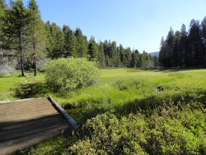 would have kept him out of the snow. Just past the cabin was the real meadow. Long green grass, a small pond with some fish
surrounded by wild blueberries. The blue berry bushes were a buzz with large bumble bees so we kept our distance. would have kept him out of the snow. Just past the cabin was the real meadow. Long green grass, a small pond with some fish
surrounded by wild blueberries. The blue berry bushes were a buzz with large bumble bees so we kept our distance. No one else was on this hike so the setting was as peaceful and serene as out hikes in the Mono Lake region.
The carnival atmosphere of throngs of tourists was gone. We walked along in silence. Admiring the sounds of the song birds,
the smell of the pine forest and the wild flowers. Small squirrels scampered about nut the meadow was otherwise quite still. On our return trip out of the meadow, we stopped on the little bridge over the pond for a mid morning snack.
Again, we sat in silence with the sounds of the forest filling our senses. Two hummingbirds flittered about a nearby bush.
One zoomed over next to Ellen spying on her to see who was this intruder in their neighborhood. He zoomed off just as quickly
but the close encounter was delightful. 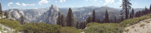 Since we were close to Glacier Point, we drove the last 5 miles out to see it and the throngs of other tourists. The point
overlooked Half Dome and the stair step falls and was quite breath taking. But on to our other hike for the day. Since we were close to Glacier Point, we drove the last 5 miles out to see it and the throngs of other tourists. The point
overlooked Half Dome and the stair step falls and was quite breath taking. But on to our other hike for the day.We wanted to wander about the giant sequoia forest in Mariposa Grove. We made the 45 minute drive only to find
we could not park so we had to take the shuttle. We made the shuttle ride and decided to take the tram tour around the grove
when the hiking trail said that the hike to the upper grove was "strenuous" .... No! 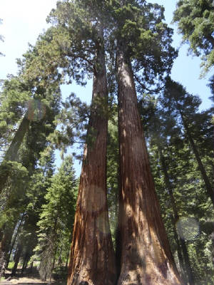 The tram tour was an audio tour where we learned about the grove, the trees, its discovery and
how to maintain this healthy grove. We got off at the top and walked down the 3 miles to the bottom passing by the Giant grizzly,
bachelor and 3 graces, California tree tunnel tree, faithful couple and the clothespin tree. The sweet smell of
a little white flower permeated the pathway. We meandered in and out of the grove gazing high at the 250' plus trees. Coming
to the bottom we were filled with a sense of admiration for these majestic giants, but tired and ready to call it a day. June
7 - Beauty and the Beast: Our last full day in Yosemite found us wandering about the sequoia grove of Tuolumne
this morning. This is a smaller grove with only about 25 mature trees.. We were looking for the meadows with wild flowers
again but the path was 4.3 miles up hill... No. The Tuolumne Grove was a nice option. It was 1 mile down followed by a meander
around the grove and the long trek back up. 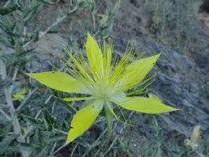 On the way down, we rounded one of the switchbacks to hear this very loud buzzing noise. We looked up,to see the largest swarm
of bees I have ever seen. They appeared to circle the hive near the top of a large pine. We mentally marked to spot to hurry
past on the way up as neither of us wanted to tangle with any bees. Further on down the path we hear the distinct sound of
a woodpecker and found one of the giant "Woody Woodpeckers" pecking away at a downed log. How cool. On the way down, we rounded one of the switchbacks to hear this very loud buzzing noise. We looked up,to see the largest swarm
of bees I have ever seen. They appeared to circle the hive near the top of a large pine. We mentally marked to spot to hurry
past on the way up as neither of us wanted to tangle with any bees. Further on down the path we hear the distinct sound of
a woodpecker and found one of the giant "Woody Woodpeckers" pecking away at a downed log. How cool.We were more than 2 hours on this hike and we still had not seen the coveted wild flowers. We headed back up
to the other end of the trail so we could skip the 4.3 mile part. The meadow was supposed to be the first 1/2 mile and it
was reported to be full of wild flowers. We hiked down to the meadow and it was a bust. While there were quite a few
flowers, it was not the canvas of flowers we were seeking. We picked a nice spot for a picnic lunch then hiked back up the
hill and moved on. By now, after 2 pretty still up hills we were a bit tired. 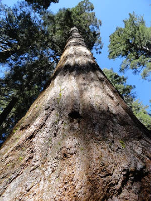 Fortunately for us, the last planned hike was up at Hetch Hetchy, about an hour drive to the north
in another section of the park. There were supposed to be fields of flowers along the O'Shaughnessy Dam. The drive up was
a mixed of beauty and the beast. The large north rim fire that burned wildly in the Fall of 2013 devastated the mountainside.
There was mass destruction of the trees and the rocks stood sentry over the ruins. However, from beneath the beast, the beauty
regrew. The wild flowers started to sprout, and in the numbers and with the varieties that we had hoped to see. We stopped
frequently en route to the dam, snapping pictures and feasting on the cornucopia of colors across the meadows and in the roadside
rocks and ditches. Flowers were everywhere! 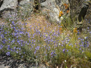 We arrived at the dam and looked across at the waterfalls 2.7 miles away. The hike was across the dam, through the tunnel
then along side of the reservoir in the hot afternoon sun. It was 1400 hours, hot and 3800' elevation. ... No. We made it
across the dam and through the tunnel and back up the hill to the car. Done. Time to head back to the hotel and call it a
day. We arrived at the dam and looked across at the waterfalls 2.7 miles away. The hike was across the dam, through the tunnel
then along side of the reservoir in the hot afternoon sun. It was 1400 hours, hot and 3800' elevation. ... No. We made it
across the dam and through the tunnel and back up the hill to the car. Done. Time to head back to the hotel and call it a
day.We have
one more hike white Wolf and Lukens Lake then head back to the other side. June 8th - Farewell to Yosemite: Our last day in the
Yosemite National Park and we wanted just one last nice hike through the wild flowers. One of the rangers 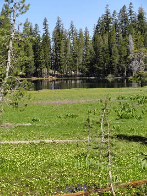 suggested White Wolf as a great meadow but it was a bust. Our last chance was Luken Lake. This was supposed to be "easy"
again. I sure would like to know how they rank the relative ease of these hikes. We had quite a bit of an up and down; so,
yes uphill both directions. The lake was beautiful with a large meadow of wild flowers and birds to the south end and a tall
pine stand with snow on the west side. We stopped for our picnic lunch and built a snowman in the last of the winter snow.
We also go in the last snowball fight of the year. suggested White Wolf as a great meadow but it was a bust. Our last chance was Luken Lake. This was supposed to be "easy"
again. I sure would like to know how they rank the relative ease of these hikes. We had quite a bit of an up and down; so,
yes uphill both directions. The lake was beautiful with a large meadow of wild flowers and birds to the south end and a tall
pine stand with snow on the west side. We stopped for our picnic lunch and built a snowman in the last of the winter snow.
We also go in the last snowball fight of the year.Heading out of the park we made out way back to Mammoth and to the Devils Postpiles. The Piles are unique geological formations 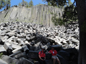 made by cooling lava. There are large hexagonal sticks lied up like a wall. Quite interesting! made by cooling lava. There are large hexagonal sticks lied up like a wall. Quite interesting!We are winding down from vacation and had to attend to the more mundane issues such as laundry... More tomorrow. June 9th - down day: Being one of our last vacation days, we decided we needed to start the transition from hiking to race mode. Ellen went out thin morning for a bird watch and I remained at the hotel catching up on work that has been put off for the last 3 weeks. Our afternoon consisted of a drive to Bishop, CA. Bishop is about 30-40 miles to the south. It is a smaller town but well placed with all of the town center laying in about a square mile. There was junior rodeo in town with lots of kids in their cowboy garb. We made a couple shop stops but remained mostly in the car. With the town being just north of Death Valley, one can imagine the heat and dry conditions that persist in the town. We are having excessive heat in the area and there are heat advisories out for the area. Tomorrow we head to cooler weather and Lake Tahoe. 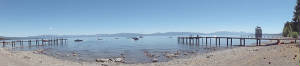 June 10th - Lake Tahoe: We had a 2.5 hour drive from Mammoth to head up to Lake Tahoe. Wild Mama is still resting
comfortably in Minden and we will see her tomorrow for the last leg into Concord. But today we were taking an easy day to
transition from active adventure to airplane adventure. June 10th - Lake Tahoe: We had a 2.5 hour drive from Mammoth to head up to Lake Tahoe. Wild Mama is still resting
comfortably in Minden and we will see her tomorrow for the last leg into Concord. But today we were taking an easy day to
transition from active adventure to airplane adventure. I had never been to Lake Tahoe before. The lake is huge with emerald green edges and cobalt blue depths with a royal blue transition zone. The breeze was light 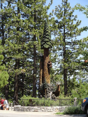 today and the 80 degree temperatures at altitude felt delightful. Looking out across the lake were the still snow capped
mountains. The locals said there was a ton of snow last week but a quick warm up spawned the tourists and the lush greenery
that surrounds the lake. We drove around the whole lake. I think the northeast shores were the most beautiful: small
sandy beached with a longer today and the 80 degree temperatures at altitude felt delightful. Looking out across the lake were the still snow capped
mountains. The locals said there was a ton of snow last week but a quick warm up spawned the tourists and the lush greenery
that surrounds the lake. We drove around the whole lake. I think the northeast shores were the most beautiful: small
sandy beached with a longer  emerald section covering a rocky bottom. We got out to stick our fingers in the lake figuring it was quite cold. But the warmth
of the sun made the shallow section we touched quite nice ..... although I am sure the deeper waters tell a more frigid tale. emerald section covering a rocky bottom. We got out to stick our fingers in the lake figuring it was quite cold. But the warmth
of the sun made the shallow section we touched quite nice ..... although I am sure the deeper waters tell a more frigid tale.We are calling it an early night. The forecasts had predicted high winds for Thursday earlier but the front is moving along faster than expected and they are now forecast for Wednesday afternoon. We are going to sneak out through the mountains with the "light and variable" predicted for early morning. So this evening we savor our vacation time and talk about the fun we had. Tomorrow we arrive in Concord and have to prepare Wild Mama for her inspection on Thursday. We have a lot of cleaning up and cleaning out to do. Everything has to be race ready for impound. June 11th - Last leg: This was an earlier than usual day to get going. We were in South Lake Tahoe and Wild Mama was still over the ridge in Minden. We had to drive back to Minden, load Wild Mama and pop over the 2 ridges that lay between us and Concord - the last leg of our vacation trip and the start of our race activities. 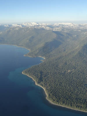 It was 44 degrees when we got us - quite chilly for both of us but we needed to go. The winds were forecast light in the morning but picking up significantly for the afternoon and even worse for Thursday as a low pressure system was approaching. We made it through the twists and winds of the mountain road. Although the speed limit was 45, with the darkness, construction and possibility of critters, we kept the speed to a minimum. A skunk darted out in front of us and I slammed on the brakes to avoid it. Thank goodness: I am not sure what the rental car deodorizing bill would have been. We arrived at Minden in the still of the pre-dawn hours. Although the sun was peaking on the sunny side of the mountain, we could only see the orange glow to illuminate our packing duties. With Wild Mama packed just before 0600 we lifted off and circled the airport to gain altitude. We had to cross Spooner pass with a 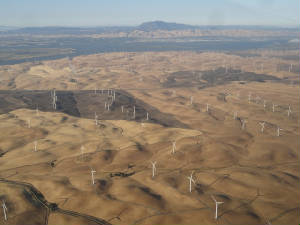 minimum of 8500' for our comfort margin, then cross the lake and find the 7000' saddle between the snow covered giants. The
lake was still and blue and beautiful set nestled among the giants that guarded her. The water was still - as was the air,
much to our delight - and we climbed out without any issues. We soon spotted the saddle and could see over top of it so we
knew we had the altitude to clear the ridge. minimum of 8500' for our comfort margin, then cross the lake and find the 7000' saddle between the snow covered giants. The
lake was still and blue and beautiful set nestled among the giants that guarded her. The water was still - as was the air,
much to our delight - and we climbed out without any issues. We soon spotted the saddle and could see over top of it so we
knew we had the altitude to clear the ridge.With the terrain behind us we looked forward to our Concord arrival. With the airport more than
50 miles off we could see Diabolo Peak through the haze; it seemed to be right in front of us but we discovered it was parallel
with the airport ... still 50 miles off! Wow - so clear! We saw the wind mill farm clearly, with the turning blades and shadows
.... still 37 miles off. We had a great ride going through our descent into Concord. We just had to pass Diabolo Peak when
we discovered why it got its name. Someone turned on the bump machine. We were rocked and tossed at 1500' passing the north
side of the peak to get to the airport. Such a devil of a time we had but we made it in to Concord with the little plunk.
No one was there at 0700. We landed and had lots of time to clean Wild Mama until we saw the first signs of life coming out on the ramp. There were several racers 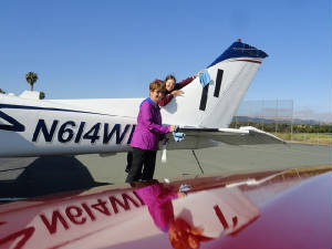 there ahead of us but they got to sleep in for the day. We started the meet and greet process, seeing our friends whom we
have not seen in quite some time. We had an oil change scheduled for 1400 and had to warm the oil for the mechanic to make
his job easily. All is running smoothly. We hung at the hotel for the afternoon and visited with our Paradise Coast 99s Chapter
Chair, Nancy Moore, and her sister in law for dinner. It was nice to meet another Floridian and Chapter sister in CA! there ahead of us but they got to sleep in for the day. We started the meet and greet process, seeing our friends whom we
have not seen in quite some time. We had an oil change scheduled for 1400 and had to warm the oil for the mechanic to make
his job easily. All is running smoothly. We hung at the hotel for the afternoon and visited with our Paradise Coast 99s Chapter
Chair, Nancy Moore, and her sister in law for dinner. It was nice to meet another Floridian and Chapter sister in CA!Tomorrow starts the official race activities - inspections and credentials. We checked the lights and all work this year - let's hope nothing burns out between now and the morning. June 12th - Inspections and the Devil: Early this morning
we met up with Gail and Lynette to get the airplane inspection completed. I am happy to say that, unlike last year, we had
no inspection drama. The lights worked and thanks to Vern all of our paperwork was in perfect order. Likewise, we completed
all of our pilot
 credentials in short order and were free for the day by 1000! credentials in short order and were free for the day by 1000! In keeping with our theme this race year, we decided to hike around Mount Diablo - that is "Devil Mountain" by translation.
The mountain was a hill by the standards when whence we came, toping out at just over 3800'. But it presented a beautiful
panoramic view of the Bay area and interior Sacramento Valley. We selected the botanical hike as it was "easier"
than the Summit Trail that went straight up the hill .... No. In keeping with our theme this race year, we decided to hike around Mount Diablo - that is "Devil Mountain" by translation.
The mountain was a hill by the standards when whence we came, toping out at just over 3800'. But it presented a beautiful
panoramic view of the Bay area and interior Sacramento Valley. We selected the botanical hike as it was "easier"
than the Summit Trail that went straight up the hill .... No.After some time in the downtown Walnut Creek wandering about we headed back to the airport to check out the competition and who has arrived. We say more friends. I guess at this point all are friends an none are competitors ...  until Monday morning! (Hi to the gals at the Q Nail Salon - Great job, thanks!) until Monday morning! (Hi to the gals at the Q Nail Salon - Great job, thanks!)June 13-15th - Pre-race formalities: As much fun as we have had over the last 3 weeks we knew that it was time to get down to business. We are here for a race and the pre-race briefing and activities are an important part of the process. Friday was our youth and aviation education day; of course, near and dear to my heart. We had 62 local girl scouts come for the 3 hours program. We have 4 stations (the #4 thanks to Mary Wunder). The astern PA gals came out in spades for the career chats, airplane demonstrations and airport demonstration. Our college teams and the Baldwin Family were other volunteers along with the Three Musketeers. The  4th station was the tower tour - a very coveted event. The girls walked away with a great understanding of aviation, careers,
airplanes and airports. We hope to have made an impression to get our next generation in the air. 4th station was the tower tour - a very coveted event. The girls walked away with a great understanding of aviation, careers,
airplanes and airports. We hope to have made an impression to get our next generation in the air.Saturday was the first briefing day and the day was not so bad. The briefings did not run over too long so we were able to get out to  lunch and enjoy some of the afternoon before the banquet. We had a great salmon meal, listened to an account about the search
for Amelia Earhart and spent some quality time with our best airplane friends. Another day of briefing awaits us tomorrow
then the big event. The excitement grows. lunch and enjoy some of the afternoon before the banquet. We had a great salmon meal, listened to an account about the search
for Amelia Earhart and spent some quality time with our best airplane friends. Another day of briefing awaits us tomorrow
then the big event. The excitement grows.Sunday found us sitting in our fly by briefings and start briefing. The fly bys are very important as we are operating on FAA waivers for lower altitude restrictions. We have to follow the procedures to the letter lest we walk away wit unwanted penalties. The remainder of the day is to strategize, relax and prepare for the big event. Less than 24 hours to go! June 16th - Race Day 1: The day we wait for all year was finally upon us. As usually, we slept fitfully but were
rested none-the-less. After the final breakfast and 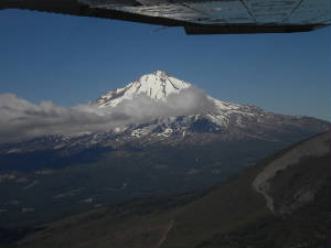 briefing we were off from Concord. We started in ripping south winds that eventually changed to more westerly and northwesterly
but we had a good first leg anyway. This was the leg we got to pass by Mt Shasta. Shasta is a 14,000’+ giant, partly
shrouded in clouds and covered in snow. We made the flyby to continue at A32 and headed off to Elko. The ceilings
were not as good as I would like heading off in the mountains. I prefer a bright sunny day or if there is a ceiling, something
in the range of 5000’ above the highest peak. We did not have that. We were still VFR but ran into some cold temperatures
and virga. At one point with a 35 degree temperature, the virga flash froze onto the leading edges of the winds but disappeared
almost as fast as it appeared. briefing we were off from Concord. We started in ripping south winds that eventually changed to more westerly and northwesterly
but we had a good first leg anyway. This was the leg we got to pass by Mt Shasta. Shasta is a 14,000’+ giant, partly
shrouded in clouds and covered in snow. We made the flyby to continue at A32 and headed off to Elko. The ceilings
were not as good as I would like heading off in the mountains. I prefer a bright sunny day or if there is a ceiling, something
in the range of 5000’ above the highest peak. We did not have that. We were still VFR but ran into some cold temperatures
and virga. At one point with a 35 degree temperature, the virga flash froze onto the leading edges of the winds but disappeared
almost as fast as it appeared.We had a nice stop in Elko, rested a bit and checked the weather. There were scattered showers in between Elko and Pinedale; and  the temperature was quite low again. We waited for the temperature aloft to rise to 43 degrees and launched. Again, we encountered
minor virga and relatively lower ceilings but the leg was good again. It is a shame that the sun was not out because we would
have loved to see the colors of the mountains highlighted by the sun. Just to add to the excitement of mountain flying, when
we needed it the most the MX20 – this is the terrain page – initiated a “precautionary shutdown” at
a very inopportune moment. Fortunately, Ellen had her finger on the race navigation book and a good beam on our location.
We had started our flyby prep into Pinedale but stopped the temperature was quite low again. We waited for the temperature aloft to rise to 43 degrees and launched. Again, we encountered
minor virga and relatively lower ceilings but the leg was good again. It is a shame that the sun was not out because we would
have loved to see the colors of the mountains highlighted by the sun. Just to add to the excitement of mountain flying, when
we needed it the most the MX20 – this is the terrain page – initiated a “precautionary shutdown” at
a very inopportune moment. Fortunately, Ellen had her finger on the race navigation book and a good beam on our location.
We had started our flyby prep into Pinedale but stopped 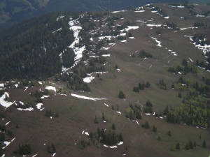 when the terrain went out and snow started hitting the windscreen. Ellen directed me toward the lower terrain and the
valley that we had marked and I initiated a climb to be on the safe side. There would be time to descend later. We zigged
and zagged until we cleared the highest stuff and headed back down. By then the snow stopped and terrain came back on line.
We had enough excitement for the day we decided to remain in Pinedale for the night. With Wild Mama tucked
safely in a hangar, we all got to get some rest. when the terrain went out and snow started hitting the windscreen. Ellen directed me toward the lower terrain and the
valley that we had marked and I initiated a climb to be on the safe side. There would be time to descend later. We zigged
and zagged until we cleared the highest stuff and headed back down. By then the snow stopped and terrain came back on line.
We had enough excitement for the day we decided to remain in Pinedale for the night. With Wild Mama tucked
safely in a hangar, we all got to get some rest.June
17th – Race Day 2: We were a bit concerned for the morning departure as our weather guru said to sleep
in and plan on a late departure. We were fortunate that we got a hangar for the night so Wild Mama could hopefully remain
snug and warm. It was rainy in the morning. The temperature was 35 degrees with a wind chill of 28 degrees. It was not my
idea of fun, but we were able to clean and pack Wild Mama in the warmth of that hangar when we arrived at the airport at 0700
– there is not “sleeping in” where I come from.
 We looked off to the north to see clear skies way off in the distance. Our ceiling was still relatively low. We looked off to the south and saw relatively clear skies but not quite clear enough yet. So we waited. By 0900 the ceiling had come up a bit although not as much as we would have liked. The south looked relatively clear but there was an ominous black cloud drifting in from the west. It was time to go. We raced off and said goodbye to Wyoming and the wonderful town of Pinedale and the to the tallest of terrain and 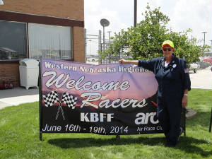 coldest of temperatures we have ever seen on a race. We deviated around the large 13,200’ mountain that was directly
on path. The clouds were low over the top of her and we could barely see the peak. The wind danced off the mountains and made
an eerie formation in the cloud. A thin, dar rope-like formation started to appear. It stated dancing and twisting against
the lighter background as it dropped from the sky. It reminded me of the water spout Vern and I had seen in the Bahamas so
I deviated further south as we watched the small rope funnel form. It continued its taunting dance as it watched us pass by
then disappeared. 5 am looking forward to the clear skies ahead. The sky broke open as we approached Scottsbluff.
It was good to be back in lower terrain with higher ceilings and warmer temperatures. I felt our icing/snow encounter possibilities
were finally over; but there were storm up ahead on the horizon. A massive conglomeration low was spinning and drifting just
north of course and threatened to cut us off at Iowa City if we did not get through. We stopped long enough to check weather,
eat and make our way back to the air for a mostly uneventful leg. We were not disappointed. coldest of temperatures we have ever seen on a race. We deviated around the large 13,200’ mountain that was directly
on path. The clouds were low over the top of her and we could barely see the peak. The wind danced off the mountains and made
an eerie formation in the cloud. A thin, dar rope-like formation started to appear. It stated dancing and twisting against
the lighter background as it dropped from the sky. It reminded me of the water spout Vern and I had seen in the Bahamas so
I deviated further south as we watched the small rope funnel form. It continued its taunting dance as it watched us pass by
then disappeared. 5 am looking forward to the clear skies ahead. The sky broke open as we approached Scottsbluff.
It was good to be back in lower terrain with higher ceilings and warmer temperatures. I felt our icing/snow encounter possibilities
were finally over; but there were storm up ahead on the horizon. A massive conglomeration low was spinning and drifting just
north of course and threatened to cut us off at Iowa City if we did not get through. We stopped long enough to check weather,
eat and make our way back to the air for a mostly uneventful leg. We were not disappointed.We came roaring in to Norfolk greeted by our many 99s friends and really yummy cookies. This was the same 99s group who staffed the stop in Nebraska last year – and did a mighty fine job, I might add! Ellen and I finally changed into shorts for the first time in days. It was a little over 90 degrees as we launched into the heat  of the day for Iowa City. of the day for Iowa City.
June 18t – Race Day 3: We ordered at 0600 pick up from the hotel to go back to the airport. There is no “sleeping in” at race time. 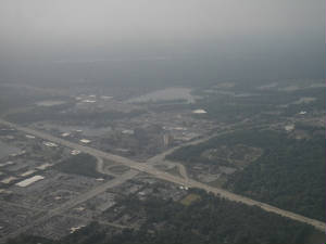 The sky was relatively clear and the storms were holding off to the north. It was time for a first shot departure. We are
allowed to leave at 0630 after the timers arrive so we wanted to be there when the clock ticked over. We were 3rd
off the block and launched into some of the haziest skies we had seen in weeks. “Relatively clear” was
the operative term for this trip. We had not seen clear and unlimited visibility since we arrived in California from Lake The sky was relatively clear and the storms were holding off to the north. It was time for a first shot departure. We are
allowed to leave at 0630 after the timers arrive so we wanted to be there when the clock ticked over. We were 3rd
off the block and launched into some of the haziest skies we had seen in weeks. “Relatively clear” was
the operative term for this trip. We had not seen clear and unlimited visibility since we arrived in California from Lake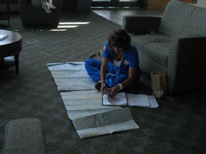 Tahoe. What we have seen thus far is clouds, lower than ideas ceilings and now the schutz and haze that was trapped below
cloud layer. But it is all flyable and we aimed to fly. The storm mass was still hovering to the north of course on the last
leg and we needed to race it to York, PA. We made two fast legs and even faster turn-around at the stops. Ellen and I worked
like a well-oiled machine and were back in the air for the final sprint to the finish. We blasted off from Athens, OH into
relatively clear skies. We had one small choke point coming and we were concerned. Garret Co Airport in WV over the small
mountains was reporting MVFR with a ceiling of Tahoe. What we have seen thus far is clouds, lower than ideas ceilings and now the schutz and haze that was trapped below
cloud layer. But it is all flyable and we aimed to fly. The storm mass was still hovering to the north of course on the last
leg and we needed to race it to York, PA. We made two fast legs and even faster turn-around at the stops. Ellen and I worked
like a well-oiled machine and were back in the air for the final sprint to the finish. We blasted off from Athens, OH into
relatively clear skies. We had one small choke point coming and we were concerned. Garret Co Airport in WV over the small
mountains was reporting MVFR with a ceiling of 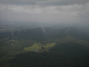 1200’. This was our highest terrain so it made sense it was the lowest ceiling. We hoped it help open for us. As we
raced our way to these baby mountains, we put the terrain feature back on the MX20 – working flawlessly now, thank goodness.
We kept checking the AWOS. As we neared, it came up to 1500’ broken layer and we skirted our way through with easy.
The storm was now less than 27 miles north of course and heading our way. It was another race to the stop at York. 1200’. This was our highest terrain so it made sense it was the lowest ceiling. We hoped it help open for us. As we
raced our way to these baby mountains, we put the terrain feature back on the MX20 – working flawlessly now, thank goodness.
We kept checking the AWOS. As we neared, it came up to 1500’ broken layer and we skirted our way through with easy.
The storm was now less than 27 miles north of course and heading our way. It was another race to the stop at York.The haze was so thick it was difficult to find the airport, especially since there was a small hump to the north of the airport where 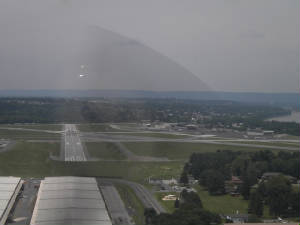 we crossed. With the airport in sight we lined up for the final flyby then made the turn to Capital City for landing. We
let out a whoo-hoo then saw the terrain ahead. Pulling up fast, we made the call to the Capital City tower and were cleared
to land. we crossed. With the airport in sight we lined up for the final flyby then made the turn to Capital City for landing. We
let out a whoo-hoo then saw the terrain ahead. Pulling up fast, we made the call to the Capital City tower and were cleared
to land. 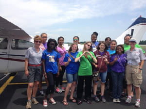 We were greeted at Capital City by our kids from Mobile. How much fun to see all of the girls with racer pictures on their
shirts. It was a happy landing. This was a tough race: some of the most challenging race conditions since
my first year in 2007 when we had to make it in to Canada amidst relatively low conditions. Time for a celebration dinner! We were greeted at Capital City by our kids from Mobile. How much fun to see all of the girls with racer pictures on their
shirts. It was a happy landing. This was a tough race: some of the most challenging race conditions since
my first year in 2007 when we had to make it in to Canada amidst relatively low conditions. Time for a celebration dinner!
June 21st - And the winner is ....: Not so fast ... no announcement
yet. Today is the last of the briefings or more appropriately, debriefings. They went well this morning although, true to
form, they were not brief. This "longing" was followed by the ARC board meeting and youth and aviation activities
at the airport. The Mobile girls are still here and we got them together with the local PA youth. All flew Young Eagles flights
and got to meet the racers and get autographs signed. It has been a long day and we still have hours to go before the banquet.
We remain hopeful for a high placement.
|
|||||||||||
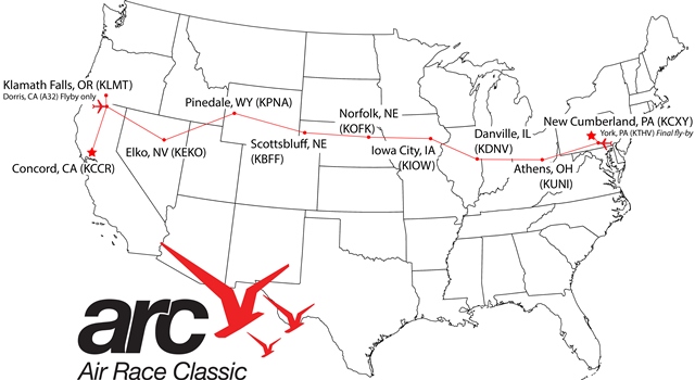
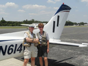 start.
 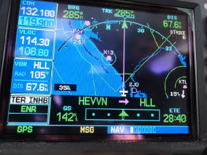 into the Gulf to see a large sand formation it the shape of an angels wing then saw that we were between two quite fitting
waypoints: "HEVVN" and "HLL". The route took us through the Emerald Cost flyway - all of the
restricted areas were cold today in anticipation of the holiday weekend - and enjoyed the scenes of emerald waters
and white sand beaches. After crossing Pensacola, we started our descent into the hot rough air. Our 65 degree cruise degraded
into the 90 degree pressure cooker.
into the Gulf to see a large sand formation it the shape of an angels wing then saw that we were between two quite fitting
waypoints: "HEVVN" and "HLL". The route took us through the Emerald Cost flyway - all of the
restricted areas were cold today in anticipation of the holiday weekend - and enjoyed the scenes of emerald waters
and white sand beaches. After crossing Pensacola, we started our descent into the hot rough air. Our 65 degree cruise degraded
into the 90 degree pressure cooker.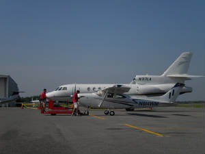 display and Team Wild Mama is here to promote the race and the Aviation
Adventures Youth Programs. ARC and Aviation Adventures will have a large youth program at the terminus
in 2015 and we want to start the excitement building early, letting everyone know to watch this race to get ready for
what is to come. With Wild Mama moved in to place, we cleaned her out and tomorrow we will clean her up with the
early morning dew, debugging her and keep her in race ready shape.
display and Team Wild Mama is here to promote the race and the Aviation
Adventures Youth Programs. ARC and Aviation Adventures will have a large youth program at the terminus
in 2015 and we want to start the excitement building early, letting everyone know to watch this race to get ready for
what is to come. With Wild Mama moved in to place, we cleaned her out and tomorrow we will clean her up with the
early morning dew, debugging her and keep her in race ready shape.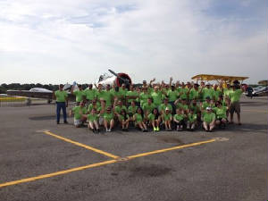 race, the youth program and, of course, Wild Mama, herself. The day was ablaze of activity ... not to mention
the fact that it was in the low 90's all day and sitting out on a black tarmac made the day seem that much warmer. But we
had the shade of a Cessna 182 to keep us cool, plus the fabulous staff at Continental Motors/Zulu Flight Center kept us with
a steady supply of water.
race, the youth program and, of course, Wild Mama, herself. The day was ablaze of activity ... not to mention
the fact that it was in the low 90's all day and sitting out on a black tarmac made the day seem that much warmer. But we
had the shade of a Cessna 182 to keep us cool, plus the fabulous staff at Continental Motors/Zulu Flight Center kept us with
a steady supply of water. Team Wild Mama and the rest of the 2014 ARC racers at the terminus in Hershey, PA. I think she was actually more excited
about the airplanes than she was at seeing Hershey Park! Lizzie's goal is to be "the first female Blue Angel", and
with the level of commitment and enthusiasm she has shown for the aviation program, I know she will achieve her goal of flying
with the Blue Angels.
Team Wild Mama and the rest of the 2014 ARC racers at the terminus in Hershey, PA. I think she was actually more excited
about the airplanes than she was at seeing Hershey Park! Lizzie's goal is to be "the first female Blue Angel", and
with the level of commitment and enthusiasm she has shown for the aviation program, I know she will achieve her goal of flying
with the Blue Angels. As for Team Wild Mama, we had a ton of visitors to the disply. Some folks were interested in hearing about the race; some
were interested in learning about Wild Mama; some were interested in the youth program. All and all, we were kept
quite busy answering questions, showing the plane and handing out free autographed posters. Terry participated in two aviation
profesional seminars where a host of professionals gave a brief overview of their aviation connection and fielded audience
questions. We had mechanics, a military pilot, a flight school manager, retired airline captain, Fed Ex pilot/flight examiner
and aviation education professionals. Judy Rice was on hand to talk about her upcoming around-the-world flight.
As for Team Wild Mama, we had a ton of visitors to the disply. Some folks were interested in hearing about the race; some
were interested in learning about Wild Mama; some were interested in the youth program. All and all, we were kept
quite busy answering questions, showing the plane and handing out free autographed posters. Terry participated in two aviation
profesional seminars where a host of professionals gave a brief overview of their aviation connection and fielded audience
questions. We had mechanics, a military pilot, a flight school manager, retired airline captain, Fed Ex pilot/flight examiner
and aviation education professionals. Judy Rice was on hand to talk about her upcoming around-the-world flight.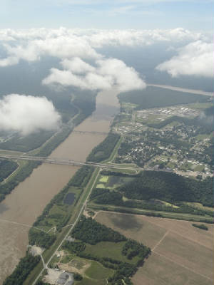 good outcome to the flight. We decided it was time to divert, get on the ground and re-assess the situation. "Houston
Approach, N614WM request divert to Beaumont." A quick turn south and we were there. The scene was almost surreal: no
planes, no people, no activity; but a large terminal, enormous ramp and full fire station. As we exited and came to a stop
in front of the terminal, one of the EMS personnel came to greet us. Advising that there were no tie downs out front, we made
a quick hot start and taxied to the rear where we could tie down out of the 15+ kt. winds that were whipping down the ramp.
We made our way to the pilot lounge, had some lunch and looked at the horseshoe that had smartly morphed into a massive
blob marching steadily to the northeast. We remained on the ground until we were confident that the blob would remain
on its present path and leave us a handy corridor down the coast toward Galveston and Corpus Christi, then loop our
way back up to the north.
good outcome to the flight. We decided it was time to divert, get on the ground and re-assess the situation. "Houston
Approach, N614WM request divert to Beaumont." A quick turn south and we were there. The scene was almost surreal: no
planes, no people, no activity; but a large terminal, enormous ramp and full fire station. As we exited and came to a stop
in front of the terminal, one of the EMS personnel came to greet us. Advising that there were no tie downs out front, we made
a quick hot start and taxied to the rear where we could tie down out of the 15+ kt. winds that were whipping down the ramp.
We made our way to the pilot lounge, had some lunch and looked at the horseshoe that had smartly morphed into a massive
blob marching steadily to the northeast. We remained on the ground until we were confident that the blob would remain
on its present path and leave us a handy corridor down the coast toward Galveston and Corpus Christi, then loop our
way back up to the north. The lowest reported ceilings were 1600' AGL, plenty for us to go along the beach, have a nice scenic tour and make our way
to our final destination. This is when the second diversion took place. Galveston dropped to a 1100' reported broken layer.
We dropped to 1000' and radioed for landing. The layer was thin so we knew we could get above it handily and continue on.
With a flight plan filed, we departed for the coastal route, climbing above the clouds to 4000' where we were supposed
to have a 6 kt tailwind. What we got instead was a 33 kt quartering headwind and a slow trip through clouds. We were
on a left deviation for most of the trip, remaining out of the clouds and sporting a relatively good, but slow ride. But near
PSX VOR we were over-run by clouds and could not seem to escape them. Ellen and I felt like we were back in El Dorado pass
last year: Ellen riding with her hands on the ceiling and everything loose in the plane taking flight at one point or another.
We were getting hand off after hand off where no one was there to take us and we rode many miles in this uncertain silence.
When we saw the weather blow up again at Fredericksburg, we decided to call it a day. "Corpus Christi Approach,
N614WM is diverting to Corpus Christi to land". Ellen programmed the GPS and handled the radio while I tried to keep
the speed, altitude and heading under control. We were on a wild ride - no rain, oddly enough, but thick and very turbulent
clouds.
The lowest reported ceilings were 1600' AGL, plenty for us to go along the beach, have a nice scenic tour and make our way
to our final destination. This is when the second diversion took place. Galveston dropped to a 1100' reported broken layer.
We dropped to 1000' and radioed for landing. The layer was thin so we knew we could get above it handily and continue on.
With a flight plan filed, we departed for the coastal route, climbing above the clouds to 4000' where we were supposed
to have a 6 kt tailwind. What we got instead was a 33 kt quartering headwind and a slow trip through clouds. We were
on a left deviation for most of the trip, remaining out of the clouds and sporting a relatively good, but slow ride. But near
PSX VOR we were over-run by clouds and could not seem to escape them. Ellen and I felt like we were back in El Dorado pass
last year: Ellen riding with her hands on the ceiling and everything loose in the plane taking flight at one point or another.
We were getting hand off after hand off where no one was there to take us and we rode many miles in this uncertain silence.
When we saw the weather blow up again at Fredericksburg, we decided to call it a day. "Corpus Christi Approach,
N614WM is diverting to Corpus Christi to land". Ellen programmed the GPS and handled the radio while I tried to keep
the speed, altitude and heading under control. We were on a wild ride - no rain, oddly enough, but thick and very turbulent
clouds.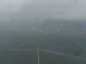 scrambled to recover our sudden sideways movement. With the aircraft stabilized we continued the last 200' for a fine landing.
DONE! Tomorrow will be another day. We laughed as we saw the skies clear not five minuets after our touchdown. It was evident
to us that today was NOT our day to go to Fredericksburg, TX.
scrambled to recover our sudden sideways movement. With the aircraft stabilized we continued the last 200' for a fine landing.
DONE! Tomorrow will be another day. We laughed as we saw the skies clear not five minuets after our touchdown. It was evident
to us that today was NOT our day to go to Fredericksburg, TX. 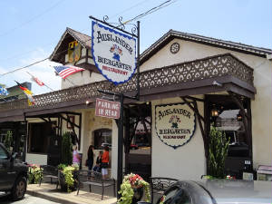 By 1000 hrs we watched the conditions stabilize to IFR and MVFR to the north. We knew that if we could not get in to Fredericksburg,
we could make the 37 mile trek to Llano and land with a 2300' ceiling. Just to be doubly sure of what we were looking at and
recalling that there was "little confidence in the forecast" from yesterday, we called flight services for a third
opinion. All were in agreement that it was time to go. We had filed direct but had little hope of actually getting it. What
they gave us was a zig zag route along V568 to SAT VOR then direct. Upon launching, ATC vectored us to the west far out and
away from our intended path. We finally got turned in and hit the clouds at 2500' but the bumps were not as bone jarring as
the day before. We broke out at 6000' and saw blue sky for the first time in a while.
By 1000 hrs we watched the conditions stabilize to IFR and MVFR to the north. We knew that if we could not get in to Fredericksburg,
we could make the 37 mile trek to Llano and land with a 2300' ceiling. Just to be doubly sure of what we were looking at and
recalling that there was "little confidence in the forecast" from yesterday, we called flight services for a third
opinion. All were in agreement that it was time to go. We had filed direct but had little hope of actually getting it. What
they gave us was a zig zag route along V568 to SAT VOR then direct. Upon launching, ATC vectored us to the west far out and
away from our intended path. We finally got turned in and hit the clouds at 2500' but the bumps were not as bone jarring as
the day before. We broke out at 6000' and saw blue sky for the first time in a while. 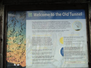
 The remainder of the day we spent in town, wandering about looking at the unique shops and taking in the local flavor.
By evening, we decided to see the Old Tunnel State Park and the bat emergence. It had rained and the trails were wet with
the newly fallen rain. We took a nature walk along the small road behind the park waiting for dusk. But the fog rolled in
and we could see nothing. The bats could have been hovering just beyond the fog line and it would have been news to us. Tomorrow
we head out happy we finally made it to Fredericksburg. We will certainly have to make a return trip.
The remainder of the day we spent in town, wandering about looking at the unique shops and taking in the local flavor.
By evening, we decided to see the Old Tunnel State Park and the bat emergence. It had rained and the trails were wet with
the newly fallen rain. We took a nature walk along the small road behind the park waiting for dusk. But the fog rolled in
and we could see nothing. The bats could have been hovering just beyond the fog line and it would have been news to us. Tomorrow
we head out happy we finally made it to Fredericksburg. We will certainly have to make a return trip. a show stopper after we departed.
 stopped yet again by the storms that were dogging the mid-west and now the east as they approached the terminus. About 4:30
pm local time, the last team who would register a finish crossed the line. It was the Baldwin Family Flyers. A cheer went
up from the crowd. By now we were al gathering back at the airport for the melt down party. But there was the grim reality
of all the team who would NOT finish: the first place team from 2013 - Classic 17, the Three Musketeers, Tookie and her
Wild Women - Classic 43; and the list went on. Only 33 teams made the 4 day grueling race. We were thankful to be counted
among those who finished.
stopped yet again by the storms that were dogging the mid-west and now the east as they approached the terminus. About 4:30
pm local time, the last team who would register a finish crossed the line. It was the Baldwin Family Flyers. A cheer went
up from the crowd. By now we were al gathering back at the airport for the melt down party. But there was the grim reality
of all the team who would NOT finish: the first place team from 2013 - Classic 17, the Three Musketeers, Tookie and her
Wild Women - Classic 43; and the list went on. Only 33 teams made the 4 day grueling race. We were thankful to be counted
among those who finished. 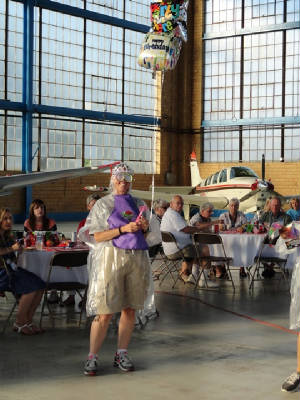 learning experiences and friendship to last a lifetime. It was also my designated birthday party; an, oh, what a celebration
it was!!!
learning experiences and friendship to last a lifetime. It was also my designated birthday party; an, oh, what a celebration
it was!!!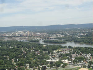 potential penalty, but the one from the officials saying that they want to inspect your airplane because you are it the top
12 race teams. We have before received the call and placed eleventh which was very hard so there is no guarantee but you know
you did OK in the grand scheme of things. In the wee hours of the morning it happened: the call came. That was the end of
sleep for me. Fortunately for Ellen she was already in blissful slumber. The swirl of questions ran in my head: how did we
really do? Could we have changed anything to make a more positive outcome? I wonder if I will have to be re-handicapped and
what will the number be?
potential penalty, but the one from the officials saying that they want to inspect your airplane because you are it the top
12 race teams. We have before received the call and placed eleventh which was very hard so there is no guarantee but you know
you did OK in the grand scheme of things. In the wee hours of the morning it happened: the call came. That was the end of
sleep for me. Fortunately for Ellen she was already in blissful slumber. The swirl of questions ran in my head: how did we
really do? Could we have changed anything to make a more positive outcome? I wonder if I will have to be re-handicapped and
what will the number be?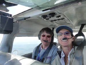 difference in scores. I flew with Laura then I was the check pilot for team 36. Now we wait. The weather was beautiful and
clear. Where have blue skies been the last few days?
difference in scores. I flew with Laura then I was the check pilot for team 36. Now we wait. The weather was beautiful and
clear. Where have blue skies been the last few days?
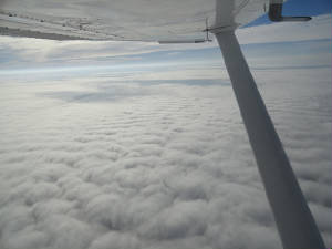 time to go home. We launched just after 0730 IFR into mixed skies. We climbed to 8000' to get above the cloudy layer and catch
whatever tailwinds were available. Our first stop would be in Brunswick, GA. We were hoping it would not be the last as afternoon
flights into FL are iffy at best.
time to go home. We launched just after 0730 IFR into mixed skies. We climbed to 8000' to get above the cloudy layer and catch
whatever tailwinds were available. Our first stop would be in Brunswick, GA. We were hoping it would not be the last as afternoon
flights into FL are iffy at best.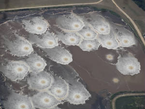 it would pose a problem for a central FL routing. By the time we landed in KBQK, the mass had exploded and was covering the
entire Orlando area and encroaching toward the east. We would make a fast stop and try to beat it to the coast to cross. If
not, we would be remaining in the Daytona area until the storm passed. We used racing speed to get along with the program.
Even then, we deviated a good 10 to 20 degrees to the east out over the water for a better ride and better tailwinds. We dodged
the worst of the storm then
it would pose a problem for a central FL routing. By the time we landed in KBQK, the mass had exploded and was covering the
entire Orlando area and encroaching toward the east. We would make a fast stop and try to beat it to the coast to cross. If
not, we would be remaining in the Daytona area until the storm passed. We used racing speed to get along with the program.
Even then, we deviated a good 10 to 20 degrees to the east out over the water for a better ride and better tailwinds. We dodged
the worst of the storm then 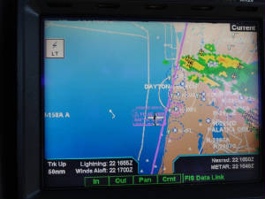 headed back over land to bob and weave our way through the buildups until we had LaBelle in sight. We landed before 1400 encountering
just a drop of rain along the way. It was good to be back!
headed back over land to bob and weave our way through the buildups until we had LaBelle in sight. We landed before 1400 encountering
just a drop of rain along the way. It was good to be back!
|
|||||||||

|
|||||||||
|
|||||||||


| undefined |
 |
| undefined |

 |
| International Organization of Women Pilots |