Crossing the Pond: Before we can really get into the meat of the day 1 adventure to Mexico,
I have to back up and start with the planning part. We had originally scheduled this trip for June but had the landing gear
issue which made us postpone the trip until now. We were a bit more apprehensive about August as the hurricanes can come fast
and furious this time of year and we all know that early in the season in June, we have not hit the building storms and the
chances of hurricanes are less. We got lucky with being between storms so we caught our first break there.
We
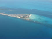
came to a little island called Holbox Island to swim with the whale sharks. There is an airstrip here which is basically private,
owned by AeroSaab. Having “Aero” anything in the name would normally lead me to believe that this is an airline.
It is, of sorts, but very small with a fleet of planes which are kin-folk to Wild Mama. The capacity of this runway at Holbox
is 5 aircraft. The internet site stated GPS coordinates which we had not even questioned as being correct . . . Until we purchased
our charts and plotted the coordinates and found ourselves about 60 miles west of where we thought we should be. We took a
wild stab at the fact the 88 degrees should have been 87 degrees to give ourselves the second set of coordinates for the island.
Not feeling too warm and fuzzy, we e-mailed the hotel where were had our reservations at the airport and asked for a fresh
set of coordinates. The next day, all fresh, we received a third set of coordinates. Still not hitting our comfort zone, we
logged on to the free version of Google Earth to see of we could get a satellite image somewhat resembling the photos on the
web site, feeling confident that AT LEAST the photos were correct.. Lo and behold we found a photo AND could identify the
runway. We set our pointer over the runway to come up with our fourth set of coordinates for our intended destination. We
also printed out a photo being confident that the low tech method of flying the coastline and using our eyeballs would work
at least as well as all our high tech gadgetry.
Having narrowed down our intended destination, we began the process
of actually planning the trip. I had contacted AOPA and they advised me to hit the MYDIA intersection to remain clear of Cuban
Airspace. We had gotten and actually studied the DOD charts, ONC J-25, the Jeppesen Mexico trip kit and we have the Americas
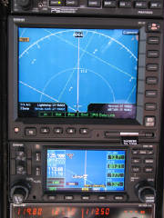
in the 430 and worldwide navigation in the MX 20. We had read the information from the Baja Adventures about crossing the
border and printed excerpts from the Manual of Tourist Entry from the Mexican Customs; the Flying to Mexico Guide; the AOPA
guide to Mexican flight rules; and the Guidelines for Entrance to Mexico of Foreign Aircraft. We had lots of confidence in
our magic carpet making the crossing of “Big Blue” but we were less confident in the paperwork portion of our
program. We located Asur FBO and e-mailed them to assist us with the arrival, customs and flight plans in Mexico. Now we felt
a little better about the paperwork.
We made our plan carefully both directions taking consideration of
the amount of fuel we carried and knowing that could be an issue if we had a normal head winds in both directions trip. The
trip direct from LaBelle would take us about 3-½ hours. Perfect. Our return will necessitate a stop for customs in
Key West - 3:09 by our calculations. Since it was just over 1-½ hours X14 to KEYW it was definitely best to go straight
and avoid the second fuel stop and climb out. So the night before we filed the flight plan IFR from X14 to MYDIA - ROBIN -
MMUN. We checked the weather forecasts; loaded and fuel Wild Mama and planned for departure at 1200 z.
We
were wheels up right on schedule. We planned to climb out to 10,000’ by the time we hit the coastline. We radioed Fort
Myers approach and got “Cleared as Filed”. Music to our ears. ATC held us at 4,000’ to get by the RSW airspace,
then directed us to climb to 9,000 and fly heading of 180 . . . to Key West. Seems they had a route change for us: X14 - EYW
- CANOA - MYDIA - ROBIN - MMUN. This made our flight now over 4-½ hours leaving us less than 1 hour of fuel reserve.
We advised ATC that we desired a shorter route whereupon they redirected us through what we though was Cuban Air space. Our
eyes grew larger. We questioned ATC and found of that the Cuban Extended Airspace is NOT the prohibited Cuban airspace but
basically space where you will be talking to Habana Center, and perfectly lawful to fly though without the necessity of permission
from Fidel. The routing from CANOA was VINKA - NOSAT - MEDUX. This gave us an anticipated flight time of 3:20; but it put
our time crossing into Mexican Airspace 25 minutes past what we had put in the flight plan. It was amended accordingly.
So here we are flying along . . . nothing but blue: beautiful blue skies; crystal clear blue waters; chilling
blue screens on the MX20 and 430. We remained out of the sight of land for nearly 3 hours which gave us the time we needed
to check on those silly little brown triangles at CANOA and other intersections. Here is where that Florida training has reared
its ugly head again. For those who fly out west in the land of class G, compulsory reporting points are probably a daily routine.
Not in Florida. We dusted off our “King” trained brain cells to recall the requirements for the compulsory reports.
Then back to the blue.
The remainder of the flight was really, well, completely uneventful. It was interesting
to talk to Habana and listen to ATC rattle off instructions in both English and Spanish. We had no trouble at all with the
accents as the controllers were extremely well versed in English. We crossed into Mexican Airspace and the crossing was, well,
very uneventful. We landed in Cancun and were directed to the customs area at Asur where we were greeted by the Asur personnel
who were expecting us. Our Mexican arrival was not the boogie-man we had feared, but was, well, very uneventful. They checked
our paperwork, passports, luggage (please leave YOUR bananas at home or eat them before you land) and joked around with my
husband, Mario. We paid our landing fees of $50 US in cash. We then paid our FBO fees and fueled up with about 50 gallons;
paid the immigration fees and ramp fee with our American Express and the bill was about $278 US. We were pleased. The FBO
assisted us and filed the flight plan to Holbox, carted our luggage back to the plane and bid us “hasta luego”
until our Monday morning return. We made a very uneventful departure to Holbox, although it was quite fun being sandwiched
between commercial jumbo jets and being told to “line up on the runway and wait” instead of the “taxi to
position and hold” as we are accustomed to hearing.
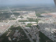
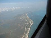
We flew out toward to coastline and over the city
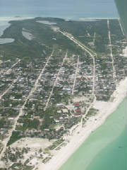
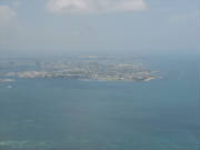
of Cancun at 1500’ watching the sea of multicolored houses lined up block after block. We skirted the coast to the north
and found that our picture of Holbox was accurate as were the coordinates of 21 degrees 30’ 52” N and 87 degrees
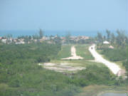
23’ 04” W as given to us by the pilot were correct. We made a landing on runway 3, being careful not to mistake
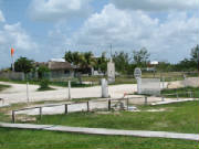
the road for the runway as the road was a bit bigger and in better condition. Hurricane Wilma passed through this area last
October and made quite a mess of things but the area is coming back very strong. The main terminal building and passenger
waiting area have not quite been fully restored, but the fact that no more than 5 people can arrive at any one time will certainly
not overwhelm the terminal.
We were greeted by Victor Saab (remember AeroSaab). His hospitality was overwhelming.
We chatted up a storm while the military guard stood by collecting information on our arrival and intended departure. Our
bags were swiftly delivered to our rooms and we hit the beach for some relaxation.
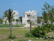
The hotel is right at
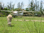
the airport - Hotel Puerto Holbox. We have a view of the beach out one side and the airplane out the other which is very comforting
to us. We have heard the many horror stories about the strange disappearance of aircraft in the Mexican Triangle so we came
armed with a prop lock, throttle lock, special non-Cessna standard door and baggage locks, our cockpit cover and a blanket
covering our panel of toys. We also came equipped with our own tie-downs as neither wheel chocks nor tie downs are standard
equipment on the island.
After our swim we headed off to town for dinner. Victor offered to call us a cab
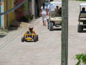
but we figured that the walk would be good. One could cover the whole town in about a day here. The streets are all dirt and
there is nary a car in sight. The cabs are golf carts, as are most of the other forms of private transportation. Victor recommended
Edelyn’s for dinner down next to the town center which was completely destroyed by the storm and in the process of being
rebuilt. Mario and Vern had the Mexican version of a Cuban sandwich - very large and filling - and I had a grilled chicken
salad. We had lemonade and sodas and ice cream for dessert and the bill was $20.
We finished out the day wandering
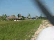
about the streets and just taking in the sights. Most of the hotels here are thatched roofs and quite small. I think we have
one of the few hotels with air conditioning. The people of the island are very friendly and hard working. There is still much
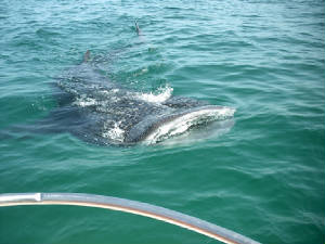
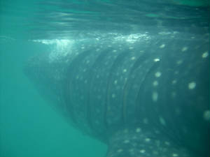
work to be done after the storm but all give a friendly hello as we pass by. Tomorrow is my day to see whale sharks. I have
tried on many occasions but I feel that the chances of success here are all but guaranteed as every place we pass we see signs
for the whale shark tours. Tonight, however, we rest, relieved that the boogie-man is no more.
![]()
![]()
